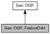
List of all members.
Member Function Documentation
| Geo::OGR::FeatureDefn::AddFieldDefn |
( |
scalar |
defn | ) |
|
| scalar Geo::OGR::FeatureDefn::GeometryIgnored |
( |
scalar |
IgnoreState | ) |
|
- Note:
- a.k.a. GetGeometryIgnored (only get), SetGeometryIgnored (only set) Get or set the ignore status of geometry when fetching features.
- Returns:
- the ignore status of geometry
- Since:
- 1.9.0
| scalar Geo::OGR::FeatureDefn::GeometryType |
( |
scalar |
geometry_type | ) |
|
Get or set the geometry type.
- Note:
- a.k.a. GeomType, GetGeomType (deprecated, returns an integer), SetGeomType (deprecated, requires an integer)
- Parameters:
-
- Returns:
- the geometry type, one of @Geo::OGR::Geometry::GEOMETRY_TYPES
| scalar Geo::OGR::FeatureDefn::GetFieldCount |
( |
| ) |
|
| scalar Geo::OGR::FeatureDefn::GetFieldIndex |
( |
scalar |
name | ) |
|
- Parameters:
-
- Returns:
- integer (-1 if no such field)
| scalar Geo::OGR::FeatureDefn::GetName |
( |
| ) |
|
- Note:
- a.k.a. Name
- Returns:
- a string
| hashref Geo::OGR::FeatureDefn::Schema |
( |
hash |
schema | ) |
|
Get or set the schema. The schema is a hash (Name => name, GeometryType => geometry_type, Fields => [list of Geo::OGR::FieldDefn objects or hashrefs from which such can be created (see Geo::OGR::FieldDefn::create)]. The Name cannot be set and the Fields are added to the schema. Fields is an array of hashrefs that contain schemas of FieldDefns. In addition, in the 'get' form of the function, each field hash contains key 'Index', whose value is the index of the field.
- Parameters:
-
- Returns:
| scalar Geo::OGR::FeatureDefn::StyleIgnored |
( |
scalar |
IgnoreState | ) |
|
- Note:
- a.k.a. GetStyleIgnored (only get), SetStyleIgnored (only set) Get or set the ignore status of style information when fetching features.
- Returns:
- the ignore status of style information
- Since:
- 1.9.0
The documentation for this class was generated from the following file:

 1.7.3
1.7.3