Geo::GDAL::Dataset Class Reference
A set of associated raster bands. More...
 Inheritance diagram for Geo::GDAL::Dataset:
 Collaboration diagram for Geo::GDAL::Dataset:
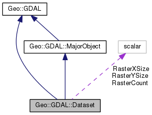
Public Member Functions | |
| public method | AddBand (scalar datatype= 'Byte', hashref options=0) |
| public Geo::GDAL::Band | Band (scalar index) |
| public list | Bands () |
| public method | BuildOverviews (scalar resampling, arrayref overviews, subref progress, scalar progress_data) |
| public method | CommitTransaction () |
| public method | Domains () |
| public list | GCPs (array GCPs, Geo::OSR::SpatialReference sr) |
| public Geo::GDAL::GeoTransform | GeoTransform (Geo::GDAL::GeoTransform scalar geo_transform) |
| public Geo::GDAL::Driver | GetDriver () |
| public list | GetFileList () |
| public scalar | GetGCPProjection () |
| public Geo::GDAL::Dataset | Open (scalar name, scalar access='ReadOnly') |
| public Geo::GDAL::Dataset | OpenShared (scalar name, scalar access='ReadOnly') |
| public scalar | ReadRaster (hash params) |
| public method | RollbackTransaction () |
| public list | Size () |
| public Geo::OSR::SpatialReference | SpatialReference (Geo::OSR::SpatialReference sr) |
| public method | StartTransaction () |
| public method | WriteRaster (hash params) |
| Public Member Functions inherited from Geo::GDAL::MajorObject | |
| public scalar | Description (scalar description) |
| public method | Domains () |
| public scalar | GetDescription () |
| public hash reference | GetMetadata (scalar domain="") |
| public method | GetMetadataDomainList () |
| public hash reference | Metadata (hashref metadata=undef, scalar domain= '') |
| public method | SetDescription (scalar NewDesc) |
| public method | SetMetadata (hashref metadata, scalar domain="") |
| Public Member Functions inherited from Geo::GDAL | |
| public list | AccessTypes () |
| public Geo::GDAL::Dataset | AutoCreateWarpedVRT (Geo::GDAL::Dataset src, Geo::OSR::SpatialReference src_srs=undef, Geo::OSR::SpatialReference dst_srs=undef, scalar ResampleAlg='NearestNeighbour', scalar maxerror=0.0) |
| public method | CPLBinaryToHex () |
| public method | CPLHexToBinary () |
| public list | Child (scalar node, scalar i) |
| public list | Children (scalar node) |
| public method | ComputeMedianCutPCT (Geo::GDAL::Band red, Geo::GDAL::Band green, Geo::GDAL::Band blue, scalar num_colors, scalar colors, subref progress, scalar progress_data) |
| public method | ComputeProximity (Geo::GDAL::Band src, Geo::GDAL::Band proximity, hashref options, subref progress, scalar progress_data) |
| public scalar | DataTypeIsComplex (scalar DataType) |
| public list | DataTypeValueRange (scalar DataType) |
| public list | DataTypes () |
| public method | Debug () |
| public scalar | DecToDMS (scalar angle, scalar axis, scalar precision=2) |
| public scalar | DecToPackedDMS (scalar dec) |
| public method | DitherRGB2PCT (scalar red, scalar green, scalar blue, scalar target, scalar colors, subref progress, scalar progress_data) |
| public method | EscapeString () |
| public scalar | FindFile (scalar class, scalar basename) |
| public method | FinderClean () |
| public method | GOA2GetAccessToken () |
| public method | GOA2GetAuthorizationURL () |
| public method | GOA2GetRefreshToken () |
| public scalar | GetCacheMax () |
| public scalar | GetCacheUsed () |
| public scalar | GetConfigOption (scalar key, scalar default) |
| public scalar | GetDataTypeSize (scalar DataType) |
| public Geo::GDAL::Driver | GetDriver (scalar name) |
| public list | GetDriverNames () |
| public method | GetJPEG2000StructureAsString () |
| public Geo::GDAL::Driver | IdentifyDriver (scalar path, scalar siblings) |
| public list | NodeData (scalar node) |
| public scalar | NodeType (scalar type) |
| public list | NodeTypes () |
| public Geo::GDAL::Dataset | Open (scalar name, scalar access= 'ReadOnly') |
| public Geo::GDAL::Dataset | OpenEx (scalar name, scalar open_flags=0, array reference allowed_drivers=undef, array reference open_options=undef, array reference sibling_files=undef) |
| public Geo::GDAL::Dataset | OpenShared (scalar name, scalar access= 'ReadOnly') |
| public scalar | PackCharacter (scalar DataType) |
| public scalar | PackedDMSToDec (scalar packed) |
| public array reference | ParseXMLString (scalar XML) |
| public method | Polygonize (Geo::GDAL::Band src, Geo::GDAL::Band mask, Geo::OGR::Layer out, scalar PixValField, hashref options, subref progress, scalar progress_data) |
| public method | PopFinderLocation () |
| public method | PushFinderLocation (scalar path) |
| public list | RIOResamplingTypes () |
| public method | RasterizeLayer (Geo::GDAL::Dataset ds, arrayref bands, Geo::OGR::Layer layer, scalar transformer, scalar arg, arrayref burn_values, hashref options, subref progress, scalar progress_data) |
| public method | ReprojectImage (scalar src_ds, scalar dst_ds, scalar src_wkt=undef, scalar dst_wkt=undef, scalar ResampleAlg='NearestNeighbour', scalar WarpMemoryLimit=0, scalar maxerror=0.0, subref progress, scalar progress_data) |
| public list | ResamplingTypes () |
| public scalar | SerializeXMLTree (arrayref XMLTree) |
| public method | SetCacheMax (scalar Bytes) |
| public method | SetConfigOption (scalar key, scalar value) |
| public method | SieveFilter (Geo::GDAL::Band src, Geo::GDAL::Band mask, Geo::GDAL::Band dst, scalar threshold, scalar connectedness, hashref options, subref progress, scalar progress_data) |
| public scalar | VersionInfo (scalar request= 'VERSION_NUM') |
Public Attributes | |
| scalar | RasterCount |
| scalar (access as $dataset->{RasterCount}) | |
| scalar | RasterXSize |
| scalar (access as $dataset->{RasterXSize}) | |
| scalar | RasterYSize |
| scalar (access as $dataset->{RasterYSize}) | |
Detailed Description
Member Function Documentation
| public method Geo::GDAL::Dataset::AddBand | ( | scalar | datatype = 'Byte', |
| hashref | options = 0 |
||
| ) |
Add a new band to the dataset. The driver must support the action.
- Parameters
-
datatype GDAL pixel data type (one of those listed by Geo::GDAL::DataTypes). options reference to a hash of format specific key=>value options.
Code:
click to view
| public Geo::GDAL::Band Geo::GDAL::Dataset::Band | ( | scalar | index | ) |
Create a band object for the band within the dataset.
- Note
- a.k.a. GetRasterBand
- Parameters
-
index 1...RasterCount
- Returns
- a new Geo::GDAL::Band object
Code:
click to view
| public list Geo::GDAL::Dataset::Bands | ( | ) |
| public method Geo::GDAL::Dataset::BuildOverviews | ( | scalar | resampling, |
| arrayref | overviews, | ||
| subref | progress, | ||
| scalar | progress_data | ||
| ) |
- Parameters
-
resampling the resampling method, one of Geo::GDAL::RIOResamplingTypes. overviews The list of overview decimation factors to build. For example [2,4,8]. progress [optional] a reference to a subroutine, which will be called with parameters (number progress, string msg, progress_data) progress_data [optional]
Code:
click to view
| public method Geo::GDAL::Dataset::CommitTransaction | ( | ) |
Code:
click to view
| public method Geo::GDAL::Dataset::Domains | ( | ) |
Code:
click to view
| public list Geo::GDAL::Dataset::GCPs | ( | array | GCPs, |
| Geo::OSR::SpatialReference | sr | ||
| ) |
Get or set the GCPs and their projection.
- Parameters
-
GCPs [optional] a list of Geo::GDAL::GCP objects sr [optional] the projection of the GCPs.
- Returns
- a list of Geo::GDAL::GCP objects followed by a Geo::OSR::SpatialReference object.
Code:
click to view
| public Geo::GDAL::GeoTransform Geo::GDAL::Dataset::GeoTransform | ( | Geo::GDAL::GeoTransform scalar | geo_transform | ) |
Transformation from pixel coordinates (column,row) to projection coordinates (x,y)
x = geo_transform[0] + column*geo_transform[1] + row*geo_transform[2]
y = geo_transform[3] + column*geo_transform[4] + row*geo_transform[5]
- Parameters
-
geo_transform [optional]
- Returns
- the geo transform in a non-void context.
Code:
click to view
| public Geo::GDAL::Driver Geo::GDAL::Dataset::GetDriver | ( | ) |
| public list Geo::GDAL::Dataset::GetFileList | ( | ) |
| public scalar Geo::GDAL::Dataset::GetGCPProjection | ( | ) |
- Returns
- projection string.
Code:
click to view
| public Geo::GDAL::Dataset Geo::GDAL::Dataset::Open | ( | scalar | name, |
| scalar | access = 'ReadOnly' |
||
| ) |
Class method. An example:
use Geo::GDAL;
- Parameters
-
name access Access type (one of those listed by Geo::GDAL::AccessTypes).
- Returns
- a new Geo::GDAL::Dataset object.
Code:
click to view
| public Geo::GDAL::Dataset Geo::GDAL::Dataset::OpenShared | ( | scalar | name, |
| scalar | access = 'ReadOnly' |
||
| ) |
Class method.
- Parameters
-
name access Access type (one of those listed by Geo::GDAL::AccessTypes).
- Returns
- a new Geo::GDAL::Dataset object.
Code:
| public scalar Geo::GDAL::Dataset::ReadRaster | ( | hash | params | ) |
Read data from the dataset.
- Parameters
-
params named parameters. These are - XOff x offset (pixel coordinates) (default is 0)
- YOff y offset (pixel coordinates) (default is 0)
- XSize width of the area to read (default is the width of the dataset)
- YSize height of the area to read (default is the height of the dataset)
- BufXSize (default is undef, i.e., the same as XSize)
- BufYSize (default is undef, i.e., the same as YSize)
- BufType data type of the buffer (default is the data type of the first band)
- BandList a reference to an array of band indeces (default is [1])
- BufPixelSpace (default is 0)
- BufLineSpace (default is 0)
- BufBandSpace (default is 0)
- ResampleAlg one of Geo::GDAL::RIOResamplingTypes (default is 'NearestNeighbour'),
- Progress reference to a progress function (default is undef)
- ProgressData (default is undef)
If the parameters are given as a list the order is as above. Entry in GDAL docs (method RasterIO)
- Returns
- a buffer, open the buffer with unpack function of Perl. See Geo::GDAL::Band::PackCharacter.
Code:
click to view
| public method Geo::GDAL::Dataset::RollbackTransaction | ( | ) |
Code:
click to view
| public list Geo::GDAL::Dataset::Size | ( | ) |
- Returns
- (width, height)
Code:
click to view
| public Geo::OSR::SpatialReference Geo::GDAL::Dataset::SpatialReference | ( | Geo::OSR::SpatialReference | sr | ) |
Get or set the projection of this dataset.
- Parameters
-
sr [optional] a Geo::OSR::SpatialReference object, which replaces the existing projection definition of this dataset.
- Returns
- a Geo::OSR::SpatialReference object, which represents the projection of this dataset.
- Note
- Methods GetProjection, SetProjection, and Projection return WKT strings.
Code:
click to view
| public method Geo::GDAL::Dataset::StartTransaction | ( | ) |
Code:
click to view
| public method Geo::GDAL::Dataset::WriteRaster | ( | hash | params | ) |
Write data into the dataset.
- Parameters
-
params named parameters. These are - XOff x offset (pixel coordinates) (default is 0)
- YOff y offset (pixel coordinates) (default is 0)
- XSize width of the area to write (default is the width of the dataset)
- YSize height of the area to write (default is the height of the dataset)
- Buf a buffer containing the data. Create the buffer with pack function of Perl. See Geo::GDAL::Band::PackCharacter.
- BufXSize (default is undef, i.e., the same as XSize)
- BufYSize (default is undef, i.e., the same as YSize)
- BufType data type of the buffer (default is the data type of the first band)
- BandList a reference to an array of band indeces (default is [1])
- BufPixelSpace (default is 0)
- BufLineSpace (default is 0)
- BufBandSpace (default is 0)
If the parameters are given as a list the order is as above. Entry in GDAL docs (method RasterIO)
Code:
click to view
The documentation for this class was generated from the following file: