Geo::OGR Class Reference
OGR utility functions. More...
 Inheritance diagram for Geo::OGR:
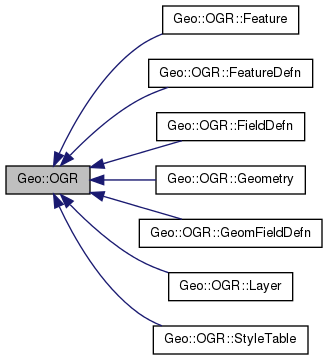
Classes | |
| class | DataSource |
| A vector dataset. More... | |
| class | Driver |
| A vector format driver. More... | |
| class | Feature |
| A collection of non-spatial and spatial attributes. More... | |
| class | FeatureDefn |
| The schema of a feature or a layer. More... | |
| class | FieldDefn |
| A definition of a non-spatial attribute. More... | |
| class | Geometry |
| Spatial data. More... | |
| class | GeomFieldDefn |
| A definition of a spatial attribute. More... | |
| class | Layer |
| A collection of similar features. More... | |
| class | StyleTable |
Public Member Functions | |
| public list | ByteOrders () |
| public Geo::GDAL::Driver | Driver (scalar name) |
| public list | DriverNames () |
| public list | Drivers () |
| public method | Flatten () |
| public scalar | GeometryTypeModify (scalar type, scalar modifier) |
| public scalar | GeometryTypeTest (scalar type, scalar test, scalar type2) |
| public list | GeometryTypes () |
| public method | GetNonLinearGeometriesEnabledFlag () |
| public method | GetOpenDSCount () |
| public method | HasM () |
| public method | HasZ () |
| public Geo::GDAL::Dataset | Open (scalar name, scalar update=0) |
| public Geo::GDAL::Dataset | OpenShared (scalar name, scalar update=0) |
| public method | RELEASE_PARENT () |
| public method | SetGenerate_DB2_V72_BYTE_ORDER (scalar Generate_DB2_V72_BYTE_ORDER) |
| public method | SetNonLinearGeometriesEnabledFlag () |
Detailed Description
OGR utility functions.
A wrapper for many OGR utility functions and a root class for all OGR classes.
Member Function Documentation
| public list Geo::OGR::ByteOrders | ( | ) |
Package subroutine.
- Returns
- a list of byte order types, XDR and NDR. XDR denotes big-endian and NDR denotes little-endian.
Code:
click to view
Reimplemented in Geo::OGR::Geometry.
| public Geo::GDAL::Driver Geo::OGR::Driver | ( | scalar | name | ) |
Package subroutine. A.k.a GetDriver.
- Parameters
-
name the short name of the driver.
- Note
- No check is made that the driver is actually a vector driver.
- Returns
- a Geo::GDAL::Driver object.
Code:
click to view
| public list Geo::OGR::DriverNames | ( | ) |
Package subroutine. A.k.a GetDriverNames
perl -MGeo::GDAL -e '@d=Geo::OGR::DriverNames;print "@d\n"'
- Note
- Use Geo::GDAL::DriverNames for raster drivers.
- Returns
- a list of the short names of all available GDAL vector drivers.
Code:
click to view
| public list Geo::OGR::Drivers | ( | ) |
Package subroutine.
- Note
- Use Geo::GDAL::Drivers for raster drivers.
- Returns
- a list of all available GDAL vector drivers.
Code:
click to view
| public method Geo::OGR::Flatten | ( | ) |
Code:
click to view
| public scalar Geo::OGR::GeometryTypeModify | ( | scalar | type, |
| scalar | modifier | ||
| ) |
Object method.
- Parameters
-
type a geometry type (one of Geo::OGR::GeometryTypes). modifier one of 'flatten', 'set_Z', 'make_collection', 'make_curve', or 'make_linear'.
- Returns
- modified geometry type.
Code:
click to view
| public list Geo::OGR::GeometryTypes | ( | ) |
Package subroutine.
- Returns
- a list of all geometry types, currently: CircularString, CircularStringM, CircularStringZ, CircularStringZM, CompoundCurve, CompoundCurveM, CompoundCurveZ, CompoundCurveZM, Curve, CurveM, CurvePolygon, CurvePolygonM, CurvePolygonZ, CurvePolygonZM, CurveZ, CurveZM, GeometryCollection, GeometryCollection25D, GeometryCollectionM, GeometryCollectionZM, LineString, LineString25D, LineStringM, LineStringZM, LinearRing, MultiCurve, MultiCurveM, MultiCurveZ, MultiCurveZM, MultiLineString, MultiLineString25D, MultiLineStringM, MultiLineStringZM, MultiPoint, MultiPoint25D, MultiPointM, MultiPointZM, MultiPolygon, MultiPolygon25D, MultiPolygonM, MultiPolygonZM, MultiSurface, MultiSurfaceM, MultiSurfaceZ, MultiSurfaceZM, None, Point, Point25D, PointM, PointZM, Polygon, Polygon25D, PolygonM, PolygonZM, PolyhedralSurface, PolyhedralSurfaceM, PolyhedralSurfaceZ, PolyhedralSurfaceZM, Surface, SurfaceM, SurfaceZ, SurfaceZM, TIN, TINM, TINZ, TINZM, Triangle, TriangleM, TriangleZ, TriangleZM, and Unknown.
Code:
click to view
Reimplemented in Geo::OGR::Geometry.
| public scalar Geo::OGR::GeometryTypeTest | ( | scalar | type, |
| scalar | test, | ||
| scalar | type2 | ||
| ) |
Object method.
- Parameters
-
type a geometry type (one of Geo::OGR::GeometryTypes). test one of 'has_z', 'is_subclass_of', 'is_curve', 'is_surface', or 'is_non_linear'. type2 a geometry type (one of Geo::OGR::GeometryTypes). Required for 'is_subclass_of' test.
- Returns
- result of the test.
Code:
click to view
| public method Geo::OGR::GetNonLinearGeometriesEnabledFlag | ( | ) |
Code:
click to view
| public method Geo::OGR::GetOpenDSCount | ( | ) |
Code:
click to view
| public method Geo::OGR::HasM | ( | ) |
Code:
click to view
| public method Geo::OGR::HasZ | ( | ) |
Code:
click to view
| public Geo::GDAL::Dataset Geo::OGR::Open | ( | scalar | name, |
| scalar | update = 0 |
||
| ) |
Object method. Open a vector data source.
- Parameters
-
name The data source string (directory, filename, etc.). update Whether to open the data source in update mode (default is not).
- Returns
- a new Geo::GDAL::Dataset object.
Code:
click to view
| public Geo::GDAL::Dataset Geo::OGR::OpenShared | ( | scalar | name, |
| scalar | update = 0 |
||
| ) |
Object method. Open a vector data source in shared mode.
- Parameters
-
name The data source string (directory, filename, etc.). update Whether to open the data source in update mode.
- Returns
- a new Geo::GDAL::Dataset object.
Code:
| public method Geo::OGR::RELEASE_PARENT | ( | ) |
Code:
click to view
Reimplemented in Geo::OGR::Layer, Geo::OGR::Geometry, Geo::OGR::FeatureDefn, and Geo::OGR::Feature.
| public method Geo::OGR::SetGenerate_DB2_V72_BYTE_ORDER | ( | scalar | Generate_DB2_V72_BYTE_ORDER | ) |
Object method. Needed only on IBM DB2.
Code:
click to view
| public method Geo::OGR::SetNonLinearGeometriesEnabledFlag | ( | ) |
Code:
click to view
The documentation for this class was generated from the following file: