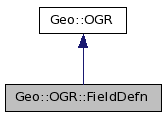
Inheritance diagram for Geo::OGR::FieldDefn:

Public Class Methods | |
| Geo::OGR::FieldDefn | new (scalar name="unnamed", scalar field_type=scalar Geo::OGR::OFTString) |
| Geo::OGR::FieldDefn | create (scalar name="unnamed", scalar field_type= 'String') |
| Geo::OGR::FieldDefn | create (hash parameters) |
Public Object Methods | |
| hashref | Schema (hash parameters) |
| scalar | Name (scalar name) |
| scalar | Type (scalar type) |
| scalar | Justify (scalar justify) |
| scalar | Width (scalar width) |
| scalar | Precision (scalar precision) |
| scalar | Ignored (scalar ignore) |
Public Attributes | |
| list | FIELD_TYPES |
| list | JUSTIFY_TYPES |
| Geo::OGR::FieldDefn Geo::OGR::FieldDefn::create | ( | hash | parameters | ) |
| parameters | named parameters: Name, Type, Justify, Width, Precision |
$fd = Geo::OGR::FieldDefn->create( Name => "name", Type => "FieldType", ...);
| Geo::OGR::FieldDefn Geo::OGR::FieldDefn::create | ( | scalar | name = "unnamed", |
|
| scalar | field_type = 'String' | |||
| ) |
| name | ||
| field_type | one of field types. Optional. Default is String. |
$fd = Geo::OGR::FieldDefn->create(...arguments...);
| scalar Geo::OGR::FieldDefn::Ignored | ( | scalar | ignore | ) |
Get and/or set the ignore status (whether this field should be omitted when fetching features) of this field.
| ignore | [optional] |
| scalar Geo::OGR::FieldDefn::Justify | ( | scalar | justify | ) |
Get and/or set the justification of this field.
| justify | [optional] as string: Undefined, Left, or Right |
| scalar Geo::OGR::FieldDefn::Name | ( | scalar | name | ) |
Get and/or set the name of the field.
| name | [optional] |
| Geo::OGR::FieldDefn Geo::OGR::FieldDefn::new | ( | scalar | name = "unnamed", |
|
| scalar | field_type = scalar Geo::OGR::OFTString | |||
| ) |
| name | ||
| field_type | as integer |
| scalar Geo::OGR::FieldDefn::Precision | ( | scalar | precision | ) |
Get and/or set the precision of this field.
| precision | [optional] |
| hashref Geo::OGR::FieldDefn::Schema | ( | hash | parameters | ) |
Get the schema or set parts of the schema
| parameters | [optional] named parameters: Name, Type, Justify, Width, Precision |
| scalar Geo::OGR::FieldDefn::Type | ( | scalar | type | ) |
| type | [optional] one of field types: Integer, IntegerList, Real, RealList, String, StringList, WideString, WideStringList, Binary, Date, Time, or DateTime (wide strings are not really supported yet?) |
| scalar Geo::OGR::FieldDefn::Width | ( | scalar | width | ) |
Get and/or set the field width.
| width | [optional] |
Field types supported by GDAL, one of: Integer IntegerList Real RealList String StringList WideString WideStringList Binary Date Time DateTime
Justify types supported by GDAL, one of: Undefined Left Right
 1.4.7
1.4.7