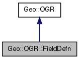
Inheritance diagram for Geo::OGR::FieldDefn:

Public Class Methods | |
| Geo::OGR::FieldDefn | new (scalar name="unnamed", scalar field_type=scalar Geo::OGR::OFTString) |
| Geo::OGR::FieldDefn | create (scalar name="unnamed", scalar field_type= 'String') |
| Geo::OGR::FieldDefn | create (hash parameters) |
Public Object Methods | |
| hashref | Schema (hash parameters) |
| scalar | Name (scalar name) |
| scalar | Type (scalar type) |
| scalar | Justify (scalar justify) |
| scalar | Width (scalar width) |
| scalar | Precision (scalar precision) |
| scalar | Ignored (scalar ignore) |
Public Attributes | |
| list | FIELD_TYPES |
| list | JUSTIFY_TYPES |
Member Function Documentation
| Geo::OGR::FieldDefn Geo::OGR::FieldDefn::create | ( | scalar | name = "unnamed", |
| scalar | field_type = 'String' |
||
| ) |
- Parameters:
-
name field_type one of field types. Optional. Default is String.
Usage:
$fd = Geo::OGR::FieldDefn->create(...arguments...);
- Returns:
- a new Geo::OGR::FieldDefn object
| Geo::OGR::FieldDefn Geo::OGR::FieldDefn::create | ( | hash | parameters | ) |
- Parameters:
-
parameters named parameters: Name, Type, Justify, Width, Precision
Usage:
$fd = Geo::OGR::FieldDefn->create( Name => "name", Type => "FieldType", ...);
- Returns:
- a new Geo::OGR::FieldDefn object
| scalar Geo::OGR::FieldDefn::Ignored | ( | scalar | ignore | ) |
Get and/or set the ignore status (whether this field should be omitted when fetching features) of this field.
- Note:
- a.k.a. IsIgnored, SetIgnored
- Parameters:
-
ignore [optional]
- Returns:
- the ignore status in non-void context
- Since:
- 1.9.0
| scalar Geo::OGR::FieldDefn::Justify | ( | scalar | justify | ) |
Get and/or set the justification of this field.
- Note:
- a.k.a. GetJustify, SetJustify
- Parameters:
-
justify [optional] as string: Undefined, Left, or Right
- Returns:
- one of Undefined Left Right in non-void context
| scalar Geo::OGR::FieldDefn::Name | ( | scalar | name | ) |
Get and/or set the name of the field.
- Note:
- a.k.a. GetName, GetNameRef, SetName
- Parameters:
-
name [optional]
- Returns:
- the name in non-void context
| Geo::OGR::FieldDefn Geo::OGR::FieldDefn::new | ( | scalar | name = "unnamed", |
| scalar | field_type = scalar Geo::OGR::OFTString |
||
| ) |
- Deprecated:
- use Geo::OGR::FieldDefn::create, which accepts type as a string
- Parameters:
-
name field_type as integer
- Returns:
- a new Geo::OGR::FieldDefn object
| scalar Geo::OGR::FieldDefn::Precision | ( | scalar | precision | ) |
Get and/or set the precision of this field.
- Note:
- a.k.a. GetPrecision, SetPrecision
- Parameters:
-
precision [optional]
- Returns:
- integer in non-void context
| hashref Geo::OGR::FieldDefn::Schema | ( | hash | parameters | ) |
Get the schema or set parts of the schema
- Parameters:
-
parameters [optional] named parameters: Name, Type, Justify, Width, Precision
- Returns:
- a reference to a hash whose keys are Name, Type, Justify, Width, and Precision
| scalar Geo::OGR::FieldDefn::Type | ( | scalar | type | ) |
- Note:
- a.k.a. GetFieldTypeName, GetTypeName, GetType, SetType
- Parameters:
-
type [optional] one of field types: Integer, IntegerList, Real, RealList, String, StringList, WideString, WideStringList, Binary, Date, Time, or DateTime (wide strings are not really supported yet?)
- Returns:
- one of field types in non-void context
| scalar Geo::OGR::FieldDefn::Width | ( | scalar | width | ) |
Get and/or set the field width.
- Note:
- a.k.a. GetWidth, SetWidth
- Parameters:
-
width [optional]
- Returns:
- integer in non-void context
Member Data Documentation
Field types supported by GDAL, one of: Integer IntegerList Real RealList String StringList WideString WideStringList Binary Date Time DateTime
Justify types supported by GDAL, one of: Undefined Left Right
The documentation for this class was generated from the following file:
- lib/Geo/OGR.pm
 1.7.6.1