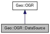
List of all members.
Public Class Methods |
| list | Capabilities () |
| Geo::OGR::DataSource | Open (scalar name, scalar update=0) |
| Geo::OGR::DataSource | OpenShared (scalar name, scalar update=0) |
Public Object Methods |
| scalar | TestCapability (scalar cap) |
| Geo::OGR::Layer | Layer (scalar layer=0) |
| list | Layers () |
| scalar | GetLayerCount () |
| Geo::OGR::Driver | GetDriver () |
| scalar | GetName () |
| Geo::OGR::Layer | CreateLayer (scalar Name, scalar SRS=undef, scalar GeometryType= 'Unknown', hashref Options=undef, hashref Schema=undef) |
| Geo::OGR::Layer | CopyLayer (scalar layer, scalar name, hashref options=undef) |
| | DeleteLayer (scalar layer) |
| | DeleteLayer (hash param) |
| Geo::OGR::Layer | ExecuteSQL (scalar statement, scalar geom=undef, scalar dialect="") |
| | ReleaseResultSet (scalar layer) |
| Geo::OGR::Layer | GetLayerByIndex (scalar index=0) |
| Geo::OGR::Layer | GetLayerByName (scalar name) |
Public Attributes |
| | name |
Member Function Documentation
| list Geo::OGR::DataSource::Capabilities |
( |
| ) |
|
- Returns:
- a list of capabilities. The class method returns a list of all potential capabilities a data source may have; the object method returns a list of all capabilities the data source has.
| Geo::OGR::Layer Geo::OGR::DataSource::CopyLayer |
( |
scalar |
layer, |
|
|
scalar |
name, |
|
|
hashref |
options = undef |
|
) |
| |
- Parameters:
-
| layer | A Geo::OGR::Layer object to be copied. |
| name | A name for the new layer. |
| options | A ref to a hash of format specific options. |
- Returns:
- a new Geo::OGR::Layer object.
| Geo::OGR::Layer Geo::OGR::DataSource::CreateLayer |
( |
scalar |
Name, |
|
|
scalar |
SRS = undef, |
|
|
scalar |
GeometryType = 'Unknown', |
|
|
hashref |
Options = undef, |
|
|
hashref |
Schema = undef |
|
) |
| |
- Note:
- This method can also be used with named parameters: $ds->CreateLayer({parameter=>value, ...}).
- Parameters:
-
| Name | A name for the new layer. |
| SRS | a Geo::OSR::SpatialReference object. |
| GeometryType | One of geometry types (a string: Point, LineString, or some else) |
| Options | A ref to a hash of format specific options. |
| Schema | Forwarded to Layer::Schema, which is called if this parameter exists. |
- Returns:
- a new Geo::OGR::Layer object.
| Geo::OGR::DataSource::DeleteLayer |
( |
scalar |
layer | ) |
|
Deletes a layer from the data source. Note that if there is a layer object for the deleted layer, it becomes unusable.
- Parameters:
-
| layer | name (primary) or index (secondary) of the layer to be deleted, if ambiguous use named parameter syntax (name or index). |
| Geo::OGR::DataSource::DeleteLayer |
( |
hash |
param | ) |
|
Deletes a layer from the data source. Note that if there are layers objects for the deleted layer, they become unusable.
- Parameters:
-
| param | Named parameter (name or index) for the layer to be deleted. |
| Geo::OGR::Layer Geo::OGR::DataSource::ExecuteSQL |
( |
scalar |
statement, |
|
|
scalar |
geom = undef, |
|
|
scalar |
dialect = "" |
|
) |
| |
| scalar Geo::OGR::DataSource::GetLayerCount |
( |
| ) |
|
- Returns:
- the number of layers this data source provides.
| scalar Geo::OGR::DataSource::GetName |
( |
| ) |
|
- Returns:
- the name of this data source.
- Parameters:
-
| layer | a name (primary) or index (secondary) of the requested layer. If not given, then returns the first layer. |
- Returns:
- a new Geo::OGR::Layer object
| list Geo::OGR::DataSource::Layers |
( |
| ) |
|
- Returns:
- a list of layers this data source provides.
An example:
- Parameters:
-
| name | The data source name (directory, filename, etc.). |
| update | Whether to open the data source in update mode. |
- Returns:
- a new Geo::OGR::DataSource object.
Reimplemented from Geo::OGR.
- Parameters:
-
| name | The data source name (directory, filename, etc.). |
| update | Whether to open the data source in update mode. |
- Returns:
- a new Geo::OGR::DataSource object.
Reimplemented from Geo::OGR.
| Geo::OGR::DataSource::ReleaseResultSet |
( |
scalar |
layer | ) |
|
- Parameters:
-
| layer | A layer the has been created with ExecuteSQL. |
| scalar Geo::OGR::DataSource::TestCapability |
( |
scalar |
cap | ) |
|
- Parameters:
-
- Returns:
- a boolean value indicating whether the data source has the specified capability.
Member Data Documentation
string (access as $datasource->{name})
The documentation for this class was generated from the following file:

 1.7.3
1.7.3