Geo::OSR::CoordinateTransformation Class Reference
An object for transforming from one projection to another. More...
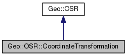
 Inheritance diagram for Geo::OSR::CoordinateTransformation:
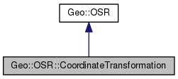
 Collaboration diagram for Geo::OSR::CoordinateTransformation:
Public Member Functions | |
| public array reference | TransformPoint (scalar x, scalar y, scalar z) |
| public method | TransformPoints (arrayref points) |
| public Geo::OSR::CoordinateTransformation | new (scalar src, scalar dst) |
 Public Member Functions inherited from Geo::OSR Public Member Functions inherited from Geo::OSR | |
| public list | AngularUnits () |
| public method | CreateCoordinateTransformation () |
| public list | Datums () |
| public list | GetProjectionMethodParamInfo (scalar projection, scalar parameter) |
| public list | GetProjectionMethodParameterList (scalar projection) |
| public array reference | GetProjectionMethods () |
| public scalar | GetUserInputAsWKT (scalar name) |
| public scalar | GetWellKnownGeogCSAsWKT (scalar name) |
| Get well known geographic coordinate system as WKT. More... | |
| public list | LinearUnits () |
| public list | Parameters () |
| public list | Projections () |
| public method | SRS_PM_GREENWICH () |
| public method | SRS_WGS84_INVFLATTENING () |
| public method | SRS_WGS84_SEMIMAJOR () |
| public method | SRS_WKT_WGS84 () |
Detailed Description
Member Function Documentation
| public Geo::OSR::CoordinateTransformation Geo::OSR::CoordinateTransformation::new | ( | scalar | src, |
| scalar | dst | ||
| ) |
Class method.
- Parameters
-
src a Geo::OSR::SpatialReference object dst a Geo::OSR::SpatialReference object
- Returns
- a new Geo::OSR::CoordinateTransformation object
 Code:
Code:
click to view
| public array reference Geo::OSR::CoordinateTransformation::TransformPoint | ( | scalar | x, |
| scalar | y, | ||
| scalar | z | ||
| ) |
- Parameters
-
x y z [optional]
- Returns
- arrayref = [$x, $y, $z]
 Code:
Code:
click to view
| public method Geo::OSR::CoordinateTransformation::TransformPoints | ( | arrayref | points | ) |
- Parameters
-
points [in/out] a reference to a list of points (line string or ring) that is modified in-place. A list of points is: ([x, y, z], [x, y, z], ...), where z is optional. Supports also lists of line strings and polygons.
 Code:
Code:
click to view
The documentation for this class was generated from the following file:


