A definition of a non-spatial attribute. More...
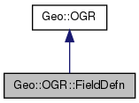
 Inheritance diagram for Geo::OGR::FieldDefn:
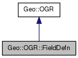
 Collaboration diagram for Geo::OGR::FieldDefn:
Public Member Functions | |
| public scalar | Default (scalar value) |
| public method | GetSchema () |
| public scalar | Ignored (scalar ignore) |
| public method | IsDefaultDriverSpecific () |
| public scalar | Justify (scalar justify) |
| public list | JustifyValues () |
| public scalar | Name (scalar name) |
| public scalar | Nullable (scalar nullable) |
| public scalar | Precision (scalar precision) |
| public hash reference | Schema (hash params) |
| public method | SetSchema () |
| public scalar | SubType (scalar SubType) |
| public method | SubTypes () |
| public scalar | Type (scalar type) |
| public list | Types () |
| public scalar | Width (scalar width) |
| public Geo::OGR::FieldDefn | new (hash params) |
| Create a new field definition. | |
 Public Member Functions inherited from Geo::OGR Public Member Functions inherited from Geo::OGR | |
| public list | ByteOrders () |
| public Geo::GDAL::Driver | Driver (scalar name) |
| public list | DriverNames () |
| public list | Drivers () |
| public method | Flatten () |
| public scalar | GeometryTypeModify (scalar type, scalar modifier) |
| public scalar | GeometryTypeTest (scalar type, scalar test, scalar type2) |
| public list | GeometryTypes () |
| public method | GetNonLinearGeometriesEnabledFlag () |
| public method | GetOpenDSCount () |
| public method | HasM () |
| public method | HasZ () |
| public Geo::GDAL::Dataset | Open (scalar name, scalar update=0) |
| public Geo::GDAL::Dataset | OpenShared (scalar name, scalar update=0) |
| public method | RELEASE_PARENT () |
| public method | SetGenerate_DB2_V72_BYTE_ORDER (scalar Generate_DB2_V72_BYTE_ORDER) |
| public method | SetNonLinearGeometriesEnabledFlag () |
Detailed Description
Member Function Documentation
| public scalar Geo::OGR::FieldDefn::Default | ( | scalar | value | ) |
Object method. Get or set the default value for this field.
- Note
- a.k.a. GetDefault and SetDefault
- Parameters
-
value [optional]
- Returns
- the default value of this field in non-void context.
 Code:
Code:
| public method Geo::OGR::FieldDefn::GetSchema | ( | ) |
 Code:
Code:
| public scalar Geo::OGR::FieldDefn::Ignored | ( | scalar | ignore | ) |
Object method. Get and/or set the ignore status (whether this field should be omitted when fetching features) of this field.
- Note
- a.k.a. IsIgnored, SetIgnored
- Parameters
-
ignore [optional]
- Returns
- the ignore status of this field in non-void context.
- Since
- 1.9.0
 Code:
Code:
| public method Geo::OGR::FieldDefn::IsDefaultDriverSpecific | ( | ) |
 Code:
Code:
| public scalar Geo::OGR::FieldDefn::Justify | ( | scalar | justify | ) |
Object method. Get and/or set the justification of this field.
- Note
- a.k.a. GetJustify, SetJustify
- Parameters
-
justify [optional] One of field justify types (Geo::OGR::FieldDefn::JustifyValues).
- Returns
- the justify value of this field in non-void context.
 Code:
Code:
| public list Geo::OGR::FieldDefn::JustifyValues | ( | ) |
Package subroutine. Justify values supported by GDAL. Current list is Left, Right, and Undefined.
 Code:
Code:
| public scalar Geo::OGR::FieldDefn::Name | ( | scalar | name | ) |
Object method. Get and/or set the name of the field.
- Note
- a.k.a. GetName, GetNameRef, SetName
- Parameters
-
name [optional]
- Returns
- the name in non-void context
 Code:
Code:
| public Geo::OGR::FieldDefn Geo::OGR::FieldDefn::new | ( | hash | params | ) |
Create a new field definition.
Class method.
- Parameters
-
Named parameters: - Name Field name (default is 'unnamed').
- Type Field type, one of Geo::OGR::FieldDefn::Types (default is 'String').
- SubType Field sub type, one of Geo::OGR::FieldDefn::SubTypes.
- Justify Justify value, one of Geo::OGR::FieldDefn::JustifyValues
- Width
- Precision
- Nullable (default is true)
- Default
- Ignored (default is false)
- Note
- Simplified parameters <name> => <type> is also supported.
- Returns
- a new Geo::OGR::FieldDefn object
 Code:
Code:
| public scalar Geo::OGR::FieldDefn::Nullable | ( | scalar | nullable | ) |
Object method. Get or set the nullable constraint for this field.
- Note
- a.k.a. IsNullable and SetNullable
- Parameters
-
nullable [optional]
- Returns
- the nullable value of this field in non-void context.
 Code:
Code:
| public scalar Geo::OGR::FieldDefn::Precision | ( | scalar | precision | ) |
Object method. Get and/or set the precision of this field.
- Note
- a.k.a. GetPrecision, SetPrecision
- Parameters
-
precision [optional]
- Returns
- the precision of this field in non-void context.
 Code:
Code:
| public hash reference Geo::OGR::FieldDefn::Schema | ( | hash | params | ) |
Object method. Get the schema or set parts of the schema
- Parameters
-
params [optional] as those in Geo::OGR::FieldDefn::new.
- Returns
- a reference to a hash whose keys are as those in Geo::OGR::FieldDefn::new.
 Code:
Code:
| public method Geo::OGR::FieldDefn::SetSchema | ( | ) |
 Code:
Code:
| public scalar Geo::OGR::FieldDefn::SubType | ( | scalar | SubType | ) |
Object method.
- Note
- a.k.a. GetSubType, SetSubType
- Parameters
-
SubType [optional] One of field sub types (Geo::OGR::FieldDefn::SubTypes).
- Returns
- the sub type of this field in non-void context.
 Code:
Code:
| public method Geo::OGR::FieldDefn::SubTypes | ( | ) |
 Code:
Code:
| public scalar Geo::OGR::FieldDefn::Type | ( | scalar | type | ) |
Object method. Get and/or set the type of the field.
- Note
- a.k.a. GetFieldTypeName, GetTypeName, GetType, SetType
- Parameters
-
type [optional] One of field types (Geo::OGR::FieldDefn::Types).
- Returns
- one of field types in non-void context.
 Code:
Code:
| public list Geo::OGR::FieldDefn::Types | ( | ) |
Package subroutine. Field types supported by GDAL. Current list is Binary, Date, DateTime, Integer, Integer64, Integer64List, IntegerList, Real, RealList, String, StringList, Time, WideString, and WideStringList. (However, WideString is not supported.)
 Code:
Code:
| public scalar Geo::OGR::FieldDefn::Width | ( | scalar | width | ) |
Object method. Get and/or set the field width.
- Note
- a.k.a. GetWidth, SetWidth
- Parameters
-
width [optional]
- Returns
- the width of this field in non-void context.
 Code:
Code:
The documentation for this class was generated from the following file:


