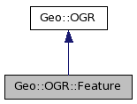
Inheritance diagram for Geo::OGR::Feature:

Public Class Methods | |
| Geo::OGR::Feature | new (scalar feature_def) |
| Geo::OGR::Feature | create (hash schema) |
Public Object Methods | |
| hashref | Schema (hash schema) |
| hashref | Row (hash row) |
| list | Tuple (list tuple) |
| Geo::OGR::FeatureDefn | GetDefnRef () |
| Geo::OGR::FieldDefn | GetFieldDefnRef (scalar field) |
| scalar | GetFieldType (scalar field) |
| SetGeometry (scalar geometry) | |
| scalar | Geometry (scalar geometry) |
| scalar | ReferenceGeometry (scalar geometry) |
| Geo::OGR::Feature | Clone () |
| scalar | Equal (scalar feature) |
| scalar | GetFieldIndex (scalar name) |
| scalar | GetFieldCount () |
| list | GetField (scalar field) |
| SetField (scalar field, list value) | |
| SetFrom (scalar other, scalar forgiving=1, hashref map) | |
| scalar | IsFieldSet (scalar field) |
| UnsetField (scalar field) | |
| scalar | FID (scalar fid) |
| scalar | GetFID () |
| SetFID (scalar fid) | |
| DumpReadable () | |
| scalar | StyleString (scalar string) |
| scalar | GetStyleString () |
| SetStyleString (scalar string) | |
| Geo::OGR::Feature Geo::OGR::Feature::Clone | ( | ) |
| Geo::OGR::Feature Geo::OGR::Feature::create | ( | hash | schema | ) |
| Geo::OGR::Feature::DumpReadable | ( | ) |
| scalar Geo::OGR::Feature::Equal | ( | scalar | feature | ) |
| scalar Geo::OGR::Feature::FID | ( | scalar | fid | ) |
| fid | [optional] the id to set for this feature |
| scalar Geo::OGR::Feature::Geometry | ( | scalar | geometry | ) |
Set or get the geometry in the feature. When setting, does a check against the schema (GeometryType) of the feature.
| geometry | [optional] a Geo::OGR::Geometry object or data from which such can be created (using Geo::OGR::Geometry::create) |
| Geo::OGR::FeatureDefn Geo::OGR::Feature::GetDefnRef | ( | ) |
| scalar Geo::OGR::Feature::GetFID | ( | ) |
| list Geo::OGR::Feature::GetField | ( | scalar | field | ) |
| field | the name (or index) of the field |
| scalar Geo::OGR::Feature::GetFieldCount | ( | ) |
| Geo::OGR::FieldDefn Geo::OGR::Feature::GetFieldDefnRef | ( | scalar | field | ) |
| scalar Geo::OGR::Feature::GetFieldIndex | ( | scalar | name | ) |
| name | the name of the field |
| scalar Geo::OGR::Feature::GetFieldType | ( | scalar | field | ) |
| field | the name (or index) of the field |
| scalar Geo::OGR::Feature::GetStyleString | ( | ) |
| scalar Geo::OGR::Feature::IsFieldSet | ( | scalar | field | ) |
| field | the name (or index) of the field |
| Geo::OGR::Feature Geo::OGR::Feature::new | ( | scalar | feature_def | ) |
| scalar Geo::OGR::Feature::ReferenceGeometry | ( | scalar | geometry | ) |
Create a new Geo::OGR::Geometry object, which references the geometry within the feature and/or create a reference to the argument geometry within the feature. This method maintains a link between the two objects and will not let the feature object be destroyed while the geometry object exists. Use with caution.
| geometry | [optional] a Geo::OGR::Geometry object |
| hashref Geo::OGR::Feature::Row | ( | hash | row | ) |
| row | [optional] feature data in a hash |
| hashref Geo::OGR::Feature::Schema | ( | hash | schema | ) |
Get or set the schema. The schema is a hash (Name => name, GeometryType => geometry_type, Fields => [list of Geo::OGR::FieldDefn objects or hashrefs from which such can be created]. The Name and GeometryType cannot be set and the Fields are added to the schema. Fields is an array of hashrefs that contain schemas of FieldDefns
| schema | [optional] |
| Geo::OGR::Feature::SetFID | ( | scalar | fid | ) |
| fid | the feature id |
| Geo::OGR::Feature::SetField | ( | scalar | field, | |
| list | value | |||
| ) |
| field | the name (or index) of the field | |
| value | is a string, integer, double, a list (year, month, day), a list (hour, minute, second, tzflag), a list (year, month, day, hour, minute, second, tzflag), or a list of integers, doubles, or strings. |
| Geo::OGR::Feature::SetFrom | ( | scalar | other, | |
| scalar | forgiving = 1, |
|||
| hashref | map | |||
| ) |
| other | a Geo::OGR::Feature object | |
| forgiving | [optional] set to false if the operation should not continue if output fields do not match some of the source fields | |
| map | [optional] a mapping from output field indexes to source fields, include into the hash all field indexes of this feature which should be set |
| Geo::OGR::Feature::SetGeometry | ( | scalar | geometry | ) |
| geometry | a Geo::OGR::Geometry object |
| Geo::OGR::Feature::SetStyleString | ( | scalar | string | ) |
| string |
| scalar Geo::OGR::Feature::StyleString | ( | scalar | string | ) |
| string | [optional] |
| list Geo::OGR::Feature::Tuple | ( | list | tuple | ) |
The schema of the tuple needs to be the same as that of the feature.
| tuple | [optional] feature data in an array |
| Geo::OGR::Feature::UnsetField | ( | scalar | field | ) |
| field | the name (or index) of the field |
 1.4.7
1.4.7