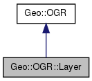
List of all members.
Member Function Documentation
| list Geo::OGR::Layer::Capabilities |
( |
| ) |
|
- Returns:
- the class method returns a list of all potential capabilities a layer may have; the object method returns a list of all capabilities the layer has
| Geo::OGR::Layer::CommitTransaction |
( |
| ) |
|
| Geo::OGR::Layer::CreateFeature |
( |
scalar |
feature | ) |
|
Inserts a feature into the layer. The given feature's id may change.
- Parameters:
-
| Geo::OGR::Layer::CreateField |
( |
scalar |
field_def, |
|
|
scalar |
approx_ok = 1 |
|
) |
| |
| Geo::OGR::Layer::DeleteFeature |
( |
scalar |
fid | ) |
|
| listref Geo::OGR::Layer::GetExtent |
( |
scalar |
force = 1 | ) |
|
- Parameters:
-
- Returns:
- the extent = ($minx, $miny, $maxx, $maxy) as a listref
| scalar Geo::OGR::Layer::GetFeatureCount |
( |
scalar |
force = 1 | ) |
|
- Parameters:
-
- Returns:
- integer
| scalar Geo::OGR::Layer::GetFeaturesRead |
( |
| ) |
|
| scalar Geo::OGR::Layer::GetName |
( |
| ) |
|
| scalar Geo::OGR::Layer::GetRefCount |
( |
| ) |
|
| Geo::OGR::Layer::InsertFeature |
( |
scalar |
feature | ) |
|
Same as CreateFeature except that the parameter feature may be a hashref (%row) or a listref (@tuple) that is fed to a Geo::OGR::Feature object's Row or Tuple method that is created in inserted into the layer.
- Parameters:
-
| Geo::OGR::Layer::ResetReading |
( |
| ) |
|
| Geo::OGR::Layer::RollbackTransaction |
( |
| ) |
|
| hashref Geo::OGR::Layer::Row |
( |
hash |
row | ) |
|
Get and/or set the data of a feature that has the supplied feature id (gets next if feature id is not given). The keys of the row are the field names. Special names FID and Geometry are used for feature id and Geometry respectively. The geometry is a Geo::OGR::Geometry object whose data is owned by the feature. It is ok to set only a subset of the fields, those fields whose keys do not exist are left unchanged.
- Parameters:
-
- Returns:
| hashref Geo::OGR::Layer::Schema |
( |
hash |
schema | ) |
|
Get and/or set the schema of the layer. The named input parameters are: Fields and ApproxOK. Fields is a reference to a list of field definitions (either Geo::OGR::FieldDefn objects or hashrefs from which they can be created). ApproxOK is a flag telling OGR whether it is ok to change the requested field definition to accommodate limitations of the layer. The output contains keys Name, GeometryType, and Fields.
- Parameters:
-
- Returns:
| Geo::OGR::Layer::SetAttributeFilter |
( |
scalar |
filter_string | ) |
|
Set or clear the attribute filter.
- Parameters:
-
| filter_string | a SQL WHERE clause or undef to clear the filter. |
| Geo::OGR::Layer::SetFeature |
( |
scalar |
feature | ) |
|
Replaces a feature in the layer based on the given feature's id. Requires RandomWrite capability
- Parameters:
-
| Geo::OGR::Layer::SetNextByIndex |
( |
scalar |
new_index | ) |
|
- Parameters:
-
| new_index | the index to which set the read cursor |
| Geo::OGR::Layer::SetSpatialFilter |
( |
scalar |
filter | ) |
|
- Parameters:
-
| filter | [optional] a Geo::OGR::Geometry object. If not given, removes the filter if there is one. |
| Geo::OGR::Layer::SetSpatialFilterRect |
( |
scalar |
minx, |
|
|
scalar |
miny, |
|
|
scalar |
maxx, |
|
|
scalar |
maxy |
|
) |
| |
- Parameters:
-
| filter | [optional] a rectangle ($minx, $miny, $maxx, $maxy). |
- Returns:
- a new Geo::OGR::Geometry object
| Geo::OGR::Layer::StartTransaction |
( |
| ) |
|
| Geo::OGR::Layer::SyncToDisk |
( |
| ) |
|
| scalar Geo::OGR::Layer::TestCapability |
( |
scalar |
cap | ) |
|
- Parameters:
-
- Returns:
- boolean
| list Geo::OGR::Layer::Tuple |
( |
list |
tuple | ) |
|
Get and/set the data of a feature that has the supplied feature id (gets next if feature id is not given). The order of the data in the tuple is: feature id, Geometry, fields in their order. The geometry is a Geo::OGR::Geometry object whose data is owned by the feature. It is ok to leave Geometry undefined, it is set only if it is defined.
- Parameters:
-
- Returns:
The documentation for this class was generated from the following file:

 1.7.3
1.7.3