Geo::GDAL::Driver Class Reference
A driver for a specific dataset format.
More...
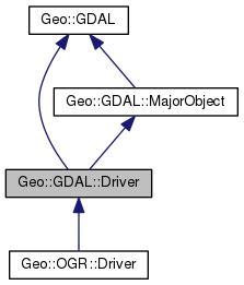
 Inheritance diagram for Geo::GDAL::Driver:
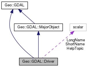
 Collaboration diagram for Geo::GDAL::Driver:
Public Member Functions | |
| public list | Capabilities () |
| public Geo::GDAL::Dataset | Copy (hash params) |
| public method | CopyFiles (scalar NewName, scalar OldName) |
| public Geo::GDAL::Dataset | Create (hash params) |
| public list | CreationDataTypes () |
| public list | CreationOptionList () |
| public method | Delete (scalar name) |
| public method | Domains () |
| public scalar | Extension () |
| public scalar | MIMEType () |
| public scalar | Name () |
| public method | Open () |
| public method | Rename (scalar NewName, scalar OldName) |
| public scalar | TestCapability (scalar cap) |
| public method | stdout_redirection_wrapper () |
 Public Member Functions inherited from Geo::GDAL::MajorObject Public Member Functions inherited from Geo::GDAL::MajorObject | |
| public scalar | Description (scalar description) |
| public method | Domains () |
| public scalar | GetDescription () |
| public hash reference | GetMetadata (scalar domain="") |
| public method | GetMetadataDomainList () |
| public hash reference | Metadata (hashref metadata=undef, scalar domain= '') |
| public method | SetDescription (scalar NewDesc) |
| public method | SetMetadata (hashref metadata, scalar domain="") |
 Public Member Functions inherited from Geo::GDAL Public Member Functions inherited from Geo::GDAL | |
| public method | ApplyVerticalShiftGrid () |
| public method | BuildVRT () |
| public method | CPLBinaryToHex () |
| public method | CPLHexToBinary () |
| public method | CreatePansharpenedVRT () |
| public scalar | DataTypeIsComplex (scalar DataType) |
| public list | DataTypeValueRange (scalar DataType) |
| public list | DataTypes () |
| public scalar | DecToDMS (scalar angle, scalar axis, scalar precision=2) |
| public scalar | DecToPackedDMS (scalar dec) |
| public method | DontUseExceptions () |
| public Geo::GDAL::Driver | Driver (scalar Name) |
| public list | DriverNames () |
| public list | Drivers () |
| public method | EscapeString () |
| public scalar | FindFile (scalar basename) |
| public method | FinderClean () |
| public method | GOA2GetAccessToken () |
| public method | GOA2GetAuthorizationURL () |
| public method | GOA2GetRefreshToken () |
| public method | GetActualURL () |
| public scalar | GetCacheMax () |
| public scalar | GetCacheUsed () |
| public scalar | GetConfigOption (scalar key) |
| public scalar | GetDataTypeSize (scalar DataType) |
| public method | GetErrorCounter () |
| public method | GetFileSystemOptions () |
| public method | GetFileSystemsPrefixes () |
| public method | GetJPEG2000StructureAsString () |
| public method | GetSignedURL () |
| public Geo::GDAL::Driver | IdentifyDriver (scalar path, scalar siblings) |
| public method | IdentifyDriverEx () |
| public method | MkdirRecursive () |
| public Geo::GDAL::Dataset | Open (hash params) |
| public Geo::GDAL::Dataset | OpenEx (hash params) |
| public list | OpenFlags () |
| public scalar | PackCharacter (scalar DataType) |
| public scalar | PackedDMSToDec (scalar packed) |
| public method | PopFinderLocation () |
| public method | PushFinderLocation (scalar path) |
| public list | RIOResamplingTypes () |
| public list | ResamplingTypes () |
| public method | RmdirRecursive () |
| public method | SetCacheMax (scalar Bytes) |
| public method | SetConfigOption (scalar key, scalar value) |
| public method | UseExceptions () |
| public method | VSICurlClearCache () |
| public method | VSIFEofL () |
| public method | VSIFOpenExL () |
| public method | VSIGetLastErrorMsg () |
| public method | VSIGetLastErrorNo () |
| public scalar | VersionInfo (scalar request= 'VERSION_NUM') |
| public scalar | errstr () |
Public Attributes | |
| scalar | HelpTopic |
| $driver->{HelpTopic} | |
| scalar | LongName |
| $driver->{LongName} | |
| scalar | ShortName |
| $driver->{ShortName} | |
Detailed Description
Member Function Documentation
| public list Geo::GDAL::Driver::Capabilities | ( | ) |
Object method.
- Returns
- A list of capabilities. When executed as a package subroutine
returns a list of all potential capabilities a driver may have. When
executed as an object method returns a list of all capabilities the
driver has.
Currently capabilities are:
CREATE, CREATECOPY, DEFAULT_FIELDS, NOTNULL_FIELDS, NOTNULL_GEOMFIELDS, OPEN, RASTER, VECTOR, and VIRTUALIO.
Examples.
<br>@all_capabilities = Geo::GDAL::Driver::Capabilities;<br>
 Code:
Code:
click to view
| public Geo::GDAL::Dataset Geo::GDAL::Driver::Copy | ( | hash | params | ) |
Object method.
Create a new raster Geo::GDAL::Dataset as a copy of an existing dataset.
- Note
- a.k.a. CreateCopy
- Parameters
-
params Named parameters:
- Name name for the new raster dataset.
- Src the source Geo::GDAL::Dataset object.
- Strict 1 (default) if the copy must be strictly equivalent, or 0 if the copy may adapt.
- Options an anonymous hash of driver specific options.
- Progress [optional] a reference to a subroutine, which will
be called with parameters (number progress, string msg, progress_data).
- ProgressData [optional]
- Returns
- a new Geo::GDAL::Dataset object.
 Code:
Code:
click to view
| public method Geo::GDAL::Driver::CopyFiles | ( | scalar | NewName, |
| scalar | OldName | ||
| ) |
Object method.
Copy the files of a dataset.
- Parameters
-
NewName String.
OldName String.
 Code:
Code:
click to view
| public Geo::GDAL::Dataset Geo::GDAL::Driver::Create | ( | hash | params | ) |
Object method.
Create a raster dataset using this driver.
- Note
- a.k.a. CreateDataset
- Parameters
-
params Named parameters:
- Name The name for the dataset (default is 'unnamed') or an object, which implements write and close.
- Width The width for the raster dataset (default is 256).
- Height The height for the raster dataset (default is 256).
- Bands The number of bands to create into the raster dataset (default is 1).
- Type The data type for the raster cells (default is 'Byte'). One of Geo::GDAL::Driver::CreationDataTypes.
- Options Driver creation options as a reference to a hash (default is {}).
- Returns
- A new Geo::GDAL::Dataset object.
 Code:
Code:
click to view
| public list Geo::GDAL::Driver::CreationDataTypes | ( | ) |
Object method.
- Returns
- a list of data types that can be used for new datasets of this format. A subset of Geo::GDAL::DataTypes
 Code:
Code:
click to view
| public list Geo::GDAL::Driver::CreationOptionList | ( | ) |
Object method.
- Returns
- a list of options, each option is a hashref, the keys are
name, type and description or Value. Value is a listref.
 Code:
Code:
click to view
| public method Geo::GDAL::Driver::Delete | ( | scalar | name | ) |
Object method.
- Parameters
-
name
 Code:
Code:
click to view
| public method Geo::GDAL::Driver::Domains | ( | ) |
 Code:
Code:
click to view
| public scalar Geo::GDAL::Driver::Extension | ( | ) |
Object method.
- Note
- The returned extension does not contain a '.' prefix.
- Returns
- a suggested single extension or a list of extensions (in
list context) for datasets.
 Code:
Code:
click to view
| public scalar Geo::GDAL::Driver::MIMEType | ( | ) |
Object method.
- Returns
- a suggested MIME type for datasets.
 Code:
Code:
click to view
| public scalar Geo::GDAL::Driver::Name | ( | ) |
Object method.
- Returns
- The short name of the driver.
 Code:
Code:
click to view
| public method Geo::GDAL::Driver::Open | ( | ) |
Object method.
The same as Geo::GDAL::Open except that only this driver is allowed.
 Code:
Code:
click to view
| public method Geo::GDAL::Driver::Rename | ( | scalar | NewName, |
| scalar | OldName | ||
| ) |
Object method.
Rename (move) a GDAL dataset.
- Parameters
-
NewName String.
OldName String.
 Code:
Code:
click to view
| public method Geo::GDAL::Driver::stdout_redirection_wrapper | ( | ) |
 Code:
Code:
click to view
| public scalar Geo::GDAL::Driver::TestCapability | ( | scalar | cap | ) |
Object method.
Test whether the driver has the specified capability.
- Parameters
-
cap A capability string (one of those returned by Capabilities).
- Returns
- a boolean value.
 Code:
Code:
click to view
The documentation for this class was generated from the following file:
- all.dox


