GDAL utility functions and a root class for raster classes.
More...
 Inheritance diagram for Geo::GDAL:
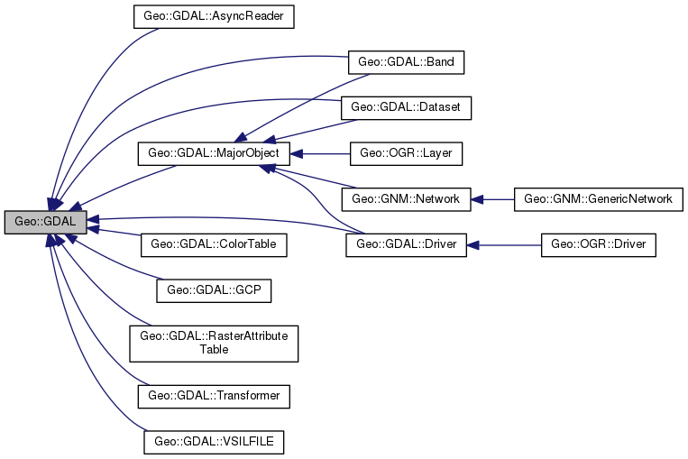
Classes | |
| class | AsyncReader |
| Enable asynchronous requests. More... | |
| class | Band |
| A raster band. More... | |
| class | ColorTable |
| A color table from a raster band or a color table, which can be used for a band. More... | |
| class | Dataset |
| A set of associated raster bands or vector layer source. More... | |
| class | Driver |
| A driver for a specific dataset format. More... | |
| class | Extent |
| A rectangular area in projection coordinates: xmin, ymin, xmax, ymax. More... | |
| class | GCP |
| A ground control point for georeferencing rasters. More... | |
| class | GeoTransform |
| An array of affine transformation coefficients. More... | |
| class | MajorObject |
| An object, which holds meta data. More... | |
| class | RasterAttributeTable |
| An attribute table in a raster band. More... | |
| class | Transformer |
More... | |
| class | VSIF |
| A GDAL virtual file system. More... | |
| class | VSILFILE |
| class | XML |
| A simple XML parser More... | |
Public Member Functions | |
| public method | ApplyVerticalShiftGrid () |
| public method | BuildVRT () |
| public method | CPLBinaryToHex () |
| public method | CPLHexToBinary () |
| public method | CreatePansharpenedVRT () |
| public scalar | DataTypeIsComplex (scalar DataType) |
| public list | DataTypeValueRange (scalar DataType) |
| public list | DataTypes () |
| public scalar | DecToDMS (scalar angle, scalar axis, scalar precision=2) |
| public scalar | DecToPackedDMS (scalar dec) |
| public method | DontUseExceptions () |
| public Geo::GDAL::Driver | Driver (scalar Name) |
| public list | DriverNames () |
| public list | Drivers () |
| public method | EscapeString () |
| public scalar | FindFile (scalar basename) |
| public method | FinderClean () |
| public method | GOA2GetAccessToken () |
| public method | GOA2GetAuthorizationURL () |
| public method | GOA2GetRefreshToken () |
| public method | GetActualURL () |
| public scalar | GetCacheMax () |
| public scalar | GetCacheUsed () |
| public scalar | GetConfigOption (scalar key) |
| public scalar | GetDataTypeSize (scalar DataType) |
| public method | GetErrorCounter () |
| public method | GetFileSystemOptions () |
| public method | GetFileSystemsPrefixes () |
| public method | GetJPEG2000StructureAsString () |
| public method | GetSignedURL () |
| public Geo::GDAL::Driver | IdentifyDriver (scalar path, scalar siblings) |
| public method | IdentifyDriverEx () |
| public method | MkdirRecursive () |
| public Geo::GDAL::Dataset | Open (hash params) |
| public Geo::GDAL::Dataset | OpenEx (hash params) |
| public list | OpenFlags () |
| public scalar | PackCharacter (scalar DataType) |
| public scalar | PackedDMSToDec (scalar packed) |
| public method | PopFinderLocation () |
| public method | PushFinderLocation (scalar path) |
| public list | RIOResamplingTypes () |
| public list | ResamplingTypes () |
| public method | RmdirRecursive () |
| public method | SetCacheMax (scalar Bytes) |
| public method | SetConfigOption (scalar key, scalar value) |
| public method | UseExceptions () |
| public method | VSICurlClearCache () |
| public method | VSIFEofL () |
| public method | VSIFOpenExL () |
| public method | VSIGetLastErrorMsg () |
| public method | VSIGetLastErrorNo () |
| public scalar | VersionInfo (scalar request= 'VERSION_NUM') |
| public scalar | errstr () |
Detailed Description
GDAL utility functions and a root class for raster classes.
Geo::GDAL wraps many GDAL utility functions and is as a root class
for all GDAL raster classes. A "raster" is an object, whose core is
a rectagular grid of cells, called a "band" in GDAL. Each cell
contains a numeric value of a specific data type.
Member Function Documentation
| public method Geo::GDAL::ApplyVerticalShiftGrid | ( | ) |
Code:
| public method Geo::GDAL::BuildVRT | ( | ) |
Code:
| public method Geo::GDAL::CPLBinaryToHex | ( | ) |
Code:
| public method Geo::GDAL::CPLHexToBinary | ( | ) |
Code:
| public method Geo::GDAL::CreatePansharpenedVRT | ( | ) |
Code:
| public scalar Geo::GDAL::DataTypeIsComplex | ( | scalar | DataType | ) |
Package subroutine.
- Parameters
-
DataType A GDAL raster cell data type (one of those listed by Geo::GDAL::DataTypes).
- Returns
- true if the data type is a complex number.
Code:
| public list Geo::GDAL::DataTypes | ( | ) |
Package subroutine.
- Returns
- a list of GDAL raster cell data types. These are currently:
Byte, CFloat32, CFloat64, CInt16, CInt32, Float32, Float64, Int16, Int32, UInt16, UInt32, and Unknown.
Code:
| public list Geo::GDAL::DataTypeValueRange | ( | scalar | DataType | ) |
Package subroutine.
- Parameters
-
DataType Data type (one of those listed by Geo::GDAL::DataTypes).
- Note
- Some returned values are inaccurate.
- Returns
- the minimum, maximum range of the data type.
Code:
| public scalar Geo::GDAL::DecToDMS | ( | scalar | angle, |
| scalar | axis, | ||
| scalar | precision = 2 |
||
| ) |
Package subroutine.
Convert decimal degrees to degrees, minutes, and seconds string
- Parameters
-
angle A number
axis A string specifying latitude or longitude ('Long').
precision
- Returns
- a string nndnn'nn.nn'"L where n is a number and L is either
N or E
Code:
| public scalar Geo::GDAL::DecToPackedDMS | ( | scalar | dec | ) |
Package subroutine.
- Parameters
-
dec Decimal degrees
- Returns
- packed DMS, i.e., a number DDDMMMSSS.SS
Code:
| public method Geo::GDAL::DontUseExceptions | ( | ) |
Package subroutine.
Do not use the Perl exception mechanism for GDAL messages. Instead
the messages are printed to standard error.
Code:
| public Geo::GDAL::Driver Geo::GDAL::Driver | ( | scalar | Name | ) |
Package subroutine.
Access a format driver.
- Parameters
-
Name The short name of the driver. One of
Geo::GDAL::DriverNames or Geo::OGR::DriverNames.
- Note
- This subroutine is imported into the main namespace if Geo::GDAL
is used with qw/:all/.
- Returns
- a Geo::GDAL::Driver object.
Code:
| public list Geo::GDAL::DriverNames | ( | ) |
Package subroutine.
Available raster format drivers.
- Note
- Use Geo::OGR::DriverNames for vector drivers.
- Returns
- a list of the short names of all available GDAL raster drivers.
Code:
| public list Geo::GDAL::Drivers | ( | ) |
Package subroutine.
- Note
- Use Geo::OGR::Drivers for vector drivers.
- Returns
- a list of all available GDAL raster drivers.
Code:
| public scalar Geo::GDAL::errstr | ( | ) |
Package subroutine.
Clear the error stack and return all generated GDAL error messages in one (possibly multiline) string.
- Returns
- the chomped error stack joined with newlines.
Code:
| public method Geo::GDAL::EscapeString | ( | ) |
Code:
| public method Geo::GDAL::FinderClean | ( | ) |
Package subroutine.
Clear the set of support file search paths.
Code:
| public scalar Geo::GDAL::FindFile | ( | scalar | basename | ) |
Package subroutine.
Search for GDAL support files.
An example:
Prints (for example):
- Parameters
-
basename The name of the file to search for. For example
'pcs.csv'.
- Returns
- the path to the searched file or undef.
Code:
| public method Geo::GDAL::GetActualURL | ( | ) |
Code:
| public scalar Geo::GDAL::GetCacheMax | ( | ) |
Package subroutine.
- Returns
- maximum amount of memory (as bytes) for caching within GDAL.
Code:
| public scalar Geo::GDAL::GetCacheUsed | ( | ) |
Package subroutine.
- Returns
- the amount of memory currently used for caching within GDAL.
Code:
| public scalar Geo::GDAL::GetConfigOption | ( | scalar | key | ) |
| public scalar Geo::GDAL::GetDataTypeSize | ( | scalar | DataType | ) |
Package subroutine.
- Parameters
-
DataType A GDAL raster cell data type (one of those listed by Geo::GDAL::DataTypes).
- Returns
- the size as the number of bits.
Code:
| public method Geo::GDAL::GetErrorCounter | ( | ) |
Code:
| public method Geo::GDAL::GetFileSystemOptions | ( | ) |
Code:
| public method Geo::GDAL::GetFileSystemsPrefixes | ( | ) |
Code:
| public method Geo::GDAL::GetJPEG2000StructureAsString | ( | ) |
Code:
| public method Geo::GDAL::GetSignedURL | ( | ) |
Code:
| public method Geo::GDAL::GOA2GetAccessToken | ( | ) |
Code:
| public method Geo::GDAL::GOA2GetAuthorizationURL | ( | ) |
Code:
| public method Geo::GDAL::GOA2GetRefreshToken | ( | ) |
Code:
| public Geo::GDAL::Driver Geo::GDAL::IdentifyDriver | ( | scalar | path, |
| scalar | siblings | ||
| ) |
Package subroutine.
- Parameters
-
path a dataset path.
siblings [optional] A list of names of files that belong to the data format.
- Returns
- a Geo::GDAL::Driver.
Code:
| public method Geo::GDAL::IdentifyDriverEx | ( | ) |
Code:
| public method Geo::GDAL::MkdirRecursive | ( | ) |
Code:
| public Geo::GDAL::Dataset Geo::GDAL::Open | ( | hash | params | ) |
Package subroutine.
Open a dataset.
An example, which opens an existing raster dataset for editing:
- Parameters
-
params Named parameters:
- Name Dataset string (typically a filename). Default is '.'.
- Access Access type, either 'ReadOnly' or 'Update'. Default is 'ReadOnly'.
- Type Dataset type, either 'Raster', 'Vector', or 'Any'. Default is 'Any'.
- Options A hash of GDAL open options passed to candidate drivers. Default is {}.
- Files A list of names of files that are auxiliary to the main file. Default is [].
- Note
- This subroutine is imported into the main namespace if Geo::GDAL
is use'd with qw/:all/.
-
Some datasets / dataset strings do not explicitly imply the
dataset type (for example a PostGIS database). If the type is not
specified in such a case the returned dataset may be of either type.
- Returns
- a new Geo::GDAL::Dataset object if success.
Code:
| public Geo::GDAL::Dataset Geo::GDAL::OpenEx | ( | hash | params | ) |
Package subroutine.
The generic dataset open method, used internally by all Open and OpenShared methods.
- Parameters
-
params Named parameters:
- Name The name of the data set or source to open. (Default is '.')
- Flags A list of access mode flags. Available flags are listed by Geo::GDAL::OpenFlags(). (Default is [])
- Drivers A list of short names of drivers that may be used. Empty list means all. (Default is [])
- Options A hash of GDAL open options passed to candidate drivers. (Default is {})
- Files A list of names of files that are auxiliary to the main file. (Default is [])
An example
<br>$ds = Geo::GDAL::OpenEx(Name => 'existing.tiff', Flags => [qw/RASTER UPDATE/]);<br>
- Returns
- a new Geo::GDAL::Dataset object.
Code:
| public list Geo::GDAL::OpenFlags | ( | ) |
| public scalar Geo::GDAL::PackCharacter | ( | scalar | DataType | ) |
Package subroutine.
Get the character that is needed for Perl's pack and unpack when
they are used with Geo::GDAL::Band::ReadRaster and
Geo::GDAL::Band::WriteRaster. Note that Geo::GDAL::Band::ReadTile
and Geo::GDAL::Band::WriteTile have simpler interfaces that do not
require pack and unpack.
- Parameters
-
DataType A GDAL raster cell data type, typically from $band->DataType.
- Returns
- a character which can be used in Perl's pack and unpack.
Code:
| public scalar Geo::GDAL::PackedDMSToDec | ( | scalar | packed | ) |
Package subroutine.
- Parameters
-
packed DMS as a number DDDMMMSSS.SS
- Returns
- decimal degrees
Code:
| public method Geo::GDAL::PopFinderLocation | ( | ) |
Package subroutine.
Remove the latest addition from the set of support file search
paths. Note that calling this subroutine may remove paths GDAL put
into the finder.
Code:
| public method Geo::GDAL::PushFinderLocation | ( | scalar | path | ) |
Package subroutine.
Add a path to the set of paths from where GDAL support files are
sought. Note that GDAL puts initially into the finder the current
directory and value of GDAL_DATA environment variable (if it
exists), installation directory (prepended with '/share/gdal' or
'/Resources/gdal'), or '/usr/local/share/gdal'. It is usually only
needed to add paths to the finder if using an alternate set of data
files or a non-installed GDAL is used (as in testing).
Code:
| public list Geo::GDAL::ResamplingTypes | ( | ) |
Package subroutine.
- Returns
- a list of GDAL resampling methods. These are currently:
Average, Bilinear, Cubic, CubicSpline, Lanczos, Max, Med, Min, Mode, NearestNeighbour, Q1, and Q3.
Code:
| public list Geo::GDAL::RIOResamplingTypes | ( | ) |
Package subroutine.
- Returns
- a list of GDAL raster IO resampling methods. These are currently:
Average, Bilinear, Cubic, CubicSpline, Gauss, Lanczos, Mode, and NearestNeighbour.
Code:
| public method Geo::GDAL::RmdirRecursive | ( | ) |
Code:
| public method Geo::GDAL::SetCacheMax | ( | scalar | Bytes | ) |
Package subroutine.
- Parameters
-
Bytes New maximum amount of memory for caching within GDAL.
Code:
| public method Geo::GDAL::SetConfigOption | ( | scalar | key, |
| scalar | value | ||
| ) |
| public method Geo::GDAL::UseExceptions | ( | ) |
Package subroutine.
Use the Perl exception mechanism for GDAL messages (failures are
confessed and warnings are warned) and collect the messages
into @Geo::GDAL::error. This is the default.
Code:
| public scalar Geo::GDAL::VersionInfo | ( | scalar | request = 'VERSION_NUM' | ) |
Package subroutine.
- Parameters
-
request A string specifying the request. Currently either
"VERSION_NUM", "RELEASE_DATE", "RELEASE_NAME", or
"--version". Default is "VERSION_NUM".
- Returns
- Requested information.
Code:
| public method Geo::GDAL::VSICurlClearCache | ( | ) |
Code:
| public method Geo::GDAL::VSIFEofL | ( | ) |
Code:
| public method Geo::GDAL::VSIFOpenExL | ( | ) |
Code:
| public method Geo::GDAL::VSIGetLastErrorMsg | ( | ) |
Code:
| public method Geo::GDAL::VSIGetLastErrorNo | ( | ) |
Code:
The documentation for this class was generated from the following file:
- all.dox