Classes | |
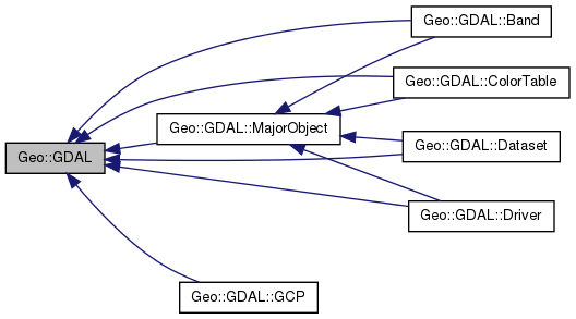
| class | Band |
| class | ColorTable |
| class | Const |
| class | Dataset |
| class | Driver |
| class | GCP |
| class | MajorObject |
| class | RasterAttributeTable |
Public Functions | |
| scalar | VersionInfo (scalar request= 'VERSION_NUM') |
| UseExceptions () | |
| DontUseExceptions () | |
| Debug (scalar msg_class, scalar msg) | |
| Error () | |
| PushErrorHandler () | |
| PopErrorHandler () | |
| ErrorReset () | |
| GetLastErrorNo () | |
| GetLastErrorType () | |
| GetLastErrorMsg () | |
| PushFinderLocation () | |
| PopFinderLocation () | |
| FinderClean () | |
| FindFile () | |
| listref | ReadDir (scalar path) |
| SetConfigOption () | |
| GetConfigOption () | |
| CPLBinaryToHex () | |
| CPLHexToBinary () | |
| listref | GCPsToGeoTransform (listref GCPs, scalar ApproxOK=1) |
| AllRegister () | |
| scalar | GetCacheMax () |
| SetCacheMax (scalar Bytes) | |
| scalar | GetCacheUsed () |
| scalar | GetDataTypeSize (scalar GDALDataType) |
| scalar | DataTypeIsComplex (scalar GDALDataType) |
| scalar | DecToDMS (scalar angle, scalar axis, scalar precision=2) |
| scalar | PackedDMSToDec (scalar packed) |
| scalar | DecToPackedDMS (scalar dec) |
| scalar | NodeType (scalar type) |
| listref | ParseXMLString (scalar XML) |
| list | NodeData (scalar node) |
| list | Children (scalar node) |
| list | Child (scalar node, scalar i) |
| scalar | SerializeXMLTree (listref XMLTree) |
| list | Drivers () |
| scalar | GetDriverCount () |
| Geo::GDAL::Driver | Driver (scalar driver) |
| Geo::GDAL::Driver | GetDriver (scalar driver) |
| An alias for the "Driver" method. | |
| Geo::GDAL::Driver | GetDriverByName (scalar ShortName) |
| Geo::GDAL::Driver | IdentifyDriver (scalar name, scalar siblings) |
| ComputeMedianCutPCT (scalar red, scalar green, scalar blue, scalar num_colors, scalar colors, scalar callback, scalar callback_data) | |
| DitherRGB2PCT (scalar red, scalar green, scalar blue, scalar target, scalar colors, scalar callback, scalar callback_data) | |
| ReprojectImage (scalar src_ds, scalar dst_ds, scalar src_wkt=undef, scalar dst_wkt=undef, scalar ResampleAlg='NearestNeighbour', scalar WarpMemoryLimit=0.0, scalar maxerror=0.0) | |
| Geo::GDAL::Dataset | AutoCreateWarpedVRT (scalar src_ds, scalar src_wkt=undef, scalar dst_wkt=undef, scalar ResampleAlg='NearestNeighbour', scalar maxerror=0.0) |
| listref | GeneralCmdLineProcessor (listref argv, scalar options=0) |
| scalar | PackCharacter (scalar DataType) |
| Geo::GDAL::Dataset | Open (scalar name, scalar access='ReadOnly') |
| Geo::GDAL::Dataset | OpenShared (scalar name, scalar access='ReadOnly') |
| scalar | GetDataTypeName (scalar GDALDataType) |
| scalar | GetDataTypeByName (scalar GDALDataType) |
| scalar | GetColorInterpretationName (scalar ColorInterpretation) |
| scalar | GetPaletteInterpretationName (scalar PaletteInterpretation) |
Member Function Documentation
| Geo::GDAL::AllRegister | ( | ) |
| Geo::GDAL::Dataset Geo::GDAL::AutoCreateWarpedVRT | ( | scalar | src_ds, |
| scalar | src_wkt = undef, |
||
| scalar | dst_wkt = undef, |
||
| scalar | ResampleAlg = 'NearestNeighbour', |
||
| scalar | maxerror = 0.0 |
||
| ) |
- Parameters:
-
src_ds a Geo::GDAL::Dataset object src_wkt dst_wkt ResampleAlg one of NearestNeighbour Bilinear Cubic CubicSpline maxerror
- Returns:
- a new Geo::GDAL::Dataset object
| list Geo::GDAL::Child | ( | scalar | node, |
| scalar | i | ||
| ) |
- Parameters:
-
node i 0 .. number of children - 1
- Returns:
| list Geo::GDAL::Children | ( | scalar | node | ) |
- Parameters:
-
node
- Returns:
| Geo::GDAL::ComputeMedianCutPCT | ( | scalar | red, |
| scalar | green, | ||
| scalar | blue, | ||
| scalar | num_colors, | ||
| scalar | colors, | ||
| scalar | callback, | ||
| scalar | callback_data | ||
| ) |
- Parameters:
-
red a Geo::GDAL::Band object green a Geo::GDAL::Band object blue a Geo::GDAL::Band object num_colors integer colors a Geo::GDAL::ColorTable object callback [optional] a reference to a subroutine, which will be called with parameters (number progress, string msg, callback_data) callback_data [optional]
| Geo::GDAL::CPLBinaryToHex | ( | ) |
| Geo::GDAL::CPLHexToBinary | ( | ) |
| scalar Geo::GDAL::DataTypeIsComplex | ( | scalar | GDALDataType | ) |
- Parameters:
-
GDALDataType
- Returns:
| Geo::GDAL::Debug | ( | scalar | msg_class, |
| scalar | msg | ||
| ) |
- Parameters:
-
msg_class msg
| scalar Geo::GDAL::DecToDMS | ( | scalar | angle, |
| scalar | axis, | ||
| scalar | precision = 2 |
||
| ) |
- Parameters:
-
angle axis precision
- Returns:
| scalar Geo::GDAL::DecToPackedDMS | ( | scalar | dec | ) |
- Parameters:
-
dec
- Returns:
- number
| Geo::GDAL::DitherRGB2PCT | ( | scalar | red, |
| scalar | green, | ||
| scalar | blue, | ||
| scalar | target, | ||
| scalar | colors, | ||
| scalar | callback, | ||
| scalar | callback_data | ||
| ) |
- Parameters:
-
red a Geo::GDAL::Band object green a Geo::GDAL::Band object blue a Geo::GDAL::Band object target a Geo::GDAL::Band object colors a Geo::GDAL::ColorTable object callback [optional] a reference to a subroutine, which will be called with parameters (number progress, string msg, callback_data) callback_data [optional]
| Geo::GDAL::DontUseExceptions | ( | ) |
| Geo::GDAL::Driver Geo::GDAL::Driver | ( | scalar | driver | ) |
- Parameters:
-
driver The name or number of the driver.
- Returns:
- a new Geo::GDAL::Driver object
| list Geo::GDAL::Drivers | ( | ) |
- Returns:
| Geo::GDAL::Error | ( | ) |
| Geo::GDAL::ErrorReset | ( | ) |
| Geo::GDAL::FinderClean | ( | ) |
| Geo::GDAL::FindFile | ( | ) |
| listref Geo::GDAL::GCPsToGeoTransform | ( | listref | GCPs, |
| scalar | ApproxOK = 1 |
||
| ) |
x = $a + j * $b + i * $c;
y = $d + j * $e + i * $f;
(i,j) is the location in pixel coordinates
(x,y) is the location in projection coordinates
- Returns:
- [$a, $b, $c, $d, $e, $f]
| listref Geo::GDAL::GeneralCmdLineProcessor | ( | listref | argv, |
| scalar | options = 0 |
||
| ) |
- Parameters:
-
argv options integer
- Returns:
- arrayref
| scalar Geo::GDAL::GetCacheMax | ( | ) |
- Returns:
| scalar Geo::GDAL::GetCacheUsed | ( | ) |
- Returns:
| scalar Geo::GDAL::GetColorInterpretationName | ( | scalar | ColorInterpretation | ) |
| Geo::GDAL::GetConfigOption | ( | ) |
| scalar Geo::GDAL::GetDataTypeByName | ( | scalar | GDALDataType | ) |
| scalar Geo::GDAL::GetDataTypeName | ( | scalar | GDALDataType | ) |
| scalar Geo::GDAL::GetDataTypeSize | ( | scalar | GDALDataType | ) |
- Parameters:
-
GDALDataType (one of Byte, UInt16, Int16, UInt32, Int32, Float32, Float64, CInt16, CInt32, CFloat32, or CFloat64)
- Returns:
| Geo::GDAL::Driver Geo::GDAL::GetDriver | ( | scalar | driver | ) |
An alias for the "Driver" method.
- Parameters:
-
driver The name or number of the driver.
- Returns:
- a new Geo::GDAL::Driver object
| Geo::GDAL::Driver Geo::GDAL::GetDriverByName | ( | scalar | ShortName | ) |
- Parameters:
-
ShortName
- Returns:
- a new Geo::GDAL::Driver object
| scalar Geo::GDAL::GetDriverCount | ( | ) |
- Returns:
| Geo::GDAL::GetLastErrorMsg | ( | ) |
| Geo::GDAL::GetLastErrorNo | ( | ) |
| Geo::GDAL::GetLastErrorType | ( | ) |
| scalar Geo::GDAL::GetPaletteInterpretationName | ( | scalar | PaletteInterpretation | ) |
| Geo::GDAL::Driver Geo::GDAL::IdentifyDriver | ( | scalar | name, |
| scalar | siblings | ||
| ) |
- Parameters:
-
name a name of a dataset siblings [optional]
- Returns:
- a new Geo::GDAL::Driver object
| list Geo::GDAL::NodeData | ( | scalar | node | ) |
- Parameters:
-
node
- Returns:
- ($NodeType, $value)
| scalar Geo::GDAL::NodeType | ( | scalar | type | ) |
Convert between integer and string expressions of CPLXMLNodeTypes
- Parameters:
-
type
- Returns:
- type
| Geo::GDAL::Dataset Geo::GDAL::Open | ( | scalar | name, |
| scalar | access = 'ReadOnly' |
||
| ) |
- Parameters:
-
name access
- Returns:
- a new Geo::GDAL::Dataset object
Reimplemented in Geo::GDAL::Dataset.
| Geo::GDAL::Dataset Geo::GDAL::OpenShared | ( | scalar | name, |
| scalar | access = 'ReadOnly' |
||
| ) |
- Parameters:
-
name access either ReadOnly or Update
- Returns:
- a new Geo::GDAL::Dataset object
Reimplemented in Geo::GDAL::Dataset.
| scalar Geo::GDAL::PackCharacter | ( | scalar | DataType | ) |
Get the character that is needed for Perl's pack and unpack when they are used with Geo::GDAL::Band::ReadRaster and Geo::GDAL::Band::WriteRaster. Note that Geo::GDAL::Band::ReadTile and Geo::GDAL::Band::WriteTile have simpler interfaces that do not require pack and unpack.
- Parameters:
-
DataType GDAL data type value, typically from $band->{DataType}
- Returns:
- character which can be used in Perl's pack and unpack
| scalar Geo::GDAL::PackedDMSToDec | ( | scalar | packed | ) |
- Parameters:
-
packed
- Returns:
| listref Geo::GDAL::ParseXMLString | ( | scalar | XML | ) |
Parses a given XML into an array of arrays and returns a reference to that. An array in the structure is: (CPLXMLNodeType, value, child, child, ...). CPLXMLNodeType is an integer.
- Parameters:
-
XML
- Returns:
- an XMLTree
| Geo::GDAL::PopErrorHandler | ( | ) |
| Geo::GDAL::PopFinderLocation | ( | ) |
| Geo::GDAL::PushErrorHandler | ( | ) |
| Geo::GDAL::PushFinderLocation | ( | ) |
| listref Geo::GDAL::ReadDir | ( | scalar | path | ) |
- Parameters:
-
path
- Returns:
- the files in the directory that path defines
| Geo::GDAL::ReprojectImage | ( | scalar | src_ds, |
| scalar | dst_ds, | ||
| scalar | src_wkt = undef, |
||
| scalar | dst_wkt = undef, |
||
| scalar | ResampleAlg = 'NearestNeighbour', |
||
| scalar | WarpMemoryLimit = 0.0, |
||
| scalar | maxerror = 0.0 |
||
| ) |
- Parameters:
-
src_ds dst_ds src_wkt dst_wkt ResampleAlg one of NearestNeighbour Bilinear Cubic CubicSpline WarpMemoryLimit maxerror
| scalar Geo::GDAL::SerializeXMLTree | ( | listref | XMLTree | ) |
- Parameters:
-
XMLTree
- Returns:
- XML
| Geo::GDAL::SetCacheMax | ( | scalar | Bytes | ) |
- Parameters:
-
Bytes
| Geo::GDAL::SetConfigOption | ( | ) |
| Geo::GDAL::UseExceptions | ( | ) |
| scalar Geo::GDAL::VersionInfo | ( | scalar | request = 'VERSION_NUM' | ) |
- Parameters:
-
request
- Returns:
- Descriptive string or version number
The documentation for this class was generated from the following file:
- lib/Geo/GDAL.pm