A raster band. More...
 Inheritance diagram for Geo::GDAL::Band:
 Collaboration diagram for Geo::GDAL::Band:
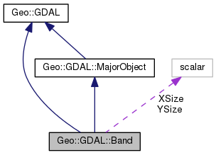
Public Member Functions | |
| public Geo::GDAL::RasterAttributeTable | AttributeTable (scalar AttributeTable) |
| public list | CategoryNames (array names) |
| public scalar | Checksum (scalar xoff=0, scalar yoff=0, scalar xsize=undef, scalar ysize=undef) |
| public scalar | ColorInterpretation (scalar color_interpretation) |
| public method | ColorInterpretations () |
| public Geo::GDAL::ColorTable | ColorTable (scalar ColorTable) |
| public method | ComputeBandStats (scalar samplestep=1) |
| public method | ComputeRasterMinMax (scalar approx_ok=0) |
| public list | ComputeStatistics (scalar approx_ok, scalar progress=undef, scalar progress_data=undef) |
| public Geo::OGR::Layer | Contours (scalar DataSource, hashref LayerConstructor, scalar ContourInterval, scalar ContourBase, arrayref FixedLevels, scalar NoDataValue, scalar IDField, scalar ElevField, subref Progress, scalar ProgressData) |
| public method | CreateMaskBand (array flags) |
| public scalar | DataType () |
| public method | Domains () |
| public method | Fill (scalar real_part, scalar imag_part=0.0) |
| public method | FillNodata (scalar mask, scalar max_search_dist, scalar smoothing_iterations, scalar options, subref progress, scalar progress_data) |
| public method | FlushCache () |
| public scalar | GetBandNumber () |
| public list | GetBlockSize () |
| public Geo::GDAL::ColorTable | GetColorTable () |
| public method | GetDataset () |
| public list | GetDefaultHistogram (scalar force=1, subref progress=undef, scalar progress_data=undef) |
| public list | GetHistogram (hash parameters) |
| public Geo::GDAL::Band | GetMaskBand () |
| public list | GetMaskFlags () |
| public scalar | GetMaximum () |
| public scalar | GetMinimum () |
| public Geo::GDAL::Band | GetOverview (scalar index) |
| public scalar | GetOverviewCount () |
| public list | GetStatistics (scalar approx_ok, scalar force) |
| public method | HasArbitraryOverviews () |
| public list | MaskFlags () |
| public scalar | NoDataValue (scalar NoDataValue) |
| public scalar | PackCharacter () |
| public scalar | ReadRaster (hash params) |
| public array reference | ReadTile (scalar xoff=0, scalar yoff=0, scalar xsize=< width >, scalar ysize=< height >) |
| public method | RegenerateOverview (Geo::GDAL::Band overview, scalar resampling, subref progress, scalar progress_data) |
| public method | RegenerateOverviews (arrayref overviews, scalar resampling, subref progress, scalar progress_data) |
| public method | ScaleAndOffset (scalar scale, scalar offset) |
| public method | SetColorTable (scalar ColorTable) |
| public list | SetDefaultHistogram (scalar min, scalar max, scalar histogram) |
| public method | SetStatistics (scalar min, scalar max, scalar mean, scalar stddev) |
| public list | Size () |
| public method | Unit (scalar type) |
| public method | WriteRaster (hash params) |
| public method | WriteTile (scalar data, scalar xoff=0, scalar yoff=0) |
| Public Member Functions inherited from Geo::GDAL::MajorObject | |
| public scalar | Description (scalar description) |
| public method | Domains () |
| public scalar | GetDescription () |
| public hash reference | GetMetadata (scalar domain="") |
| public method | GetMetadataDomainList () |
| public hash reference | Metadata (hashref metadata=undef, scalar domain= '') |
| public method | SetDescription (scalar NewDesc) |
| public method | SetMetadata (hashref metadata, scalar domain="") |
| Public Member Functions inherited from Geo::GDAL | |
| public list | AccessTypes () |
| public Geo::GDAL::Dataset | AutoCreateWarpedVRT (Geo::GDAL::Dataset src, Geo::OSR::SpatialReference src_srs=undef, Geo::OSR::SpatialReference dst_srs=undef, scalar ResampleAlg='NearestNeighbour', scalar maxerror=0.0) |
| public method | CPLBinaryToHex () |
| public method | CPLHexToBinary () |
| public list | Child (scalar node, scalar i) |
| public list | Children (scalar node) |
| public method | ComputeMedianCutPCT (Geo::GDAL::Band red, Geo::GDAL::Band green, Geo::GDAL::Band blue, scalar num_colors, scalar colors, subref progress, scalar progress_data) |
| public method | ComputeProximity (Geo::GDAL::Band src, Geo::GDAL::Band proximity, hashref options, subref progress, scalar progress_data) |
| public scalar | DataTypeIsComplex (scalar DataType) |
| public list | DataTypeValueRange (scalar DataType) |
| public list | DataTypes () |
| public method | Debug () |
| public scalar | DecToDMS (scalar angle, scalar axis, scalar precision=2) |
| public scalar | DecToPackedDMS (scalar dec) |
| public method | DitherRGB2PCT (scalar red, scalar green, scalar blue, scalar target, scalar colors, subref progress, scalar progress_data) |
| public method | EscapeString () |
| public scalar | FindFile (scalar class, scalar basename) |
| public method | FinderClean () |
| public method | GOA2GetAccessToken () |
| public method | GOA2GetAuthorizationURL () |
| public method | GOA2GetRefreshToken () |
| public scalar | GetCacheMax () |
| public scalar | GetCacheUsed () |
| public scalar | GetConfigOption (scalar key, scalar default) |
| public scalar | GetDataTypeSize (scalar DataType) |
| public Geo::GDAL::Driver | GetDriver (scalar name) |
| public list | GetDriverNames () |
| public method | GetJPEG2000StructureAsString () |
| public Geo::GDAL::Driver | IdentifyDriver (scalar path, scalar siblings) |
| public list | NodeData (scalar node) |
| public scalar | NodeType (scalar type) |
| public list | NodeTypes () |
| public Geo::GDAL::Dataset | Open (scalar name, scalar access= 'ReadOnly') |
| public Geo::GDAL::Dataset | OpenEx (scalar name, scalar open_flags=0, array reference allowed_drivers=undef, array reference open_options=undef, array reference sibling_files=undef) |
| public Geo::GDAL::Dataset | OpenShared (scalar name, scalar access= 'ReadOnly') |
| public scalar | PackCharacter (scalar DataType) |
| public scalar | PackedDMSToDec (scalar packed) |
| public array reference | ParseXMLString (scalar XML) |
| public method | Polygonize (Geo::GDAL::Band src, Geo::GDAL::Band mask, Geo::OGR::Layer out, scalar PixValField, hashref options, subref progress, scalar progress_data) |
| public method | PopFinderLocation () |
| public method | PushFinderLocation (scalar path) |
| public list | RIOResamplingTypes () |
| public method | RasterizeLayer (Geo::GDAL::Dataset ds, arrayref bands, Geo::OGR::Layer layer, scalar transformer, scalar arg, arrayref burn_values, hashref options, subref progress, scalar progress_data) |
| public method | ReprojectImage (scalar src_ds, scalar dst_ds, scalar src_wkt=undef, scalar dst_wkt=undef, scalar ResampleAlg='NearestNeighbour', scalar WarpMemoryLimit=0, scalar maxerror=0.0, subref progress, scalar progress_data) |
| public list | ResamplingTypes () |
| public scalar | SerializeXMLTree (arrayref XMLTree) |
| public method | SetCacheMax (scalar Bytes) |
| public method | SetConfigOption (scalar key, scalar value) |
| public method | SieveFilter (Geo::GDAL::Band src, Geo::GDAL::Band mask, Geo::GDAL::Band dst, scalar threshold, scalar connectedness, hashref options, subref progress, scalar progress_data) |
| public scalar | VersionInfo (scalar request= 'VERSION_NUM') |
Public Attributes | |
| scalar | XSize |
| Object attribute. scalar (access as $band->{XSize}) | |
| scalar | YSize |
| Object attribute. scalar (access as $band->{YSize}) | |
Detailed Description
Member Function Documentation
| public Geo::GDAL::RasterAttributeTable Geo::GDAL::Band::AttributeTable | ( | scalar | AttributeTable | ) |
- Parameters
-
AttributeTable [optional] A Geo::GDAL::RasterAttributeTable object.
- Returns
- a new Geo::GDAL::RasterAttributeTable object, whose data is contained within the band.
Code:
| public list Geo::GDAL::Band::CategoryNames | ( | array | names | ) |
- Parameters
-
names [optional]
- Returns
Code:
| public scalar Geo::GDAL::Band::Checksum | ( | scalar | xoff = 0, |
| scalar | yoff = 0, |
||
| scalar | xsize = undef, |
||
| scalar | ysize = undef |
||
| ) |
Computes a checksum from the raster or a part of it.
- Parameters
-
xoff yoff xsize ysize
- Returns
- the checksum.
Code:
| public scalar Geo::GDAL::Band::ColorInterpretation | ( | scalar | color_interpretation | ) |
- Note
- a.k.a. GetRasterColorInterpretation and GetColorInterpretation (get only and returns an integer), SetRasterColorInterpretation and SetColorInterpretation (set only and requires an integer)
- Parameters
-
color_interpretation [optional] new color interpretation, one of Geo::GDAL::Band::ColorInterpretations.
- Returns
- color interpretation, one of Geo::GDAL::Band::ColorInterpretations.
Code:
| public method Geo::GDAL::Band::ColorInterpretations | ( | ) |
Code:
| public Geo::GDAL::ColorTable Geo::GDAL::Band::ColorTable | ( | scalar | ColorTable | ) |
Get or set the color table of this band.
- Parameters
-
ColorTable [optional] a Geo::GDAL::ColorTable object
- Returns
- a new Geo::GDAL::ColorTable object in a non-void context.
Code:
| public method Geo::GDAL::Band::ComputeBandStats | ( | scalar | samplestep = 1 | ) |
- Parameters
-
samplestep the row increment in computing the statistics.
- Note
- Returns uncorrected sample standard deviation.
See also Geo::GDAL::Band::ComputeStatistics.
- Returns
- a list (mean, stddev).
Code:
| public method Geo::GDAL::Band::ComputeRasterMinMax | ( | scalar | approx_ok = 0 | ) |
- Returns
- arrayref MinMax = [min, max]
Code:
| public list Geo::GDAL::Band::ComputeStatistics | ( | scalar | approx_ok, |
| scalar | progress = undef, |
||
| scalar | progress_data = undef |
||
| ) |
- Parameters
-
approx_ok Whether it is allowed to compute the statistics based on overviews or similar.
- Note
- Returns uncorrected sample standard deviation.
See also Geo::GDAL::Band::ComputeBandStats.
- Returns
- a list ($min, $max, $mean, $stddev).
Code:
| public Geo::OGR::Layer Geo::GDAL::Band::Contours | ( | scalar | DataSource, |
| hashref | LayerConstructor, | ||
| scalar | ContourInterval, | ||
| scalar | ContourBase, | ||
| arrayref | FixedLevels, | ||
| scalar | NoDataValue, | ||
| scalar | IDField, | ||
| scalar | ElevField, | ||
| subref | Progress, | ||
| scalar | ProgressData | ||
| ) |
Generate contours for this raster band. This method can also be used with named parameters.
- Note
- This method is a wrapper for ContourGenerate.
An example:
- Parameters
-
DataSource a Geo::OGR::DataSource object, default is a Memory data source LayerConstructor data for Geo::OGR::DataSource::CreateLayer, default is {Name => 'contours'} ContourInterval default is 100 ContourBase default is 0 FixedLevels a reference to a list of fixed contour levels, default is [] NoDataValue default is undef IDField default is '', i.e., no field (the field is created if this is given) ElevField default is '', i.e., no field (the field is created if this is given) progress [optional] a reference to a subroutine, which will be called with parameters (number progress, string msg, progress_data) progress_data [optional]
- Returns
Code:
| public method Geo::GDAL::Band::CreateMaskBand | ( | array | flags | ) |
- Note
- May invalidate any previous mask band obtained with Geo::GDAL::Band::GetMaskBand.
- Parameters
-
flags one or more mask flags. The flags are Geo::GDAL::Band::MaskFlags.
Code:
| public scalar Geo::GDAL::Band::DataType | ( | ) |
| public method Geo::GDAL::Band::Domains | ( | ) |
Code:
| public method Geo::GDAL::Band::Fill | ( | scalar | real_part, |
| scalar | imag_part = 0.0 |
||
| ) |
Fill the band with a constant value.
- Parameters
-
real_part Real component of fill value. imag_part Imaginary component of fill value.
Code:
| public method Geo::GDAL::Band::FillNodata | ( | scalar | mask, |
| scalar | max_search_dist, | ||
| scalar | smoothing_iterations, | ||
| scalar | options, | ||
| subref | progress, | ||
| scalar | progress_data | ||
| ) |
Interpolate values for pixels in this raster. The pixels to fill should be marked in the mask band with zero.
- Note
- This is a wrapper for Geo::GDAL::FillNodata.
- Parameters
-
mask [optional] a mask band indicating pixels to be interpolated (zero valued) (default is to get it with Geo::GDAL::Band::GetMaskBand). max_search_dist [optional] the maximum number of pixels to search in all directions to find values to interpolate from (default is 10). smoothing_iterations [optional] the number of 3x3 smoothing filter passes to run (0 or more) (default is 0). options [optional] A reference to a hash. No options have been defined so far for this algorithm (default is {}). progress [optional] a reference to a subroutine, which will be called with parameters (number progress, string msg, progress_data) (default is undef). progress_data [optional] (default is undef).
Documentation for GDAL algorithms
Code:
| public method Geo::GDAL::Band::FlushCache | ( | ) |
Write cached data to disk. There is usually no need to call this method.
Code:
| public scalar Geo::GDAL::Band::GetBandNumber | ( | ) |
- Note
- a.k.a. GetBand
- Returns
- the number of this band.
Code:
| public list Geo::GDAL::Band::GetBlockSize | ( | ) |
- Returns
- the size of a preferred i/o raster blocks as a list (width, height).
Code:
| public Geo::GDAL::ColorTable Geo::GDAL::Band::GetColorTable | ( | ) |
- Note
- a.k.a. GetRasterColorTable, see also ColorTable
- Returns
- a color table object.
Code:
| public method Geo::GDAL::Band::GetDataset | ( | ) |
Code:
| public list Geo::GDAL::Band::GetDefaultHistogram | ( | scalar | force = 1, |
| subref | progress = undef, |
||
| scalar | progress_data = undef |
||
| ) |
- Parameters
-
force true to force the computation progress [optional] a reference to a subroutine, which will be called with parameters (number progress, string msg, progress_data) progress_data [optional]
- Returns
- a list: ($min, $max, arrayref histogram).
Code:
| public list Geo::GDAL::Band::GetHistogram | ( | hash | parameters | ) |
Compute histogram from the raster.
- Parameters
-
parameters Named parameters: - Min the lower bound, default is -0.5
- Max the upper bound, default is 255.5
- Buckets the number of buckets in the histogram, default is 256
- IncludeOutOfRange whether to use the first and last values in the returned list for out of range values, default is false; the bucket size is (Max-Min) / Buckets if this is false and (Max-Min) / (Buckets-2) if this is true
- ApproxOK if histogram can be computed from overviews, default is false
- Progress an optional progress function, the default is undef
- ProgressData data for the progress function, the default is undef
- Returns
- a list which contains the count of values in each bucket
Code:
| public Geo::GDAL::Band Geo::GDAL::Band::GetMaskBand | ( | ) |
- Returns
- the mask band associated with this band.
Code:
| public list Geo::GDAL::Band::GetMaskFlags | ( | ) |
- Returns
- th mask flags of the mask band associated with this band. The flags are Geo::GDAL::Band::MaskFlags.
Code:
| public scalar Geo::GDAL::Band::GetMaximum | ( | ) |
- Note
- Call Geo::GDAL::Band::ComputeStatistics before calling GetMaximum to make sure the value is computed.
- Returns
- statistical minimum of the band or undef if statistics are not kept or computed in scalar context. In list context returns the maximum value or a (kind of) maximum value supported by the data type and a boolean value, which indicates which is the case (true is first, false is second).
Code:
| public scalar Geo::GDAL::Band::GetMinimum | ( | ) |
- Note
- Call Geo::GDAL::Band::ComputeStatistics before calling GetMinimum to make sure the value is computed.
- Returns
- statistical minimum of the band or undef if statistics are not kept or computed in scalar context. In list context returns the minimum value or a (kind of) minimum value supported by the data type and a boolean value, which indicates which is the case (true is first, false is second).
Code:
| public Geo::GDAL::Band Geo::GDAL::Band::GetOverview | ( | scalar | index | ) |
- Parameters
-
index 0..GetOverviewCount-1
- Returns
- a Geo::GDAL::Band object, which represents the internal overview band, or undef. if the index is out of bounds.
Code:
| public scalar Geo::GDAL::Band::GetOverviewCount | ( | ) |
- Returns
- the number of overviews available of the band.
Code:
| public list Geo::GDAL::Band::GetStatistics | ( | scalar | approx_ok, |
| scalar | force | ||
| ) |
- Parameters
-
approx_ok Whether it is allowed to compute the statistics based on overviews or similar. force Whether to force scanning of the whole raster.
- Note
- Uses Geo::GDAL::Band::ComputeStatistics internally.
- Returns
- a list ($min, $max, $mean, $stddev).
Code:
| public method Geo::GDAL::Band::HasArbitraryOverviews | ( | ) |
- Returns
- true or false.
Code:
| public list Geo::GDAL::Band::MaskFlags | ( | ) |
Class method.
- Returns
- the list of mask flags. These are
- AllValid: There are no invalid pixels, all mask values will be 255. When used this will normally be the only flag set.
- PerDataset: The mask band is shared between all bands on the dataset.
- Alpha: The mask band is actually an alpha band and may have values other than 0 and 255.
- NoData: Indicates the mask is actually being generated from nodata values. (mutually exclusive of Alpha).
Code:
| public scalar Geo::GDAL::Band::NoDataValue | ( | scalar | NoDataValue | ) |
- Note
- a.k.a. GetNoDataValue (get only), SetNoDataValue (set only)
- Parameters
-
NoDataValue [optional] Get or set the "no data" value.
- Note
- $band->NoDataValue(undef) sets the "no data" value to the Posix floating point maximum.
- Returns
- the "no data" value in scalar context. In list context returns the no data value or an out of range value and a boolean value, which indicates which is the case (true is first, false is second).
Code:
| public scalar Geo::GDAL::Band::PackCharacter | ( | ) |
- Returns
- the character to use in Perl pack and unpack for the DataType of this band.
Code:
| public scalar Geo::GDAL::Band::ReadRaster | ( | hash | params | ) |
Read data from the band.
- Parameters
-
params named parameters. These are - XOff x offset (pixel coordinates) (default is 0)
- YOff y offset (pixel coordinates) (default is 0)
- XSize width of the area to read (default is the width of the band)
- YSize height of the area to read (default is the height of the band)
- BufXSize (default is undef, i.e., the same as XSize)
- BufYSize (default is undef, i.e., the same as YSize)
- BufType data type of the buffer (default is the data type of the band)
- BufPixelSpace (default is 0)
- BufLineSpace (default is 0)
- ResampleAlg one of Geo::GDAL::RIOResamplingTypes (default is 'NearestNeighbour'),
- Progress reference to a progress function (default is undef)
- ProgressData (default is undef)
If the parameters are given as a list the order is as above. Entry in GDAL docs (method RasterIO)
- Returns
- a buffer, open the buffer with unpack function of Perl. See Geo::GDAL::Band::PackCharacter.
Code:
| public array reference Geo::GDAL::Band::ReadTile | ( | scalar | xoff = 0, |
| scalar | yoff = 0, |
||
| scalar | xsize = <width>, |
||
| scalar | ysize = <height> |
||
| ) |
Usage example (print the data from a band):
Another usage example (process the data of a large dataset that has one band):
- Parameters
-
xoff yoff xsize ysize
- Returns
- a two-dimensional Perl array, organizes as data->[y][x], y = 0..height-1, x = 0..width-1.
Code:
| public method Geo::GDAL::Band::RegenerateOverview | ( | Geo::GDAL::Band | overview, |
| scalar | resampling, | ||
| subref | progress, | ||
| scalar | progress_data | ||
| ) |
- Parameters
-
overview a Geo::GDAL::Band object for the overview. resampling [optional] the resampling method (one of Geo::GDAL::RIOResamplingTypes) (default is Average). progress [optional] a reference to a subroutine, which will be called with parameters (number progress, string msg, progress_data) progress_data [optional]
Code:
| public method Geo::GDAL::Band::RegenerateOverviews | ( | arrayref | overviews, |
| scalar | resampling, | ||
| subref | progress, | ||
| scalar | progress_data | ||
| ) |
- Todo:
- This is not yet available
- Parameters
-
overviews a list of Geo::GDAL::Band objects for the overviews. resampling [optional] the resampling method (one of Geo::GDAL::RIOResamplingTypes) (default is Average). progress [optional] a reference to a subroutine, which will be called with parameters (number progress, string msg, progress_data) progress_data [optional]
Code:
| public method Geo::GDAL::Band::ScaleAndOffset | ( | scalar | scale, |
| scalar | offset | ||
| ) |
Scale and offset are used to transform raw pixel values into the units returned by GetUnits(). The conversion function is:
- Returns
- a list ($scale, $offset), the values are undefined if they are not set.
- Since
- version 1.9 of the bindings.
Code:
| public method Geo::GDAL::Band::SetColorTable | ( | scalar | ColorTable | ) |
- Note
- a.k.a. SetRasterColorTable, see also ColorTable
- Parameters
-
ColorTable A color table object.
Code:
| public list Geo::GDAL::Band::SetDefaultHistogram | ( | scalar | min, |
| scalar | max, | ||
| scalar | histogram | ||
| ) |
- Parameters
-
min max histogram reference to an array containing the histogram
Code:
| public method Geo::GDAL::Band::SetStatistics | ( | scalar | min, |
| scalar | max, | ||
| scalar | mean, | ||
| scalar | stddev | ||
| ) |
Save the statistics of the band if possible (the format can save arbitrary metadata).
- Parameters
-
min max mean stddev Code:
click to view
| public list Geo::GDAL::Band::Size | ( | ) |
- Returns
- the size of the band as a list (width, height).
Code:
| public method Geo::GDAL::Band::Unit | ( | scalar | type | ) |
- Parameters
-
type [optional] the unit (a string).
- Note
- $band->Unit(undef) sets the unit value to an empty string.
- Returns
- the unit (a string).
- Since
- version 1.9 of the bindings.
Code:
| public method Geo::GDAL::Band::WriteRaster | ( | hash | params | ) |
Write data into the band.
- Parameters
-
params named parameters. These are - XOff x offset (pixel coordinates) (default is 0)
- YOff y offset (pixel coordinates) (default is 0)
- XSize width of the area to write (default is the width of the band)
- YSize height of the area to write (default is the height of the band)
- Buf a buffer containing the data. Create the buffer with pack function of Perl. See Geo::GDAL::Band::PackCharacter.
- BufXSize (default is undef, i.e., the same as XSize)
- BufYSize (default is undef, i.e., the same as YSize)
- BufType data type of the buffer (default is the data type of the band)
- BufPixelSpace (default is 0)
- BufLineSpace (default is 0)
If the parameters are given as a list the order is as above. Entry in GDAL docs (method RasterIO)
Code:
| public method Geo::GDAL::Band::WriteTile | ( | scalar | data, |
| scalar | xoff = 0, |
||
| scalar | yoff = 0 |
||
| ) |
- Parameters
-
data A two-dimensional Perl array, organizes as data->[y][x], y = 0..height-1, x = 0..width-1. xoff yoff
Code:
The documentation for this class was generated from the following file: