Geo::OGR Class Reference
OGR utility functions. More...
 Inheritance diagram for Geo::OGR:
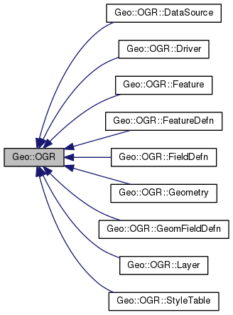
Classes | |
| class | DataSource |
| A source and/or storage of vector data layers. More... | |
| class | Driver |
| A vector format driver. More... | |
| class | Feature |
| A collection of non-spatial and spatial attributes. More... | |
| class | FeatureDefn |
| A definition of the attributes of a feature class or a layer. More... | |
| class | FieldDefn |
| A definition of a non-spatial attribute. More... | |
| class | Geometry |
| Spatial data. More... | |
| class | GeomFieldDefn |
| A definition of a spatial attribute. More... | |
| class | Layer |
| A collection of similar features. More... | |
| class | StyleTable |
Public Member Functions | |
| public list | ByteOrders () |
| public scalar | GeometryTypeModify (scalar type, scalar modifier) |
| public scalar | GeometryTypeTest (scalar type, scalar test, scalar type2) |
| public list | GeometryTypes () |
| public Geo::OGR::Driver | GetDriver (scalar name) |
| public list | GetDriverNames () |
| public method | GetNonLinearGeometriesEnabledFlag () |
| public Geo::OGR::DataSource | GetOpenDS (scalar number) |
| public scalar | GetOpenDSCount () |
| public method | OLMD_FID64 () |
| public Geo::OGR::DataSource | Open (scalar name, scalar update=0) |
| public Geo::OGR::DataSource | OpenShared (scalar name, scalar update=0) |
| public method | SetGenerate_DB2_V72_BYTE_ORDER (scalar Generate_DB2_V72_BYTE_ORDER) |
| public method | SetNonLinearGeometriesEnabledFlag () |
Detailed Description
OGR utility functions.
A wrapper for many OGR utility functions and a root class for all OGR classes.
Member Function Documentation
| public list Geo::OGR::ByteOrders | ( | ) |
Class method.
- Returns
- a list of byte order types, XDR and NDR. XDR denotes big-endian and NDR denotes little-endian.
Code:
click to view
| public scalar Geo::OGR::GeometryTypeModify | ( | scalar | type, |
| scalar | modifier | ||
| ) |
- Parameters
-
type a geometry type (one of Geo::OGR::GeometryTypes). modifier one of 'flatten', 'set_Z', 'make_collection', 'make_curve', or 'make_linear'.
- Returns
- modified geometry type.
Code:
click to view
| public list Geo::OGR::GeometryTypes | ( | ) |
Class method.
- Returns
- a list of all geometry types, currently: CircularString, CircularStringZ, CompoundCurve, CompoundCurveZ, CurvePolygon, CurvePolygonZ, GeometryCollection, GeometryCollection25D, LineString, LineString25D, LinearRing, MultiCurve, MultiCurveZ, MultiLineString, MultiLineString25D, MultiPoint, MultiPoint25D, MultiPolygon, MultiPolygon25D, MultiSurface, MultiSurfaceZ, None, Point, Point25D, Polygon, Polygon25D, and Unknown.
Code:
click to view
| public scalar Geo::OGR::GeometryTypeTest | ( | scalar | type, |
| scalar | test, | ||
| scalar | type2 | ||
| ) |
- Parameters
-
type a geometry type (one of Geo::OGR::GeometryTypes). test one of 'has_z', 'is_subclass_of', 'is_curve', 'is_surface', or 'is_non_linear'. type2 a geometry type (one of Geo::OGR::GeometryTypes). Required for 'is_subclass_of' test.
- Returns
- result of the test.
Code:
click to view
| public Geo::OGR::Driver Geo::OGR::GetDriver | ( | scalar | name | ) |
- Parameters
-
name a driver name. One of Geo::OGR::GetDriverNames.
- Returns
- a Geo::OGR::Driver object that represents the internal driver.
Code:
click to view
| public list Geo::OGR::GetDriverNames | ( | ) |
- Returns
- a list of the names of available Geo::OGR::Drivers.
Code:
click to view
| public method Geo::OGR::GetNonLinearGeometriesEnabledFlag | ( | ) |
Code:
click to view
| public Geo::OGR::DataSource Geo::OGR::GetOpenDS | ( | scalar | number | ) |
- Parameters
-
number The number of the requested data source.
- Returns
- a new Geo::OGR::DataSource object.
Code:
click to view
| public scalar Geo::OGR::GetOpenDSCount | ( | ) |
- Returns
- the number of all open data sources.
Code:
click to view
| public method Geo::OGR::OLMD_FID64 | ( | ) |
Code:
click to view
| public Geo::OGR::DataSource Geo::OGR::Open | ( | scalar | name, |
| scalar | update = 0 |
||
| ) |
- Parameters
-
name The data source string (directory, filename, etc.). update Whether to open the data source in update mode.
- Returns
- a new Geo::OGR::DataSource object.
Code:
click to view
| public Geo::OGR::DataSource Geo::OGR::OpenShared | ( | scalar | name, |
| scalar | update = 0 |
||
| ) |
- Parameters
-
name The data source string (directory, filename, etc.). update Whether to open the data source in update mode.
- Returns
- a new Geo::OGR::DataSource object.
Code:
| public method Geo::OGR::SetGenerate_DB2_V72_BYTE_ORDER | ( | scalar | Generate_DB2_V72_BYTE_ORDER | ) |
Needed only on IBM DB2.
Code:
click to view
| public method Geo::OGR::SetNonLinearGeometriesEnabledFlag | ( | ) |
Code:
click to view
The documentation for this class was generated from the following file: