Geo::GDAL::GCP Class Reference
A ground control point for georeferencing images. More...
 Inheritance diagram for Geo::GDAL::GCP:
 Collaboration diagram for Geo::GDAL::GCP:
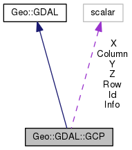
Public Member Functions | |
| public scalar | new (scalar x=0.0, scalar y=0.0, scalar z=0.0, scalar column=0.0, scalar row=0.0, scalar info="", scalar id="") |
| Public Member Functions inherited from Geo::GDAL | |
| public list | AccessTypes () |
| public Geo::GDAL::Dataset | AutoCreateWarpedVRT (Geo::GDAL::Dataset src, Geo::OSR::SpatialReference src_srs=undef, Geo::OSR::SpatialReference dst_srs=undef, scalar ResampleAlg='NearestNeighbour', scalar maxerror=0.0) |
| public method | CPLBinaryToHex () |
| public method | CPLHexToBinary () |
| public list | Child (scalar node, scalar i) |
| public list | Children (scalar node) |
| public method | ComputeMedianCutPCT (Geo::GDAL::Band red, Geo::GDAL::Band green, Geo::GDAL::Band blue, scalar num_colors, scalar colors, subref progress, scalar progress_data) |
| public method | ComputeProximity (Geo::GDAL::Band src, Geo::GDAL::Band proximity, hashref options, subref progress, scalar progress_data) |
| public scalar | DataTypeIsComplex (scalar DataType) |
| public list | DataTypeValueRange (scalar DataType) |
| public list | DataTypes () |
| public method | Debug () |
| public scalar | DecToDMS (scalar angle, scalar axis, scalar precision=2) |
| public scalar | DecToPackedDMS (scalar dec) |
| public method | DitherRGB2PCT (scalar red, scalar green, scalar blue, scalar target, scalar colors, subref progress, scalar progress_data) |
| public method | EscapeString () |
| public scalar | FindFile (scalar class, scalar basename) |
| public method | FinderClean () |
| public method | GOA2GetAccessToken () |
| public method | GOA2GetAuthorizationURL () |
| public method | GOA2GetRefreshToken () |
| public scalar | GetCacheMax () |
| public scalar | GetCacheUsed () |
| public scalar | GetConfigOption (scalar key, scalar default) |
| public scalar | GetDataTypeSize (scalar DataType) |
| public Geo::GDAL::Driver | GetDriver (scalar name) |
| public list | GetDriverNames () |
| public method | GetJPEG2000StructureAsString () |
| public Geo::GDAL::Driver | IdentifyDriver (scalar path, scalar siblings) |
| public list | NodeData (scalar node) |
| public scalar | NodeType (scalar type) |
| public list | NodeTypes () |
| public Geo::GDAL::Dataset | Open (scalar name, scalar access= 'ReadOnly') |
| public Geo::GDAL::Dataset | OpenEx (scalar name, scalar open_flags=0, array reference allowed_drivers=undef, array reference open_options=undef, array reference sibling_files=undef) |
| public Geo::GDAL::Dataset | OpenShared (scalar name, scalar access= 'ReadOnly') |
| public scalar | PackCharacter (scalar DataType) |
| public scalar | PackedDMSToDec (scalar packed) |
| public array reference | ParseXMLString (scalar XML) |
| public method | Polygonize (Geo::GDAL::Band src, Geo::GDAL::Band mask, Geo::OGR::Layer out, scalar PixValField, hashref options, subref progress, scalar progress_data) |
| public method | PopFinderLocation () |
| public method | PushFinderLocation (scalar path) |
| public list | RIOResamplingTypes () |
| public method | RasterizeLayer (Geo::GDAL::Dataset ds, arrayref bands, Geo::OGR::Layer layer, scalar transformer, scalar arg, arrayref burn_values, hashref options, subref progress, scalar progress_data) |
| public method | ReprojectImage (scalar src_ds, scalar dst_ds, scalar src_wkt=undef, scalar dst_wkt=undef, scalar ResampleAlg='NearestNeighbour', scalar WarpMemoryLimit=0, scalar maxerror=0.0, subref progress, scalar progress_data) |
| public list | ResamplingTypes () |
| public scalar | SerializeXMLTree (arrayref XMLTree) |
| public method | SetCacheMax (scalar Bytes) |
| public method | SetConfigOption (scalar key, scalar value) |
| public method | SieveFilter (Geo::GDAL::Band src, Geo::GDAL::Band mask, Geo::GDAL::Band dst, scalar threshold, scalar connectedness, hashref options, subref progress, scalar progress_data) |
| public scalar | VersionInfo (scalar request= 'VERSION_NUM') |
Public Attributes | |
| scalar | Column |
| pixel x coordinate (access as $gcp->{Column}) More... | |
| scalar | Id |
| unique identifier (string) (access as $gcp->{Id}) | |
| scalar | Info |
| informational message (access as $gcp->{Info}) | |
| scalar | Row |
| pixel y coordinate (access as $gcp->{Row}) More... | |
| scalar | X |
| projection coordinate (access as $gcp->{X}) | |
| scalar | Y |
| projection coordinate (access as $gcp->{Y}) | |
| scalar | Z |
| projection coordinate (access as $gcp->{Z}) | |
Detailed Description
Member Function Documentation
| public scalar Geo::GDAL::GCP::new | ( | scalar | x = 0.0, |
| scalar | y = 0.0, |
||
| scalar | z = 0.0, |
||
| scalar | column = 0.0, |
||
| scalar | row = 0.0, |
||
| scalar | info = "", |
||
| scalar | id = "" |
||
| ) |
Class method.
- Parameters
-
x projection coordinate y projection coordinate z projection coordinate column pixel x coordinate row pixel y coordinate info informational message id unique identifier (string)
- Returns
- a new Geo::GDAL::GCP object
Code:
click to view
Member Data Documentation
| scalar Geo::GDAL::GCP::Column |
| scalar Geo::GDAL::GCP::Row |
The documentation for this class was generated from the following file: