A definition of the attributes of a feature class or a layer. More...
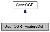
 Inheritance diagram for Geo::OGR::FeatureDefn:
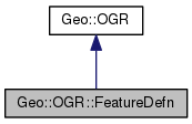
 Collaboration diagram for Geo::OGR::FeatureDefn:
Public Member Functions | |
| public method | AddField (hash params) |
| public method | DeleteField (scalar name) |
| public object | GetFieldDefn (scalar name) |
| public list | GetFieldNames () |
| public scalar | GetName () |
| public hash reference | GetSchema () |
| Get the schema of this feature or layer definition. More... | |
| public method | IsSame (Geo::OGR::FeatureDefn defn) |
| public scalar | IsStyleIgnored () |
| public method | SetStyleIgnored (scalar IgnoreState) |
| public Geo::OGR::FeatureDefn | new (hash schema) |
 Public Member Functions inherited from Geo::OGR Public Member Functions inherited from Geo::OGR | |
| public list | ByteOrders () |
| public scalar | GeometryTypeModify (scalar type, scalar modifier) |
| public scalar | GeometryTypeTest (scalar type, scalar test, scalar type2) |
| public list | GeometryTypes () |
| public Geo::OGR::Driver | GetDriver (scalar name) |
| public list | GetDriverNames () |
| public method | GetNonLinearGeometriesEnabledFlag () |
| public Geo::OGR::DataSource | GetOpenDS (scalar number) |
| public scalar | GetOpenDSCount () |
| public method | OLMD_FID64 () |
| public Geo::OGR::DataSource | Open (scalar name, scalar update=0) |
| public Geo::OGR::DataSource | OpenShared (scalar name, scalar update=0) |
| public method | SetGenerate_DB2_V72_BYTE_ORDER (scalar Generate_DB2_V72_BYTE_ORDER) |
| public method | SetNonLinearGeometriesEnabledFlag () |
Detailed Description
A definition of the attributes of a feature class or a layer.
A definition object is a collection of field definition objects. A read-only definition object is obtained from a layer or a feature.
Member Function Documentation
| public method Geo::OGR::FeatureDefn::AddField | ( | hash | params | ) |
- Parameters
-
params named parameters to create a new Geo::OGR::FieldDefn or Geo::OGR::GeomFieldDefn object.
 Code:
Code:
| public method Geo::OGR::FeatureDefn::DeleteField | ( | scalar | name | ) |
- Note
- Currently only geometry fields can be deleted.
- Parameters
-
index the index of the geometry field to be deleted.
 Code:
Code:
| public object Geo::OGR::FeatureDefn::GetFieldDefn | ( | scalar | name | ) |
- Parameters
-
name the name of the field.
- Returns
- either a Geo::OGR::FieldDefn or Geo::OGR::GeomFieldDefn object that represents the field in question.
 Code:
Code:
| public list Geo::OGR::FeatureDefn::GetFieldNames | ( | ) |
The names of the fields in this layer or feature definition.
- Returns
- the list of field names.
 Code:
Code:
| public scalar Geo::OGR::FeatureDefn::GetName | ( | ) |
- Returns
- the name of this layer or feature definition.
 Code:
Code:
| public hash reference Geo::OGR::FeatureDefn::GetSchema | ( | ) |
Get the schema of this feature or layer definition.
The schema is a hash whose keywords are Name, StyleIgnored and Fields. Fields is an anonymous array of first non-spatial and then spatial field schemas as in Geo::OGR::FieldDefn::Schema and Geo::OGR::GeomFieldDefn::Schema.
- Returns
- the schema of this feature or layer definition.
 Code:
Code:
| public method Geo::OGR::FeatureDefn::IsSame | ( | Geo::OGR::FeatureDefn | defn | ) |
- Returns
- true if this definition is similar to the other definition, false otherwise.
 Code:
Code:
| public scalar Geo::OGR::FeatureDefn::IsStyleIgnored | ( | ) |
Get the ignore status of style information when fetching features.
- Returns
- the ignore status of style information
- Since
- 1.9.0
 Code:
Code:
| public Geo::OGR::FeatureDefn Geo::OGR::FeatureDefn::new | ( | hash | schema | ) |
Class method. Creates a new layer or feature definition. The new definition is either initialized to the given schema or it will contain no non-spatial fields and one spatial field, whose Name is '' and GeometryType is 'Unknown' or the value of the named parameter GeometryType.
- Parameters
-
schema [optional] The schema for the new feature definition, as in Geo::OGR::FeatureDefn::Schema.
- Returns
- a Geo::OGR::FeatureDefn object
Example usage:
 Code:
Code:
| public method Geo::OGR::FeatureDefn::SetStyleIgnored | ( | scalar | IgnoreState | ) |
Set the ignore status of style information when fetching features.
- Since
- 1.9.0
 Code:
Code:
The documentation for this class was generated from the following file:


