Geo::GDAL::ColorTable Class Reference
A color table from a raster band or a color table, which can be used for a band.
More...
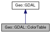
 Inheritance diagram for Geo::GDAL::ColorTable:
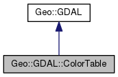
 Collaboration diagram for Geo::GDAL::ColorTable:
Public Member Functions | |
| public Geo::GDAL::ColorTable | Clone () |
| public list | Color (scalar index, array color) |
| public list | Colors (array colors) |
| public method | CreateColorRamp (scalar start_index, arrayref start_color, scalar end_index, arrayref end_color) |
| public scalar | GetCount () |
| public scalar | GetPaletteInterpretation () |
| public Geo::GDAL::ColorTable | new (scalar GDALPaletteInterp= 'RGB') |
 Public Member Functions inherited from Geo::GDAL Public Member Functions inherited from Geo::GDAL | |
| public method | ApplyVerticalShiftGrid () |
| public method | BuildVRT () |
| public method | CPLBinaryToHex () |
| public method | CPLHexToBinary () |
| public method | CreatePansharpenedVRT () |
| public scalar | DataTypeIsComplex (scalar DataType) |
| public list | DataTypeValueRange (scalar DataType) |
| public list | DataTypes () |
| public scalar | DecToDMS (scalar angle, scalar axis, scalar precision=2) |
| public scalar | DecToPackedDMS (scalar dec) |
| public method | DontUseExceptions () |
| public Geo::GDAL::Driver | Driver (scalar Name) |
| public list | DriverNames () |
| public list | Drivers () |
| public method | EscapeString () |
| public scalar | FindFile (scalar basename) |
| public method | FinderClean () |
| public method | GOA2GetAccessToken () |
| public method | GOA2GetAuthorizationURL () |
| public method | GOA2GetRefreshToken () |
| public method | GetActualURL () |
| public scalar | GetCacheMax () |
| public scalar | GetCacheUsed () |
| public scalar | GetConfigOption (scalar key) |
| public scalar | GetDataTypeSize (scalar DataType) |
| public method | GetErrorCounter () |
| public method | GetFileSystemOptions () |
| public method | GetFileSystemsPrefixes () |
| public method | GetJPEG2000StructureAsString () |
| public method | GetSignedURL () |
| public Geo::GDAL::Driver | IdentifyDriver (scalar path, scalar siblings) |
| public method | IdentifyDriverEx () |
| public method | MkdirRecursive () |
| public Geo::GDAL::Dataset | Open (hash params) |
| public Geo::GDAL::Dataset | OpenEx (hash params) |
| public list | OpenFlags () |
| public scalar | PackCharacter (scalar DataType) |
| public scalar | PackedDMSToDec (scalar packed) |
| public method | PopFinderLocation () |
| public method | PushFinderLocation (scalar path) |
| public list | RIOResamplingTypes () |
| public list | ResamplingTypes () |
| public method | RmdirRecursive () |
| public method | SetCacheMax (scalar Bytes) |
| public method | SetConfigOption (scalar key, scalar value) |
| public method | UseExceptions () |
| public method | VSICurlClearCache () |
| public method | VSIFEofL () |
| public method | VSIFOpenExL () |
| public method | VSIGetLastErrorMsg () |
| public method | VSIGetLastErrorNo () |
| public scalar | VersionInfo (scalar request= 'VERSION_NUM') |
| public scalar | errstr () |
Detailed Description
A color table from a raster band or a color table, which can be used for a band.
Member Function Documentation
| public Geo::GDAL::ColorTable Geo::GDAL::ColorTable::Clone | ( | ) |
Object method.
Clone an existing color table.
- Returns
- a new Geo::GDAL::ColorTable object
 Code:
Code:
click to view
| public list Geo::GDAL::ColorTable::Color | ( | scalar | index, |
| array | color | ||
| ) |
Object method.
Get or set a color in this color table.
- Parameters
-
index The index of the color in the table. Note that the
color table may expand if the index is larger than the current max
index of this table and a color is given. An attempt to retrieve a
color out of the current size of the table causes an error.
color [optional] The color, either a list or a reference to a
list. If the list is too short or has undef values, the undef values
are taken as 0 except for alpha, which is taken as 255.
- Note
- A color is an array of four integers having a value between 0
and 255: (gray, red, cyan or hue; green, magenta, or lightness;
blue, yellow, or saturation; alpha or blackband)
- Returns
- A color, in list context a list and in scalar context a reference to an anonymous array.
 Code:
Code:
click to view
| public list Geo::GDAL::ColorTable::Colors | ( | array | colors | ) |
Object method.
Get or set the colors in this color table.
- Note
- The color table will expand to the size of the input list but
it will not shrink.
- Parameters
-
colors [optional] A list of all colors (a list of lists) for this color table.
- Returns
- A list of colors (a list of lists).
 Code:
Code:
click to view
| public method Geo::GDAL::ColorTable::CreateColorRamp | ( | scalar | start_index, |
| arrayref | start_color, | ||
| scalar | end_index, | ||
| arrayref | end_color | ||
| ) |
Object method.
- Parameters
-
start_index
start_color
end_index
end_color
 Code:
Code:
click to view
| public scalar Geo::GDAL::ColorTable::GetCount | ( | ) |
Object method.
- Returns
- The number of colors in this color table.
 Code:
Code:
click to view
| public scalar Geo::GDAL::ColorTable::GetPaletteInterpretation | ( | ) |
Object method.
- Returns
- palette interpretation (string)
 Code:
Code:
click to view
| public Geo::GDAL::ColorTable Geo::GDAL::ColorTable::new | ( | scalar | GDALPaletteInterp = 'RGB' | ) |
Class method.
Create a new empty color table.
- Returns
- a new Geo::GDAL::ColorTable object
 Code:
Code:
click to view
The documentation for this class was generated from the following file:
- all.dox


