A set of associated raster bands or vector layer source.
More...
 Inheritance diagram for Geo::GDAL::Dataset:
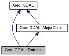 Collaboration diagram for Geo::GDAL::Dataset:
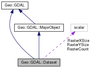
Public Member Functions | |
| public method | AddBand (scalar datatype= 'Byte', hashref options={}) |
| public method | AdviseRead () |
| public Geo::GDAL::Band | Band (scalar index) |
| public list | Bands () |
| public method | BuildOverviews (scalar resampling, arrayref overviews, coderef progress, scalar progress_data) |
| public Geo::GDAL::Dataset | BuildVRT (scalar Dest, arrayref Sources, hashref Options, coderef progress, scalar progress_data) |
| public method | CommitTransaction () |
| public Geo::GDAL::ColorTable | ComputeColorTable (hash params) |
| public Geo::OGR::Layer | CopyLayer (scalar layer, scalar name, hashref options=undef) |
| public Geo::OGR::Layer | CreateLayer (hash params) |
| Create a new vector layer into this dataset. More... | |
| public method | CreateMaskBand () |
| public Geo::GDAL::Dataset | DEMProcessing (scalar Dest, scalar Processing, scalar ColorFilename, hashref Options, coderef progress, scalar progress_data) |
| public method | Dataset () |
| public method | DeleteLayer (scalar name) |
| public Geo::GDAL::Band | Dither (hash params) |
| public method | Domains () |
| public Geo::GDAL::Driver | Driver () |
| public Geo::OGR::Layer | ExecuteSQL (scalar statement, scalar geom=undef, scalar dialect="") |
| public Geo::GDAL::Extent | Extent (array params) |
| public list | GCPs (array GCPs, Geo::OSR::SpatialReference sr) |
| public Geo::GDAL::GeoTransform | GeoTransform (Geo::GDAL::GeoTransform scalar geo_transform) |
| public method | GetDriver () |
| public list | GetFileList () |
| public scalar | GetGCPProjection () |
| public Geo::OGR::Layer | GetLayer (scalar name) |
| public list | GetLayerNames () |
| public method | GetNextFeature () |
| public method | GetStyleTable () |
| public Geo::GDAL::Dataset | Grid (scalar Dest, hashref Options) |
| public scalar | Info (hashref Options) |
| public Geo::GDAL::Dataset | Nearblack (scalar Dest, hashref Options, coderef progress, scalar progress_data) |
| public Geo::GDAL::Dataset | Open () |
| public Geo::GDAL::Dataset | OpenShared () |
| public Geo::GDAL::Dataset | Rasterize (scalar Dest, hashref Options, coderef progress, scalar progress_data) |
| public scalar | ReadRaster (hash params) |
| public method | ReadTile () |
| public method | ReleaseResultSet (scalar layer) |
| public method | ResetReading () |
| public method | RollbackTransaction () |
| public method | SetStyleTable () |
| public list | Size () |
| public Geo::OSR::SpatialReference | SpatialReference (Geo::OSR::SpatialReference sr) |
| public method | StartTransaction () |
| public method | TestCapability () |
| public method | Tile (Geo::GDAL::Extent e) |
| public Geo::GDAL::Dataset | Translate (scalar Dest, hashref Options, coderef progress, scalar progress_data) |
| public Geo::GDAL::Dataset | Warp (scalar Dest, hashref Options, coderef progress, scalar progress_data) |
| public Geo::GDAL::Dataset | Warped (hash params) |
| public method | WriteRaster (hash params) |
| public method | WriteTile () |
| Public Member Functions inherited from Geo::GDAL::MajorObject | |
| public scalar | Description (scalar description) |
| public method | Domains () |
| public scalar | GetDescription () |
| public hash reference | GetMetadata (scalar domain="") |
| public method | GetMetadataDomainList () |
| public hash reference | Metadata (hashref metadata=undef, scalar domain= '') |
| public method | SetDescription (scalar NewDesc) |
| public method | SetMetadata (hashref metadata, scalar domain="") |
| Public Member Functions inherited from Geo::GDAL | |
| public method | ApplyVerticalShiftGrid () |
| public method | BuildVRT () |
| public method | CPLBinaryToHex () |
| public method | CPLHexToBinary () |
| public method | CreatePansharpenedVRT () |
| public scalar | DataTypeIsComplex (scalar DataType) |
| public list | DataTypeValueRange (scalar DataType) |
| public list | DataTypes () |
| public scalar | DecToDMS (scalar angle, scalar axis, scalar precision=2) |
| public scalar | DecToPackedDMS (scalar dec) |
| public method | DontUseExceptions () |
| public Geo::GDAL::Driver | Driver (scalar Name) |
| public list | DriverNames () |
| public list | Drivers () |
| public method | EscapeString () |
| public scalar | FindFile (scalar basename) |
| public method | FinderClean () |
| public method | GOA2GetAccessToken () |
| public method | GOA2GetAuthorizationURL () |
| public method | GOA2GetRefreshToken () |
| public method | GetActualURL () |
| public scalar | GetCacheMax () |
| public scalar | GetCacheUsed () |
| public scalar | GetConfigOption (scalar key) |
| public scalar | GetDataTypeSize (scalar DataType) |
| public method | GetErrorCounter () |
| public method | GetFileSystemOptions () |
| public method | GetFileSystemsPrefixes () |
| public method | GetJPEG2000StructureAsString () |
| public method | GetSignedURL () |
| public Geo::GDAL::Driver | IdentifyDriver (scalar path, scalar siblings) |
| public method | IdentifyDriverEx () |
| public method | MkdirRecursive () |
| public Geo::GDAL::Dataset | Open (hash params) |
| public Geo::GDAL::Dataset | OpenEx (hash params) |
| public list | OpenFlags () |
| public scalar | PackCharacter (scalar DataType) |
| public scalar | PackedDMSToDec (scalar packed) |
| public method | PopFinderLocation () |
| public method | PushFinderLocation (scalar path) |
| public list | RIOResamplingTypes () |
| public list | ResamplingTypes () |
| public method | RmdirRecursive () |
| public method | SetCacheMax (scalar Bytes) |
| public method | SetConfigOption (scalar key, scalar value) |
| public method | UseExceptions () |
| public method | VSICurlClearCache () |
| public method | VSIFEofL () |
| public method | VSIFOpenExL () |
| public method | VSIGetLastErrorMsg () |
| public method | VSIGetLastErrorNo () |
| public scalar | VersionInfo (scalar request= 'VERSION_NUM') |
| public scalar | errstr () |
Public Attributes | |
| scalar | RasterCount |
| scalar (access as $dataset->{RasterCount}) | |
| scalar | RasterXSize |
| scalar (access as $dataset->{RasterXSize}) | |
| scalar | RasterYSize |
| scalar (access as $dataset->{RasterYSize}) | |
Detailed Description
Constructor & Destructor Documentation
| public method Geo::GDAL::Dataset::Dataset | ( | ) |
Code:
Member Function Documentation
| public method Geo::GDAL::Dataset::AddBand | ( | scalar | datatype = 'Byte', |
| hashref | options = {} |
||
| ) |
Object method.
Add a new band to the dataset. The driver must support the action.
- Parameters
-
datatype GDAL raster cell data type (one of those listed by Geo::GDAL::DataTypes).
options reference to a hash of format specific options.
- Returns
- The added band.
Code:
| public method Geo::GDAL::Dataset::AdviseRead | ( | ) |
Code:
| public Geo::GDAL::Band Geo::GDAL::Dataset::Band | ( | scalar | index | ) |
Object method.
Create a band object for the band within the dataset.
- Note
- a.k.a. GetRasterBand
- Parameters
-
index 1...RasterCount, default is 1.
- Returns
- a new Geo::GDAL::Band object
Code:
| public list Geo::GDAL::Dataset::Bands | ( | ) |
| public method Geo::GDAL::Dataset::BuildOverviews | ( | scalar | resampling, |
| arrayref | overviews, | ||
| coderef | progress, | ||
| scalar | progress_data | ||
| ) |
Object method.
- Parameters
-
resampling the resampling method, one of Geo::GDAL::RIOResamplingTypes.
overviews The list of overview decimation factors to
build. For example [2,4,8].
progress [optional] a reference to a subroutine, which will
be called with parameters (number progress, string msg, progress_data)
progress_data [optional]
Code:
| public Geo::GDAL::Dataset Geo::GDAL::Dataset::BuildVRT | ( | scalar | Dest, |
| arrayref | Sources, | ||
| hashref | Options, | ||
| coderef | progress, | ||
| scalar | progress_data | ||
| ) |
Object method.
Build a virtual dataset from a set of datasets.
- Parameters
-
Dest Destination raster dataset definition string (typically
filename), or an object, which implements write and close.
Sources A list of filenames of input datasets or a list of
dataset objects.
Options See section Processing options.
- Returns
- Dataset object
- Note
- This subroutine is imported into the main namespace if Geo::GDAL
is use'd with qw/:all/.
Code:
| public method Geo::GDAL::Dataset::CommitTransaction | ( | ) |
Code:
| public Geo::GDAL::ColorTable Geo::GDAL::Dataset::ComputeColorTable | ( | hash | params | ) |
Object method.
Compute a color table from an RGB image
- Parameters
-
params Named parameters:
- Red The red band, the default is to use the red band of this dataset.
- Green The green band, the default is to use the green band of this dataset.
- Blue The blue band, the default is to use the blue band of this dataset.
- NumColors The number of colors in the computed color table. Default is 256.
- Progress reference to a progress function (default is undef)
- ProgressData (default is undef)
- Method The computation method. The default and currently only option is the median cut algorithm.
- Returns
- a new color table object.
Code:
| public Geo::OGR::Layer Geo::GDAL::Dataset::CopyLayer | ( | scalar | layer, |
| scalar | name, | ||
| hashref | options = undef |
||
| ) |
Object method.
- Parameters
-
layer A Geo::OGR::Layer object to be copied.
name A name for the new layer.
options A ref to a hash of format specific options.
- Returns
- a new Geo::OGR::Layer object.
Code:
| public Geo::OGR::Layer Geo::GDAL::Dataset::CreateLayer | ( | hash | params | ) |
Create a new vector layer into this dataset.
Object method.
- Parameters
-
%params Named parameters:
- Name (scalar) name for the new layer.
- Fields (array reference) a list of (scalar and geometry) field definitions as in
Geo::OGR::Layer::CreateField.
- ApproxOK (boolean value, default is true) a flag, which is forwarded to Geo::OGR::Layer::CreateField.
- Options (hash reference) driver specific hash of layer creation options.
- Schema (hash reference, deprecated, use Fields and Name) may contain keys Name, Fields, GeomFields, GeometryType.
- SRS (scalar) the spatial reference for the default geometry field.
- GeometryType (scalar) the type of the default geometry field
(if only one geometry field). Default is 'Unknown'.
- Note
- If Fields or Schema|Fields is not given, a default geometry
field (Name => '', GeometryType => 'Unknown') is created. If it is
given and it contains spatial fields, both GeometryType and SRS are
ignored. The type can be also set with the named parameter.
Example:
<br> CreateLayer(<br> Fields => [ { Name => 'class',<br> Type => 'Integer' },<br> { Name => 'geom',<br> Type => 'LineString25D' } ] );<br>
-
Many formats allow only one spatial field, which currently
requires the use of GeometryType.
- Returns
- a new Geo::OGR::Layer object.
Code:
| public method Geo::GDAL::Dataset::CreateMaskBand | ( | ) |
Object method.
Add a mask band to the dataset.
Code:
| public method Geo::GDAL::Dataset::DeleteLayer | ( | scalar | name | ) |
Object method.
Deletes a layer from the data source. Note that if there is a layer
object for the deleted layer, it becomes unusable.
- Parameters
-
name name of the layer to delete.
Code:
| public Geo::GDAL::Dataset Geo::GDAL::Dataset::DEMProcessing | ( | scalar | Dest, |
| scalar | Processing, | ||
| scalar | ColorFilename, | ||
| hashref | Options, | ||
| coderef | progress, | ||
| scalar | progress_data | ||
| ) |
Object method.
Apply a DEM processing to this dataset.
- Parameters
-
Dest Destination raster dataset definition string (typically filename) or an object, which implements write and close.
Processing Processing to apply, one of "hillshade", "slope", "aspect", "color-relief", "TRI", "TPI", or "Roughness".
ColorFilename The color palette for color-relief.
Options See section Processing options.
progress [optional] A reference to a subroutine, which will
be called with parameters (number progress, string msg, progress_data).
progress_data [optional]
Code:
| public Geo::GDAL::Band Geo::GDAL::Dataset::Dither | ( | hash | params | ) |
Object method.
Compute one band with color table image from an RGB image
params Named parameters:
- Red The red band, the default is to use the red band of this dataset.
- Green The green band, the default is to use the green band of this dataset.
- Blue The blue band, the default is to use the blue band of this dataset.
- Dest The destination band. If this is not defined, a new in-memory band (and a dataset) will be created.
- ColorTable The color table for the result. If this is not defined, and the destination band does not contain one, it will be computed with the ComputeColorTable method.
- Progress Reference to a progress function (default is undef). Note that if ColorTable is computed using ComputeColorTable method, the progress will run twice from 0 to 1.
- ProgressData (default is undef)
- Returns
- the destination band.
Usage example. This code converts an RGB JPEG image into a one band PNG image with a color table.
<br>my $d = Geo::GDAL::Open('pic.jpg');<br>
Code:
| public method Geo::GDAL::Dataset::Domains | ( | ) |
Code:
| public Geo::GDAL::Driver Geo::GDAL::Dataset::Driver | ( | ) |
Object method.
- Note
- a.k.a. GetDriver
- Returns
- a Geo::GDAL::Driver object that was used to open or create this dataset.
Code:
| public Geo::OGR::Layer Geo::GDAL::Dataset::ExecuteSQL | ( | scalar | statement, |
| scalar | geom = undef, |
||
| scalar | dialect = "" |
||
| ) |
Object method.
- Parameters
-
statement A SQL statement.
geom A Geo::OGR::Geometry object.
dialect
- Returns
- a new Geo::OGR::Layer object. The data source object will
exist as long as the layer object exists.
Code:
| public Geo::GDAL::Extent Geo::GDAL::Dataset::Extent | ( | array | params | ) |
Object method.
- Parameters
-
params nothing, or a list ($xoff, $yoff, $w, $h)
- Returns
- A new Geo::GDAL::Extent object that represents the area that
this raster or the specified tile covers.
Code:
| public list Geo::GDAL::Dataset::GCPs | ( | array | GCPs, |
| Geo::OSR::SpatialReference | sr | ||
| ) |
Object method.
Get or set the GCPs and their projection.
- Parameters
-
GCPs [optional] a list of Geo::GDAL::GCP objects
sr [optional] the projection of the GCPs.
- Returns
- a list of Geo::GDAL::GCP objects followed by a Geo::OSR::SpatialReference object.
Code:
| public Geo::GDAL::GeoTransform Geo::GDAL::Dataset::GeoTransform | ( | Geo::GDAL::GeoTransform scalar | geo_transform | ) |
Object method.
Transformation from cell coordinates (column,row) to projection
coordinates (x,y)
- Parameters
-
geo_transform [optional]
- Returns
- the geo transform in a non-void context.
Code:
| public method Geo::GDAL::Dataset::GetDriver | ( | ) |
Code:
| public list Geo::GDAL::Dataset::GetFileList | ( | ) |
| public scalar Geo::GDAL::Dataset::GetGCPProjection | ( | ) |
Object method.
- Returns
- projection string.
Code:
| public Geo::OGR::Layer Geo::GDAL::Dataset::GetLayer | ( | scalar | name | ) |
Object method.
- Parameters
-
name the name of the requested layer. If not given, then
returns the first layer in the data source.
- Returns
- a new Geo::OGR::Layer object that represents the layer
in the data source.
Code:
| public list Geo::GDAL::Dataset::GetLayerNames | ( | ) |
Object method.
- Note
- Delivers the functionality of undocumented method GetLayerCount.
- Returns
- a list of the names of the layers this data source provides.
Code:
| public method Geo::GDAL::Dataset::GetNextFeature | ( | ) |
Code:
| public method Geo::GDAL::Dataset::GetStyleTable | ( | ) |
Code:
| public Geo::GDAL::Dataset Geo::GDAL::Dataset::Grid | ( | scalar | Dest, |
| hashref | Options | ||
| ) |
Object method.
Creates a regular raster grid from this data source.
This is equivalent to the gdal_grid utility.
- Parameters
-
Dest Destination raster dataset definition string (typically
filename) or an object, which implements write and close.
Options See section Processing options.
Code:
| public scalar Geo::GDAL::Dataset::Info | ( | hashref | Options | ) |
Object method.
Information about this dataset.
- Parameters
-
Options See section Processing options.
Code:
| public Geo::GDAL::Dataset Geo::GDAL::Dataset::Nearblack | ( | scalar | Dest, |
| hashref | Options, | ||
| coderef | progress, | ||
| scalar | progress_data | ||
| ) |
Object method.
Convert nearly black/white pixels to black/white.
- Parameters
-
Dest Destination raster dataset definition string (typically
filename), destination dataset to which to add an alpha or mask
band, or an object, which implements write and close.
Options See section Processing options.
- Returns
- Dataset if destination dataset definition string was given,
otherwise a boolean for success/fail but the method croaks if there
was an error.
Code:
| public Geo::GDAL::Dataset Geo::GDAL::Dataset::Open | ( | ) |
| public Geo::GDAL::Dataset Geo::GDAL::Dataset::OpenShared | ( | ) |
Package subroutine.
The same as Geo::GDAL::OpenShared
Code:
| public Geo::GDAL::Dataset Geo::GDAL::Dataset::Rasterize | ( | scalar | Dest, |
| hashref | Options, | ||
| coderef | progress, | ||
| scalar | progress_data | ||
| ) |
Object method.
Render data from this data source into a raster.
- Parameters
-
Dest Destination raster dataset definition string (typically
filename), destination dataset, or an object, which implements write and close.
Options See section Processing options.
- Returns
- Dataset if destination dataset definition string was given,
otherwise a boolean for success/fail but the method croaks if there
was an error.
Code:
| public scalar Geo::GDAL::Dataset::ReadRaster | ( | hash | params | ) |
Object method.
Read data from the dataset.
- Parameters
-
params Named parameters:
- XOff x offset (cell coordinates) (default is 0)
- YOff y offset (cell coordinates) (default is 0)
- XSize width of the area to read (default is the width of the dataset)
- YSize height of the area to read (default is the height of the dataset)
- BufXSize (default is undef, i.e., the same as XSize)
- BufYSize (default is undef, i.e., the same as YSize)
- BufType data type of the buffer (default is the data type of the first band)
- BandList a reference to an array of band indices (default is [1])
- BufPixelSpace (default is 0)
- BufLineSpace (default is 0)
- BufBandSpace (default is 0)
- ResampleAlg one of Geo::GDAL::RIOResamplingTypes (default is 'NearestNeighbour'),
- Progress reference to a progress function (default is undef)
- ProgressData (default is undef)
Entry in GDAL docs (method RasterIO)
- Returns
- a buffer, open the buffer with unpack function of Perl. See Geo::GDAL::Band::PackCharacter.
Code:
| public method Geo::GDAL::Dataset::ReadTile | ( | ) |
Code:
| public method Geo::GDAL::Dataset::ReleaseResultSet | ( | scalar | layer | ) |
Object method.
- Parameters
-
layer A layer the has been created with ExecuteSQL.
- Note
- There is no need to call this method. The result set layer is
released in the destructor of the layer that was created with SQL.
Code:
| public method Geo::GDAL::Dataset::ResetReading | ( | ) |
Code:
| public method Geo::GDAL::Dataset::RollbackTransaction | ( | ) |
Code:
| public method Geo::GDAL::Dataset::SetStyleTable | ( | ) |
Code:
| public list Geo::GDAL::Dataset::Size | ( | ) |
Object method.
- Returns
- (width, height)
Code:
| public Geo::OSR::SpatialReference Geo::GDAL::Dataset::SpatialReference | ( | Geo::OSR::SpatialReference | sr | ) |
Object method.
Get or set the projection of this dataset.
- Parameters
-
sr [optional] a Geo::OSR::SpatialReference object,
which replaces the existing projection definition of this dataset.
- Returns
- a Geo::OSR::SpatialReference object, which represents the
projection of this dataset.
- Note
- Methods GetProjection, SetProjection, and Projection return WKT strings.
Code:
| public method Geo::GDAL::Dataset::StartTransaction | ( | ) |
Code:
| public method Geo::GDAL::Dataset::TestCapability | ( | ) |
Code:
| public method Geo::GDAL::Dataset::Tile | ( | Geo::GDAL::Extent | e | ) |
Object method.
Compute the top left cell coordinates and width and height of the
tile that covers the given extent.
- Parameters
-
e The extent whose tile is needed.
- Note
- Requires that the raster is a strictly north up one.
- Returns
- A list ($xoff, $yoff, $xsize, $ysize).
Code:
| public Geo::GDAL::Dataset Geo::GDAL::Dataset::Translate | ( | scalar | Dest, |
| hashref | Options, | ||
| coderef | progress, | ||
| scalar | progress_data | ||
| ) |
Object method.
Convert this dataset into another format.
- Parameters
-
Dest Destination dataset definition string (typically
filename) or an object, which implements write and close.
Options See section Processing options.
- Returns
- New dataset object if destination dataset definition
string was given, otherwise a boolean for success/fail but the
method croaks if there was an error.
Code:
| public Geo::GDAL::Dataset Geo::GDAL::Dataset::Warp | ( | scalar | Dest, |
| hashref | Options, | ||
| coderef | progress, | ||
| scalar | progress_data | ||
| ) |
Object method.
Reproject this dataset.
- Parameters
-
Dest Destination raster dataset definition string (typically
filename) or an object, which implements write and close.
Options See section Processing options.
- Note
- This method can be run as a package subroutine with a list of
datasets as the first argument to mosaic several datasets.
Code:
| public Geo::GDAL::Dataset Geo::GDAL::Dataset::Warped | ( | hash | params | ) |
Object method.
Create a virtual warped dataset from this dataset.
- Parameters
-
params Named parameters:
- SrcSRS Override the spatial reference system of this dataset if there is one (default is undef).
- DstSRS The target spatial reference system of the result (default is undef).
- ResampleAlg The resampling algorithm (default is 'NearestNeighbour').
- MaxError Maximum error measured in input cellsize that is allowed in approximating the transformation (default is 0 for exact calculations).
# Documentation for GDAL warper.
- Returns
- a new Geo::GDAL::Dataset object
Code:
| public method Geo::GDAL::Dataset::WriteRaster | ( | hash | params | ) |
Object method.
Write data into the dataset.
- Parameters
-
params Named parameters:
- XOff x offset (cell coordinates) (default is 0)
- YOff y offset (cell coordinates) (default is 0)
- XSize width of the area to write (default is the width of the dataset)
- YSize height of the area to write (default is the height of the dataset)
- Buf a buffer (or a reference to a buffer) containing the data. Create the buffer with pack function of Perl. See Geo::GDAL::Band::PackCharacter.
- BufXSize (default is undef, i.e., the same as XSize)
- BufYSize (default is undef, i.e., the same as YSize)
- BufType data type of the buffer (default is the data type of the first band)
- BandList a reference to an array of band indices (default is [1])
- BufPixelSpace (default is 0)
- BufLineSpace (default is 0)
- BufBandSpace (default is 0)
Entry in GDAL docs (method RasterIO)
Code:
| public method Geo::GDAL::Dataset::WriteTile | ( | ) |
Code:
The documentation for this class was generated from the following file:
- all.dox