A collection of non-spatial and spatial attributes.
More...
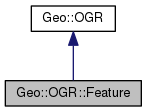
 Inheritance diagram for Geo::OGR::Feature:
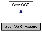
 Collaboration diagram for Geo::OGR::Feature:
Public Member Functions | |
| public Geo::OGR::Feature | Clone () |
| public method | DumpReadable () |
| public scalar | Equal (scalar feature) |
| public scalar | FID (scalar id) |
| Get or set the id of this feature. More... | |
| public method | Field (scalar name, scalar value,...) |
| Get, set, or unset the field value. More... | |
| public method | FillUnsetWithDefault () |
| public method | Geometry (scalar name, scalar geometry) |
| Get or set the value of a geometry field. More... | |
| public Geo::OGR::FeatureDefn | GetDefn () |
| public scalar | GetFID () |
| public list | GetField (scalar name) |
| public scalar | GetFieldDefn (scalar name) |
| public list | GetFieldNames () |
| public scalar | GetGeomFieldDefn (scalar name) |
| public method | GetNativeData () |
| public method | GetNativeMediaType () |
| public hash reference | GetSchema () |
| Get the schema of this feature. More... | |
| public scalar | GetStyleString () |
| public method | IsFieldNull () |
| public method | IsFieldSetAndNotNull () |
| public Geo::OGR::Layer | Layer () |
| public hash reference | Row (hash row) |
| public method | SetFID (scalar id) |
| public method | SetField (scalar name, array Value) |
| public method | SetFieldNull () |
| public method | SetFrom (scalar other, scalar forgiving=1, hashref map) |
| public method | SetNativeData () |
| public method | SetNativeMediaType () |
| public method | SetStyleString (scalar string) |
| public list | Tuple (array tuple) |
| public scalar | Validate (list flags) |
| public Geo::OGR::Feature | new (hash schema) |
| Create a new feature. More... | |
 Public Member Functions inherited from Geo::OGR Public Member Functions inherited from Geo::OGR | |
| public list | ByteOrders () |
| public Geo::GDAL::Driver | Driver (scalar name) |
| public list | DriverNames () |
| public list | Drivers () |
| public method | Flatten () |
| public scalar | GeometryTypeModify (scalar type, scalar modifier) |
| public scalar | GeometryTypeTest (scalar type, scalar test, scalar type2) |
| public list | GeometryTypes () |
| public method | GetNonLinearGeometriesEnabledFlag () |
| public method | GetOpenDSCount () |
| public method | HasM () |
| public method | HasZ () |
| public Geo::GDAL::Dataset | Open (scalar name, scalar update=0) |
| public Geo::GDAL::Dataset | OpenShared (scalar name, scalar update=0) |
| public method | SetGenerate_DB2_V72_BYTE_ORDER (scalar Generate_DB2_V72_BYTE_ORDER) |
| public method | SetNonLinearGeometriesEnabledFlag () |
Detailed Description
A collection of non-spatial and spatial attributes.
A feature is a collection of non-spatial and spatial attributes and
an id, which is a special attribute, and data records according to
this data model. Attributes are called fields and some fields are
spatial, i.e., their value is a geometry. Fields have at least a
name and a type. Features may exist within a layer or
separetely. The data model of a feature is a definition object.
Member Function Documentation
| public Geo::OGR::Feature Geo::OGR::Feature::Clone | ( | ) |
| public method Geo::OGR::Feature::DumpReadable | ( | ) |
Object method.
Write the contents of this feature to stdout.
 Code:
Code:
| public scalar Geo::OGR::Feature::Equal | ( | scalar | feature | ) |
Object method.
- Parameters
-
feature a Geo::OGR::Feature object for comparison
- Returns
- boolean
 Code:
Code:
| public scalar Geo::OGR::Feature::FID | ( | scalar | id | ) |
Get or set the id of this feature.
Object method.
- Parameters
-
id [optional] the id to set for this feature.
- Returns
- integer the id of this feature.
 Code:
Code:
| public method Geo::OGR::Feature::Field | ( | scalar | name, |
| scalar | value, | ||
| ... | |||
| ) |
Get, set, or unset the field value.
Object method.
- Parameters
-
name the name (or the index) of the field.
value a scalar, a list of scalars or a reference to a
list. If undef, the field is unset. If a scalar or a list of
scalars, the field is set from them.
- Note
- Non-scalar fields (for example Date) can be set either from a
scalar, which is then assumed to be a string and parsed, or from a
list of values (for example year, month, day for Date).
-
Setting and getting Integer64 fields requires 'use bigint' if
$Config{ivsize} is smaller than 8, i.e., in a 32 bit machine.
- Returns
- in non-void context the value of the field, which may be a
scalar or a list, depending on the field type. For unset fields the
undef value is returned.
 Code:
Code:
| public method Geo::OGR::Feature::FillUnsetWithDefault | ( | ) |
 Code:
Code:
| public method Geo::OGR::Feature::Geometry | ( | scalar | name, |
| scalar | geometry | ||
| ) |
Get or set the value of a geometry field.
Object method.
- Note
- This method delivers the functionality of undocumented methods
SetGeometry($geometry), SetGeometryDirectly, SetGeomField,
SetGeomFieldDirectly, GetGeometry, GetGeometryRef.
Set or get the geometry in the feature. When setting, does a check
against the schema (GeometryType) of the feature. If the parameter
is a geometry object, it is cloned.
- Parameters
-
name [optional] the name of the spatial field,
whose geometry is to be set. If not given, sets or gets the geometry
of the first (or the single) spatial field.
geometry [optional] a Geo::OGR::Geometry object or a
reference to a hash from which such can be created (using
Geo::OGR::Geometry::new).
- Returns
- in a non-void context the indicated geometry in the feature
as a Geo::OGR::Geometry object. The returned object contains a
reference to the actual geometry data in the feature (the geometry
is not cloned) and to the feature object, thus keeping the feature
object from being destroyed while the geometry object exists.
 Code:
Code:
| public Geo::OGR::FeatureDefn Geo::OGR::Feature::GetDefn | ( | ) |
Object method.
- Note
- A.k.a GetDefnRef.
- Returns
- a Geo::OGR::FeatureDefn object, which represents the definition of this feature.
 Code:
Code:
| public scalar Geo::OGR::Feature::GetFID | ( | ) |
Object method.
- Returns
- the feature id (an integer).
 Code:
Code:
| public list Geo::OGR::Feature::GetField | ( | scalar | name | ) |
| public scalar Geo::OGR::Feature::GetFieldDefn | ( | scalar | name | ) |
Object method.
Get the definition of a field.
- Parameters
-
name the name of the field.
- Returns
- a Geo::OGR::FieldDefn object.
 Code:
Code:
| public list Geo::OGR::Feature::GetFieldNames | ( | ) |
Object method.
Get the names of the fields in this feature.
 Code:
Code:
| public scalar Geo::OGR::Feature::GetGeomFieldDefn | ( | scalar | name | ) |
Object method.
Get the definition of a spatial field.
- Parameters
-
name the name of the spatial field.
- Returns
- a Geo::OGR::GeomFieldDefn object.
 Code:
Code:
| public method Geo::OGR::Feature::GetNativeData | ( | ) |
 Code:
Code:
| public method Geo::OGR::Feature::GetNativeMediaType | ( | ) |
 Code:
Code:
| public hash reference Geo::OGR::Feature::GetSchema | ( | ) |
Get the schema of this feature.
Object method.
- Returns
- the schema as a hash whose keywords are Name, StyleIgnored
and Fields. Fields is an anonymous array of first non-spatial and
then spatial field schemas as in Geo::OGR::FieldDefn::Schema() and
Geo::OGR::GeomFieldDefn::Schema().
 Code:
Code:
| public scalar Geo::OGR::Feature::GetStyleString | ( | ) |
Object method.
- Returns
- a string
 Code:
Code:
| public method Geo::OGR::Feature::IsFieldNull | ( | ) |
 Code:
Code:
| public method Geo::OGR::Feature::IsFieldSetAndNotNull | ( | ) |
 Code:
Code:
| public Geo::OGR::Layer Geo::OGR::Feature::Layer | ( | ) |
Object method.
- Returns
- the layer to which this feature belongs to or undef.
 Code:
Code:
| public Geo::OGR::Feature Geo::OGR::Feature::new | ( | hash | schema | ) |
Create a new feature.
Class method.
- Parameters
-
Named parameters:
- Schema a reference to a schema hash, or a Geo::OGR::Layer,
Geo::OGR::Feature, or Geo::OGR::FeatureDefn object.
- Values values for the feature attributes.
- StyleIgnored whether the style can be omitted when fetching
features. (default is false)
Schema is a hash with the following keys:
- Name name of the schema (not used).
- Fields a list of Geo::OGR::FieldDefn or Geo::OGR::GeomFieldDefn
objects or references to hashes from which fields can be created.
- GeometryType the geometry type if the feature has only one spatial field.
- Note
- Do not mix GeometryType and geometry fields in Fields list.
-
Old syntax where the argument is a Geo::OGR::FeatureDefn
object or Schema hash is supported.
- Returns
- a new Geo::OGR::Feature object.
 Code:
Code:
| public hash reference Geo::OGR::Feature::Row | ( | hash | row | ) |
Object method.
- Note
- This method discards the data the destination feature (or
layer) does not support. Changes in data due to differences between
field types may also occur.
Get and/or set the data of the feature. The key of the (key,value)
pairs of the row is the field name. Special field names FID and
Geometry are used for feature id and (single) geometry
respectively. The geometry/ies is/are set and get using the
Geo::OGR::Feature::Geometry method. Field values are set using the
Geo::OGR::Feature::Field method.
- Parameters
-
row [optional] feature data in a hash.
- Returns
- a reference to feature data in a hash. Spatial fields are
returned as Geo::OGR::Geometry objects.
 Code:
Code:
| public method Geo::OGR::Feature::SetFID | ( | scalar | id | ) |
Object method.
- Parameters
-
id the feature id.
 Code:
Code:
| public method Geo::OGR::Feature::SetField | ( | scalar | name, |
| array | Value | ||
| ) |
| public method Geo::OGR::Feature::SetFieldNull | ( | ) |
 Code:
Code:
| public method Geo::OGR::Feature::SetFrom | ( | scalar | other, |
| scalar | forgiving = 1, |
||
| hashref | map | ||
| ) |
Object method.
- Parameters
-
other a Geo::OGR::Feature object
forgiving [optional] set to false if the operation should not
continue if output fields do not match some of the source fields
map [optional] a mapping from output field indexes to source
fields, include into the hash all field indexes of this feature
which should be set
 Code:
Code:
| public method Geo::OGR::Feature::SetNativeData | ( | ) |
 Code:
Code:
| public method Geo::OGR::Feature::SetNativeMediaType | ( | ) |
 Code:
Code:
| public method Geo::OGR::Feature::SetStyleString | ( | scalar | string | ) |
Object method.
- Parameters
-
string
 Code:
Code:
| public list Geo::OGR::Feature::Tuple | ( | array | tuple | ) |
Object method.
- Note
- This method discards the data the destination feature (or
layer) does not support. Changes in data due to differences between
field types may also occur.
-
The schema of the tuple needs to be the same as that of the
feature.
Get and/set the data of the feature. The expected data in the tuple
is ([feature_id,] non-spatial fields, spatial fields). The fields in
the tuple are in the order they are in the schema. Field values are
set using the Geo::OGR::Feature::Field method. Geometries are set
and get using the Geo::OGR::Feature::Geometry method.
- Parameters
-
tuple [optional] feature data in an array
- Returns
- feature data in an array
 Code:
Code:
| public scalar Geo::OGR::Feature::Validate | ( | list | flags | ) |
Object method.
- Parameters
-
flags one of more of null, geom_type, width,
allow_null_when_default, or all.
- Exceptions
-
croaks with an error message if the feature is not valid.
- Returns
- integer denoting the validity of the feature object.
 Code:
Code:
The documentation for this class was generated from the following file:
- all.dox


