A raster band.
More...
 Inheritance diagram for Geo::GDAL::Band:
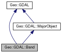 Collaboration diagram for Geo::GDAL::Band:
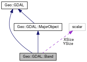
Public Member Functions | |
| public method | AdviseRead () |
| public Geo::GDAL::RasterAttributeTable | AttributeTable (scalar AttributeTable) |
| public list | BlockSize () |
| public list | CategoryNames (array names) |
| public scalar | Checksum (scalar xoff=0, scalar yoff=0, scalar xsize=undef, scalar ysize=undef) |
| public hashref | ClassCounts (scalar classifier, scalar progress=undef, scalar progress_data=undef) |
| public scalar | ColorInterpretation (scalar color_interpretation) |
| public method | ColorInterpretations () |
| public Geo::GDAL::ColorTable | ColorTable (scalar ColorTable) |
| public method | ComputeBandStats (scalar samplestep=1) |
| public method | ComputeRasterMinMax (scalar approx_ok=0) |
| public list | ComputeStatistics (scalar approx_ok, scalar progress=undef, scalar progress_data=undef) |
| public Geo::OGR::Layer | Contours (scalar DataSource, hashref LayerConstructor, scalar ContourInterval, scalar ContourBase, arrayref FixedLevels, scalar NoDataValue, scalar IDField, scalar ElevField, coderef Progress, scalar ProgressData) |
| public method | CreateMaskBand (array flags) |
| public scalar | DataType () |
| public Geo::GDAL::Dataset | Dataset () |
| public scalar | DeleteNoDataValue () |
| public Geo::GDAL::Band | Distance (hash params) |
| public method | Domains () |
| public method | Fill (scalar real_part, scalar imag_part=0.0) |
| public method | FillNoData (scalar mask, scalar max_search_dist, scalar smoothing_iterations, scalar options, coderef progress, scalar progress_data) |
| public method | FlushCache () |
| public scalar | GetBandNumber () |
| public method | GetBlockSize () |
| public list | GetDefaultHistogram (scalar force=1, coderef progress=undef, scalar progress_data=undef) |
| public list | GetHistogram (hash parameters) |
| public Geo::GDAL::Band | GetMaskBand () |
| public list | GetMaskFlags () |
| public scalar | GetMaximum () |
| public scalar | GetMinimum () |
| public Geo::GDAL::Band | GetOverview (scalar index) |
| public scalar | GetOverviewCount () |
| public list | GetStatistics (scalar approx_ok, scalar force) |
| public method | HasArbitraryOverviews () |
| public list | MaskFlags () |
| public scalar | NoDataValue (scalar NoDataValue) |
| public scalar | PackCharacter () |
| public method | Piddle (scalar piddle, scalar xoff=0, scalar yoff=0, scalar xsize=< width >, scalar ysize=< height >, scalar xdim, scalar ydim) |
| public Geo::OGR::Layer | Polygonize (hash params) |
| public method | RasterAttributeTable () |
| public scalar | ReadRaster (hash params) |
| public array reference | ReadTile (scalar xoff=0, scalar yoff=0, scalar xsize=< width >, scalar ysize=< height >) |
| public method | Reclassify (scalar classifier, scalar progress=undef, scalar progress_data=undef) |
| public method | RegenerateOverview (Geo::GDAL::Band overview, scalar resampling, coderef progress, scalar progress_data) |
| public method | RegenerateOverviews (arrayref overviews, scalar resampling, coderef progress, scalar progress_data) |
| public method | ScaleAndOffset (scalar scale, scalar offset) |
| public list | SetDefaultHistogram (scalar min, scalar max, scalar histogram) |
| public method | SetStatistics (scalar min, scalar max, scalar mean, scalar stddev) |
| public Geo::GDAL::Band | Sieve (hash params) |
| public list | Size () |
| public method | Unit (scalar type) |
| public method | WriteRaster (hash params) |
| public method | WriteTile (scalar data, scalar xoff=0, scalar yoff=0) |
| Public Member Functions inherited from Geo::GDAL::MajorObject | |
| public scalar | Description (scalar description) |
| public method | Domains () |
| public scalar | GetDescription () |
| public hash reference | GetMetadata (scalar domain="") |
| public method | GetMetadataDomainList () |
| public hash reference | Metadata (hashref metadata=undef, scalar domain= '') |
| public method | SetDescription (scalar NewDesc) |
| public method | SetMetadata (hashref metadata, scalar domain="") |
| Public Member Functions inherited from Geo::GDAL | |
| public method | ApplyVerticalShiftGrid () |
| public method | BuildVRT () |
| public method | CPLBinaryToHex () |
| public method | CPLHexToBinary () |
| public method | CreatePansharpenedVRT () |
| public scalar | DataTypeIsComplex (scalar DataType) |
| public list | DataTypeValueRange (scalar DataType) |
| public list | DataTypes () |
| public scalar | DecToDMS (scalar angle, scalar axis, scalar precision=2) |
| public scalar | DecToPackedDMS (scalar dec) |
| public method | DontUseExceptions () |
| public Geo::GDAL::Driver | Driver (scalar Name) |
| public list | DriverNames () |
| public list | Drivers () |
| public method | EscapeString () |
| public scalar | FindFile (scalar basename) |
| public method | FinderClean () |
| public method | GOA2GetAccessToken () |
| public method | GOA2GetAuthorizationURL () |
| public method | GOA2GetRefreshToken () |
| public method | GetActualURL () |
| public scalar | GetCacheMax () |
| public scalar | GetCacheUsed () |
| public scalar | GetConfigOption (scalar key) |
| public scalar | GetDataTypeSize (scalar DataType) |
| public method | GetErrorCounter () |
| public method | GetFileSystemOptions () |
| public method | GetFileSystemsPrefixes () |
| public method | GetJPEG2000StructureAsString () |
| public method | GetSignedURL () |
| public Geo::GDAL::Driver | IdentifyDriver (scalar path, scalar siblings) |
| public method | IdentifyDriverEx () |
| public method | MkdirRecursive () |
| public Geo::GDAL::Dataset | Open (hash params) |
| public Geo::GDAL::Dataset | OpenEx (hash params) |
| public list | OpenFlags () |
| public scalar | PackCharacter (scalar DataType) |
| public scalar | PackedDMSToDec (scalar packed) |
| public method | PopFinderLocation () |
| public method | PushFinderLocation (scalar path) |
| public list | RIOResamplingTypes () |
| public list | ResamplingTypes () |
| public method | RmdirRecursive () |
| public method | SetCacheMax (scalar Bytes) |
| public method | SetConfigOption (scalar key, scalar value) |
| public method | UseExceptions () |
| public method | VSICurlClearCache () |
| public method | VSIFEofL () |
| public method | VSIFOpenExL () |
| public method | VSIGetLastErrorMsg () |
| public method | VSIGetLastErrorNo () |
| public scalar | VersionInfo (scalar request= 'VERSION_NUM') |
| public scalar | errstr () |
Public Attributes | |
| scalar | XSize |
| Object attribute. scalar (access as $band->{XSize}) | |
| scalar | YSize |
| Object attribute. scalar (access as $band->{YSize}) | |
Detailed Description
Member Function Documentation
| public method Geo::GDAL::Band::AdviseRead | ( | ) |
Code:
| public Geo::GDAL::RasterAttributeTable Geo::GDAL::Band::AttributeTable | ( | scalar | AttributeTable | ) |
Object method.
- Parameters
-
AttributeTable [optional] A Geo::GDAL::RasterAttributeTable object.
- Returns
- a new Geo::GDAL::RasterAttributeTable object, whose data is
contained within the band.
Code:
| public list Geo::GDAL::Band::BlockSize | ( | ) |
Object method.
A.k.a GetBlockSize
- Returns
- The size of a preferred i/o raster block size as a list
(width, height).
Code:
| public list Geo::GDAL::Band::CategoryNames | ( | array | names | ) |
Object method.
- Parameters
-
names [optional]
- Returns
Code:
| public scalar Geo::GDAL::Band::Checksum | ( | scalar | xoff = 0, |
| scalar | yoff = 0, |
||
| scalar | xsize = undef, |
||
| scalar | ysize = undef |
||
| ) |
Object method.
Computes a checksum from the raster or a part of it.
- Parameters
-
xoff
yoff
xsize
ysize
- Returns
- the checksum.
Code:
| public hashref Geo::GDAL::Band::ClassCounts | ( | scalar | classifier, |
| scalar | progress = undef, |
||
| scalar | progress_data = undef |
||
| ) |
Object method.
Compute the counts of cell values or number of cell values in ranges.
- Note
- Classifier is required only for float bands.
-
NoData values are counted similar to other values when
classifier is not defined for integer rasters.
- Parameters
-
classifier Anonymous array of format [ $comparison,
$classifier ], where $comparison is a string '<', '<=', '>', or '>='
and $classifier is an anonymous array of format [ $value,
$value|$classifier, $value|$classifier ], where $value is a numeric
value against which the reclassified value is compared to. If the
comparison returns true, then the second $value or $classifier is
applied, and if not then the third $value or $classifier.
In the example below, the line is divided into ranges
[-inf..3), [3..5), and [5..inf], i.e., three ranges with class
indexes 0, 1, and 2. Note that the indexes are used as keys for
class counts and not the class values (here 1.0, 2.0, and 3.0),
which are used in Geo::GDAL::Band::Reclassify.
<br>$classifier = [ '<', [5.0, [3.0, 1.0, 2.0], 3.0] ];<br># Howto create this $classifier from @class_boundaries:<br>my $classifier = ['<='];<br>my $tree = [$class_boundaries[0], 0, 1];<br>for my $i (1 .. $#class_boundaries) {<br> $tree = [$class_boundaries[$i], [@$tree], $i+1];<br>}<br>push @$classifier, $tree;<br>
- Returns
- a reference to an anonymous hash, which contains the class
values (indexes) as keys and the number of cells with that value or
in that range as values. If the subroutine is user terminated an
error is raised.
Code:
| public scalar Geo::GDAL::Band::ColorInterpretation | ( | scalar | color_interpretation | ) |
Object method.
- Note
- a.k.a. GetRasterColorInterpretation and GetColorInterpretation
(get only and returns an integer), SetRasterColorInterpretation and
SetColorInterpretation (set only and requires an integer)
- Parameters
-
color_interpretation [optional] new color interpretation, one
of Geo::GDAL::Band::ColorInterpretations.
- Returns
- The color interpretation of this band. One of Geo::GDAL::Band::ColorInterpretations.
Code:
| public method Geo::GDAL::Band::ColorInterpretations | ( | ) |
Package subroutine.
- Returns
- a list of types of color interpretation for raster
bands. These are currently:
AlphaBand, BlackBand, BlueBand, CyanBand, GrayIndex, GreenBand, HueBand, LightnessBand, MagentaBand, PaletteIndex, RedBand, SaturationBand, Undefined, YCbCr_CbBand, YCbCr_CrBand, YCbCr_YBand, and YellowBand.
Code:
| public Geo::GDAL::ColorTable Geo::GDAL::Band::ColorTable | ( | scalar | ColorTable | ) |
Object method.
Get or set the color table of this band.
- Parameters
-
ColorTable [optional] a Geo::GDAL::ColorTable object
- Returns
- A new Geo::GDAL::ColorTable object which represents the
internal color table associated with this band. Returns undef this
band does not have an associated color table.
Code:
| public method Geo::GDAL::Band::ComputeBandStats | ( | scalar | samplestep = 1 | ) |
Object method.
- Parameters
-
samplestep the row increment in computing the statistics.
- Note
- Returns uncorrected sample standard deviation.
See also Geo::GDAL::Band::ComputeStatistics.
- Returns
- a list (mean, stddev).
Code:
| public method Geo::GDAL::Band::ComputeRasterMinMax | ( | scalar | approx_ok = 0 | ) |
Object method.
- Returns
- arrayref MinMax = [min, max]
Code:
| public list Geo::GDAL::Band::ComputeStatistics | ( | scalar | approx_ok, |
| scalar | progress = undef, |
||
| scalar | progress_data = undef |
||
| ) |
Object method.
- Parameters
-
approx_ok Whether it is allowed to compute the statistics
based on overviews or similar.
- Note
- Returns uncorrected sample standard deviation.
See also Geo::GDAL::Band::ComputeBandStats.
- Returns
- a list ($min, $max, $mean, $stddev).
Code:
| public Geo::OGR::Layer Geo::GDAL::Band::Contours | ( | scalar | DataSource, |
| hashref | LayerConstructor, | ||
| scalar | ContourInterval, | ||
| scalar | ContourBase, | ||
| arrayref | FixedLevels, | ||
| scalar | NoDataValue, | ||
| scalar | IDField, | ||
| scalar | ElevField, | ||
| coderef | Progress, | ||
| scalar | ProgressData | ||
| ) |
Object method.
Generate contours for this raster band. This method can also be used with named parameters.
- Note
- This method is a wrapper for ContourGenerate.
An example:
<br>use Geo::GDAL;<br>$dem = Geo::GDAL::Open('dem.gtiff');<br>$contours = $dem->Band->Contours(ContourInterval => 10, ElevField => 'z');<br>$n = $contours->GetFeatureCount;<br>
- Parameters
-
DataSource a Geo::OGR::DataSource object, default is a Memory data source
LayerConstructor data for Geo::OGR::DataSource::CreateLayer, default is {Name => 'contours'}
ContourInterval default is 100
ContourBase default is 0
FixedLevels a reference to a list of fixed contour levels, default is []
NoDataValue default is undef
IDField default is '', i.e., no field (the field is created if this is given)
ElevField default is '', i.e., no field (the field is created if this is given)
progress [optional] a reference to a subroutine, which will
be called with parameters (number progress, string msg, progress_data)
progress_data [optional]
- Returns
Code:
| public method Geo::GDAL::Band::CreateMaskBand | ( | array | flags | ) |
Object method.
- Note
- May invalidate any previous mask band obtained with Geo::GDAL::Band::GetMaskBand.
- Parameters
-
flags one or more mask flags. The flags are Geo::GDAL::Band::MaskFlags.
Code:
| public Geo::GDAL::Dataset Geo::GDAL::Band::Dataset | ( | ) |
Object method.
- Returns
- The dataset which this band belongs to.
Code:
| public scalar Geo::GDAL::Band::DataType | ( | ) |
| public scalar Geo::GDAL::Band::DeleteNoDataValue | ( | ) |
Object method.
Code:
| public Geo::GDAL::Band Geo::GDAL::Band::Distance | ( | hash | params | ) |
Object method.
Compute distances to specific cells of this raster.
- Parameters
-
params Named parameters:
- Distance A raster band, into which the distances are computed. If not given, a not given, a new in-memory raster band is created and returned. The data type of the raster can be given in the options.
- Options Hash of options. Options are:
- Values A list of cell values in this band to measure the distance from. If this option is not provided, the distance will be computed to non-zero pixel values. Currently pixel values are internally processed as integers.
- DistUnits=PIXEL|GEO Indicates whether distances will be computed in cells or in georeferenced units. The default is pixel units. This also determines the interpretation of MaxDist.
- MaxDist=n The maximum distance to search. Distances greater than this value will not be computed. Instead output cells will be set to a NoData value.
- NoData=n The NoData value to use on the distance band for cells that are beyond MaxDist. If not provided, the distance band will be queried for a NoData value. If one is not found, 65535 will be used (255 if the type is Byte).
- Use_Input_NoData=YES|NO If this option is set, the NoData value of this band will be respected. Leaving NoData cells in the input as NoData pixels in the distance raster.
- Fixed_Buf_Val=n If this option is set, all cells within the MaxDist threshold are set to this value instead of the distance value.
- DataType The data type for the result if it is not given.
- Progress Progress function.
- ProgressData Additional parameter for the progress function.
- Note
- This GDAL function behind this API is called GDALComputeProximity.
- Returns
- The distance raster.
Code:
| public method Geo::GDAL::Band::Domains | ( | ) |
Code:
| public method Geo::GDAL::Band::Fill | ( | scalar | real_part, |
| scalar | imag_part = 0.0 |
||
| ) |
Object method.
Fill the band with a constant value.
- Parameters
-
real_part Real component of fill value.
imag_part Imaginary component of fill value.
Code:
| public method Geo::GDAL::Band::FillNoData | ( | scalar | mask, |
| scalar | max_search_dist, | ||
| scalar | smoothing_iterations, | ||
| scalar | options, | ||
| coderef | progress, | ||
| scalar | progress_data | ||
| ) |
Object method.
Interpolate values for cells in this raster. The cells to fill
should be marked in the mask band with zero.
- Parameters
-
mask [optional] a mask band indicating cells to be interpolated (zero valued) (default is to get it with Geo::GDAL::Band::GetMaskBand).
max_search_dist [optional] the maximum number of cells to
search in all directions to find values to interpolate from (default is 10).
smoothing_iterations [optional] the number of 3x3 smoothing filter passes to run (0 or more) (default is 0).
options [optional] A reference to a hash. No options have been defined so far for this algorithm (default is {}).
progress [optional] a reference to a subroutine, which will
be called with parameters (number progress, string msg, progress_data) (default is undef).
progress_data [optional] (default is undef).
Documentation for GDAL algorithms
Code:
| public method Geo::GDAL::Band::FlushCache | ( | ) |
Object method.
Write cached data to disk. There is usually no need to call this
method.
Code:
| public scalar Geo::GDAL::Band::GetBandNumber | ( | ) |
Object method.
- Returns
- The index of this band in the parent dataset list of bands.
Code:
| public method Geo::GDAL::Band::GetBlockSize | ( | ) |
Code:
| public list Geo::GDAL::Band::GetDefaultHistogram | ( | scalar | force = 1, |
| coderef | progress = undef, |
||
| scalar | progress_data = undef |
||
| ) |
Object method.
- Parameters
-
force true to force the computation
progress [optional] a reference to a subroutine, which will
be called with parameters (number progress, string msg, progress_data)
progress_data [optional]
- Note
- See Note in Geo::GDAL::Band::GetHistogram.
- Returns
- a list: ($min, $max, arrayref histogram).
Code:
| public list Geo::GDAL::Band::GetHistogram | ( | hash | parameters | ) |
Object method.
Compute histogram from the raster.
- Parameters
-
parameters Named parameters:
- Min the lower bound, default is -0.5
- Max the upper bound, default is 255.5
- Buckets the number of buckets in the histogram, default is 256
- IncludeOutOfRange whether to use the first and last values in the returned list
for out of range values, default is false;
the bucket size is (Max-Min) / Buckets if this is false and
(Max-Min) / (Buckets-2) if this is true
- ApproxOK if histogram can be computed from overviews, default is false
- Progress an optional progress function, the default is undef
- ProgressData data for the progress function, the default is undef
- Note
- Histogram counts are treated as strings in the bindings to be
able to use large integers (if GUIntBig is larger than Perl IV). In
practice this is only important if you have a 32 bit machine and
very large bucket counts. In those cases it may also be necessary to
use Math::BigInt.
- Returns
- a list which contains the count of values in each bucket
Code:
| public Geo::GDAL::Band Geo::GDAL::Band::GetMaskBand | ( | ) |
Object method.
- Returns
- the mask band associated with this
band.
Code:
| public list Geo::GDAL::Band::GetMaskFlags | ( | ) |
Object method.
- Returns
- the mask flags of the mask band associated with this
band. The flags are one or more of Geo::GDAL::Band::MaskFlags.
Code:
| public scalar Geo::GDAL::Band::GetMaximum | ( | ) |
Object method.
- Note
- Call Geo::GDAL::Band::ComputeStatistics before calling
GetMaximum to make sure the value is computed.
- Returns
- statistical minimum of the band or undef if statistics are
not kept or computed in scalar context. In list context returns the
maximum value or a (kind of) maximum value supported by the data
type and a boolean value, which indicates which is the case (true is
first, false is second).
Code:
| public scalar Geo::GDAL::Band::GetMinimum | ( | ) |
Object method.
- Note
- Call Geo::GDAL::Band::ComputeStatistics before calling
GetMinimum to make sure the value is computed.
- Returns
- statistical minimum of the band or undef if statistics are
not kept or computed in scalar context. In list context returns the
minimum value or a (kind of) minimum value supported by the data
type and a boolean value, which indicates which is the case (true is
first, false is second).
Code:
| public Geo::GDAL::Band Geo::GDAL::Band::GetOverview | ( | scalar | index | ) |
Object method.
- Parameters
-
index 0..GetOverviewCount-1
- Returns
- a Geo::GDAL::Band object, which represents the internal
overview band, or undef. if the index is out of bounds.
Code:
| public scalar Geo::GDAL::Band::GetOverviewCount | ( | ) |
Object method.
- Returns
- the number of overviews available of the band.
Code:
| public list Geo::GDAL::Band::GetStatistics | ( | scalar | approx_ok, |
| scalar | force | ||
| ) |
Object method.
- Parameters
-
approx_ok Whether it is allowed to compute the statistics
based on overviews or similar.
force Whether to force scanning of the whole raster.
- Note
- Uses Geo::GDAL::Band::ComputeStatistics internally.
- Returns
- a list ($min, $max, $mean, $stddev).
Code:
| public method Geo::GDAL::Band::HasArbitraryOverviews | ( | ) |
Object method.
- Returns
- true or false.
Code:
| public list Geo::GDAL::Band::MaskFlags | ( | ) |
Package subroutine.
- Returns
- the list of mask flags. These are
- AllValid: There are no invalid cell, all mask values will be 255.
When used this will normally be the only flag set.
- PerDataset: The mask band is shared between all bands on the dataset.
- Alpha: The mask band is actually an alpha band and may have values
other than 0 and 255.
- NoData: Indicates the mask is actually being generated from NoData values.
(mutually exclusive of Alpha).
Code:
| public scalar Geo::GDAL::Band::NoDataValue | ( | scalar | NoDataValue | ) |
Object method.
Get or set the "no data" value.
- Parameters
-
NoDataValue [optional]
- Note
- $band->NoDataValue(undef) sets the NoData value to the
Posix floating point maximum. Use Geo::GDAL::Band::DeleteNoDataValue
to stop this band using a NoData value.
- Returns
- The NoData value or undef in scalar context. An undef
value indicates that there is no NoData value associated with this
band.
Code:
| public scalar Geo::GDAL::Band::PackCharacter | ( | ) |
Object method.
- Returns
- The character to use in Perl pack and unpack for the data of this band.
Code:
| public method Geo::GDAL::Band::Piddle | ( | scalar | piddle, |
| scalar | xoff = 0, |
||
| scalar | yoff = 0, |
||
| scalar | xsize = <width>, |
||
| scalar | ysize = <height>, |
||
| scalar | xdim, | ||
| scalar | ydim | ||
| ) |
Object method.
Read or write band data from/into a piddle.
- Note
- The PDL module must be available for this method to work. Also, you
should 'use PDL' in the code that you use this method.
- Parameters
-
piddle [only when writing] The piddle from which to read the data to be written into the band.
xoff,yoff The offset for data in the band, default is top left (0, 0).
xsize,ysize [optional] The size of the window in the band.
xdim,ydim [optional, only when reading from a band] The size of the piddle to create.
- Returns
- A new piddle when reading from a band (no not use when writing into a band).
Code:
| public Geo::OGR::Layer Geo::GDAL::Band::Polygonize | ( | hash | params | ) |
Object method.
Polygonize this raster band.
- Parameters
-
params Named parameters:
- Mask A raster band, which is used as a mask to select polygonized areas. Default is undef.
- OutLayer A vector layer into which the polygons are written. If not given, an in-memory layer 'polygonized' is created and returned.
- PixValField The name of the field in the output layer into which the cell value of the polygon area is stored. Default is 'val'.
- Options Hash or list of options. Connectedness can be set to 8
to use 8-connectedness, otherwise 4-connectedness is
used. ForceIntPixel can be set to 1 to force using a 32 bit int buffer
for cell values in the process. If this is not set and the data type
of this raster does not fit into a 32 bit int buffer, a 32 bit float
buffer is used.
- Progress Progress function.
- ProgressData Additional parameter for the progress function.
- Returns
- Output vector layer.
Code:
| public method Geo::GDAL::Band::RasterAttributeTable | ( | ) |
Code:
| public scalar Geo::GDAL::Band::ReadRaster | ( | hash | params | ) |
Object method.
Read data from the band.
- Parameters
-
params Named parameters:
- XOff x offset (cell coordinates) (default is 0)
- YOff y offset (cell coordinates) (default is 0)
- XSize width of the area to read (default is the width of the band)
- YSize height of the area to read (default is the height of the band)
- BufXSize (default is undef, i.e., the same as XSize)
- BufYSize (default is undef, i.e., the same as YSize)
- BufType data type of the buffer (default is the data type of the band)
- BufPixelSpace (default is 0)
- BufLineSpace (default is 0)
- ResampleAlg one of Geo::GDAL::RIOResamplingTypes (default is 'NearestNeighbour'),
- Progress reference to a progress function (default is undef)
- ProgressData (default is undef)
Entry in GDAL docs (method RasterIO)
- Returns
- a buffer, open the buffer with unpack function of Perl. See Geo::GDAL::Band::PackCharacter.
Code:
| public array reference Geo::GDAL::Band::ReadTile | ( | scalar | xoff = 0, |
| scalar | yoff = 0, |
||
| scalar | xsize = <width>, |
||
| scalar | ysize = <height> |
||
| ) |
Object method.
Read band data into a Perl array.
- Note
- Accessing band data in this way is slow. Consider using PDL and Geo::GDAL::Band::Piddle.
Usage example (print the data from a band):
<br>print "@$_\n" for ( @{ $band->ReadTile() } );<br>
Another usage example (process the data of a large dataset that has one band):
<br>my($W,$H) = $dataset->Band()->Size();<br>my($xoff,$yoff,$w,$h) = (0,0,200,200);<br>while (1) {<br> if ($xoff >= $W) {<br> $xoff = 0;<br> $yoff += $h;<br> last if $yoff >= $H;<br> }<br> my $data = $dataset->Band(1)->ReadTile($xoff,$yoff,min($W-$xoff,$w),min($H-$yoff,$h));<br> # add your data processing code here<br> $dataset->Band(1)->WriteTile($data,$xoff,$yoff);<br> $xoff += $w;<br>}<br><br>sub min {<br> return $_[0] < $_[1] ? $_[0] : $_[1];<br>}<br>
- Parameters
-
xoff Number of cell to skip before starting to read from a row. Pixels are read from left to right.
yoff Number of cells to skip before starting to read from a column. Pixels are read from top to bottom.
xsize Number of cells to read from each row.
ysize Number of cells to read from each column.
- Returns
- a two-dimensional Perl array, organizes as data->[y][x], y =
0..height-1, x = 0..width-1. I.e., y is row and x is column.
Code:
| public method Geo::GDAL::Band::Reclassify | ( | scalar | classifier, |
| scalar | progress = undef, |
||
| scalar | progress_data = undef |
||
| ) |
Object method.
Reclassify the cells in the band.
- Note
- NoData values in integer rasters are reclassified if
explicitly specified in the hash classifier. However, they are not
reclassified to the default value, if one is specified. In real
valued rasters nodata cells are not reclassified.
-
If the subroutine is user terminated or the classifier is
incorrect, already reclassified cells will stay reclassified but an
error is raised.
- Parameters
-
classifier For integer rasters an anonymous hash, which
contains old class values as keys and new class values as values, or
an array classifier as in Geo::GDAL::Band::ClassCounts. In a hash
classifier a special key '*' (star) can be used as default, to act
as a fallback new class value. For real valued rasters the
classifier is as in Geo::GDAL::Band::ClassCounts.
Code:
| public method Geo::GDAL::Band::RegenerateOverview | ( | Geo::GDAL::Band | overview, |
| scalar | resampling, | ||
| coderef | progress, | ||
| scalar | progress_data | ||
| ) |
Object method.
- Parameters
-
overview a Geo::GDAL::Band object for the overview.
resampling [optional] the resampling method (one of Geo::GDAL::RIOResamplingTypes) (default is Average).
progress [optional] a reference to a subroutine, which will
be called with parameters (number progress, string msg, progress_data)
progress_data [optional]
Code:
| public method Geo::GDAL::Band::RegenerateOverviews | ( | arrayref | overviews, |
| scalar | resampling, | ||
| coderef | progress, | ||
| scalar | progress_data | ||
| ) |
Object method.
- Todo:
- This is not yet available
- Parameters
-
overviews a list of Geo::GDAL::Band objects for the overviews.
resampling [optional] the resampling method (one of Geo::GDAL::RIOResamplingTypes) (default is Average).
progress [optional] a reference to a subroutine, which will
be called with parameters (number progress, string msg, progress_data)
progress_data [optional]
Code:
| public method Geo::GDAL::Band::ScaleAndOffset | ( | scalar | scale, |
| scalar | offset | ||
| ) |
Object method.
Scale and offset are used to transform raw cell values into the
units returned by GetUnits(). The conversion function is:
- Returns
- a list ($scale, $offset), the values are undefined if they
are not set.
- Since
- version 1.9 of the bindings.
Code:
| public list Geo::GDAL::Band::SetDefaultHistogram | ( | scalar | min, |
| scalar | max, | ||
| scalar | histogram | ||
| ) |
Object method.
- Parameters
-
min
max
- Note
- See Note in Geo::GDAL::Band::GetHistogram.
- Parameters
-
histogram reference to an array containing the histogram
Code:
| public method Geo::GDAL::Band::SetStatistics | ( | scalar | min, |
| scalar | max, | ||
| scalar | mean, | ||
| scalar | stddev | ||
| ) |
Object method.
Save the statistics of the band if possible (the format can save
arbitrary metadata).
- Parameters
-
min
max
mean
stddev
Code:
| public Geo::GDAL::Band Geo::GDAL::Band::Sieve | ( | hash | params | ) |
Object method.
Remove small areas by merging them into the largest neighbour area.
- Parameters
-
params Named parameters:
- Mask A raster band, which is used as a mask to select sieved areas. Default is undef.
- Dest A raster band into which the result is written. If not given, an new in-memory raster band is created and returned.
- Threshold The smallest area size (in number of cells) which are not sieved away.
- Options Hash or list of options. {Connectedness => 4} can be specified to use 4-connectedness, otherwise 8-connectedness is used.
- Progress Progress function.
- ProgressData Additional parameter for the progress function.
- Returns
- The filtered raster band.
Code:
| public list Geo::GDAL::Band::Size | ( | ) |
Object method.
- Returns
- The size of the band as a list (width, height).
Code:
| public method Geo::GDAL::Band::Unit | ( | scalar | type | ) |
Object method.
- Parameters
-
type [optional] the unit (a string).
- Note
- $band->Unit(undef) sets the unit value to an empty string.
- Returns
- the unit (a string).
- Since
- version 1.9 of the bindings.
Code:
| public method Geo::GDAL::Band::WriteRaster | ( | hash | params | ) |
Object method.
Write data into the band.
- Parameters
-
params Named parameters:
- XOff x offset (cell coordinates) (default is 0)
- YOff y offset (cell coordinates) (default is 0)
- XSize width of the area to write (default is the width of the band)
- YSize height of the area to write (default is the height of the band)
- Buf a buffer (or a reference to a buffer) containing the data. Create the buffer with pack function of Perl. See Geo::GDAL::Band::PackCharacter.
- BufXSize (default is undef, i.e., the same as XSize)
- BufYSize (default is undef, i.e., the same as YSize)
- BufType data type of the buffer (default is the data type of the band)
- BufPixelSpace (default is 0)
- BufLineSpace (default is 0)
Entry in GDAL docs (method RasterIO)
Code:
| public method Geo::GDAL::Band::WriteTile | ( | scalar | data, |
| scalar | xoff = 0, |
||
| scalar | yoff = 0 |
||
| ) |
Object method.
Write band data from a Perl array.
- Note
- Accessing band data in this way is slow. Consider using PDL and Geo::GDAL::Band::Piddle.
- Parameters
-
data A two-dimensional Perl array, organizes as data->[y][x], y =
0..height-1, x = 0..width-1.
xoff
yoff
Code:
The documentation for this class was generated from the following file:
- all.dox