Geo::GNM::Network Class Reference
 Inheritance diagram for Geo::GNM::Network:
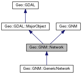 Collaboration diagram for Geo::GNM::Network:
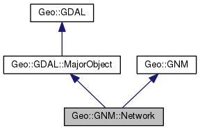
Public Member Functions | |
| public method | CommitTransaction () |
| public method | CopyLayer () |
| public method | DisconnectAll () |
| public method | GetFeatureByGlobalFID () |
| public method | GetFileList () |
| public method | GetLayerByIndex () |
| public method | GetLayerByName () |
| public method | GetLayerCount () |
| public method | GetName () |
| public method | GetPath () |
| public method | GetProjection () |
| public method | GetProjectionRef () |
| public method | GetVersion () |
| public method | RollbackTransaction () |
| public method | StartTransaction () |
| Public Member Functions inherited from Geo::GDAL::MajorObject | |
| public scalar | Description (scalar description) |
| public method | Domains () |
| public scalar | GetDescription () |
| public hash reference | GetMetadata (scalar domain="") |
| public method | GetMetadataDomainList () |
| public hash reference | Metadata (hashref metadata=undef, scalar domain= '') |
| public method | SetDescription (scalar NewDesc) |
| public method | SetMetadata (hashref metadata, scalar domain="") |
| Public Member Functions inherited from Geo::GDAL | |
| public method | ApplyVerticalShiftGrid () |
| public method | BuildVRT () |
| public method | CPLBinaryToHex () |
| public method | CPLHexToBinary () |
| public method | CreatePansharpenedVRT () |
| public scalar | DataTypeIsComplex (scalar DataType) |
| public list | DataTypeValueRange (scalar DataType) |
| public list | DataTypes () |
| public scalar | DecToDMS (scalar angle, scalar axis, scalar precision=2) |
| public scalar | DecToPackedDMS (scalar dec) |
| public method | DontUseExceptions () |
| public Geo::GDAL::Driver | Driver (scalar Name) |
| public list | DriverNames () |
| public list | Drivers () |
| public method | EscapeString () |
| public scalar | FindFile (scalar basename) |
| public method | FinderClean () |
| public method | GOA2GetAccessToken () |
| public method | GOA2GetAuthorizationURL () |
| public method | GOA2GetRefreshToken () |
| public method | GetActualURL () |
| public scalar | GetCacheMax () |
| public scalar | GetCacheUsed () |
| public scalar | GetConfigOption (scalar key) |
| public scalar | GetDataTypeSize (scalar DataType) |
| public method | GetErrorCounter () |
| public method | GetFileSystemOptions () |
| public method | GetFileSystemsPrefixes () |
| public method | GetJPEG2000StructureAsString () |
| public method | GetSignedURL () |
| public Geo::GDAL::Driver | IdentifyDriver (scalar path, scalar siblings) |
| public method | IdentifyDriverEx () |
| public method | MkdirRecursive () |
| public Geo::GDAL::Dataset | Open (hash params) |
| public Geo::GDAL::Dataset | OpenEx (hash params) |
| public list | OpenFlags () |
| public scalar | PackCharacter (scalar DataType) |
| public scalar | PackedDMSToDec (scalar packed) |
| public method | PopFinderLocation () |
| public method | PushFinderLocation (scalar path) |
| public list | RIOResamplingTypes () |
| public list | ResamplingTypes () |
| public method | RmdirRecursive () |
| public method | SetCacheMax (scalar Bytes) |
| public method | SetConfigOption (scalar key, scalar value) |
| public method | UseExceptions () |
| public method | VSICurlClearCache () |
| public method | VSIFEofL () |
| public method | VSIFOpenExL () |
| public method | VSIGetLastErrorMsg () |
| public method | VSIGetLastErrorNo () |
| public scalar | VersionInfo (scalar request= 'VERSION_NUM') |
| public scalar | errstr () |
| Public Member Functions inherited from Geo::GNM | |
| public method | CastToGenericNetwork () |
| public method | CastToNetwork () |
| public method | GATConnectedComponents () |
| public method | GATDijkstraShortestPath () |
| public method | GATKShortestPath () |
| public method | GNM_EDGE_DIR_BOTH () |
| public method | GNM_EDGE_DIR_SRCTOTGT () |
| public method | GNM_EDGE_DIR_TGTTOSRC () |
Detailed Description
Member Function Documentation
| public method Geo::GNM::Network::CommitTransaction | ( | ) |
Code:
click to view
| public method Geo::GNM::Network::CopyLayer | ( | ) |
Code:
click to view
| public method Geo::GNM::Network::DisconnectAll | ( | ) |
Code:
click to view
| public method Geo::GNM::Network::GetFeatureByGlobalFID | ( | ) |
Code:
click to view
| public method Geo::GNM::Network::GetFileList | ( | ) |
Code:
click to view
| public method Geo::GNM::Network::GetLayerByIndex | ( | ) |
Code:
click to view
| public method Geo::GNM::Network::GetLayerByName | ( | ) |
Code:
click to view
| public method Geo::GNM::Network::GetLayerCount | ( | ) |
Code:
click to view
| public method Geo::GNM::Network::GetName | ( | ) |
Code:
click to view
| public method Geo::GNM::Network::GetPath | ( | ) |
Code:
click to view
| public method Geo::GNM::Network::GetProjection | ( | ) |
Code:
click to view
| public method Geo::GNM::Network::GetProjectionRef | ( | ) |
Code:
click to view
| public method Geo::GNM::Network::GetVersion | ( | ) |
Code:
click to view
| public method Geo::GNM::Network::RollbackTransaction | ( | ) |
Code:
click to view
| public method Geo::GNM::Network::StartTransaction | ( | ) |
Code:
click to view
The documentation for this class was generated from the following file:
- all.dox