Geo::OGR::Driver Class Reference
A vector format driver.
More...
 Inheritance diagram for Geo::OGR::Driver:
 Collaboration diagram for Geo::OGR::Driver:
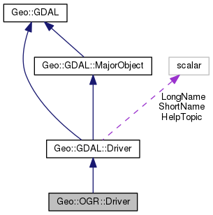
Public Member Functions | |
| public Geo::GDAL::Dataset | Copy (Geo::GDAL::Dataset source, scalar name, arrayref options=undef) |
| public Geo::GDAL::Dataset | Create (scalar name, hashref options=undef) |
| public method | Open () |
| Public Member Functions inherited from Geo::GDAL::Driver | |
| public list | Capabilities () |
| public Geo::GDAL::Dataset | Copy (hash params) |
| public method | CopyFiles (scalar NewName, scalar OldName) |
| public Geo::GDAL::Dataset | Create (hash params) |
| public list | CreationDataTypes () |
| public list | CreationOptionList () |
| public method | Delete (scalar name) |
| public method | Domains () |
| public scalar | Extension () |
| public scalar | MIMEType () |
| public scalar | Name () |
| public method | Open () |
| public method | Rename (scalar NewName, scalar OldName) |
| public scalar | TestCapability (scalar cap) |
| public method | stdout_redirection_wrapper () |
| Public Member Functions inherited from Geo::GDAL::MajorObject | |
| public scalar | Description (scalar description) |
| public method | Domains () |
| public scalar | GetDescription () |
| public hash reference | GetMetadata (scalar domain="") |
| public method | GetMetadataDomainList () |
| public hash reference | Metadata (hashref metadata=undef, scalar domain= '') |
| public method | SetDescription (scalar NewDesc) |
| public method | SetMetadata (hashref metadata, scalar domain="") |
| Public Member Functions inherited from Geo::GDAL | |
| public method | ApplyVerticalShiftGrid () |
| public method | BuildVRT () |
| public method | CPLBinaryToHex () |
| public method | CPLHexToBinary () |
| public method | CreatePansharpenedVRT () |
| public scalar | DataTypeIsComplex (scalar DataType) |
| public list | DataTypeValueRange (scalar DataType) |
| public list | DataTypes () |
| public scalar | DecToDMS (scalar angle, scalar axis, scalar precision=2) |
| public scalar | DecToPackedDMS (scalar dec) |
| public method | DontUseExceptions () |
| public Geo::GDAL::Driver | Driver (scalar Name) |
| public list | DriverNames () |
| public list | Drivers () |
| public method | EscapeString () |
| public scalar | FindFile (scalar basename) |
| public method | FinderClean () |
| public method | GOA2GetAccessToken () |
| public method | GOA2GetAuthorizationURL () |
| public method | GOA2GetRefreshToken () |
| public method | GetActualURL () |
| public scalar | GetCacheMax () |
| public scalar | GetCacheUsed () |
| public scalar | GetConfigOption (scalar key) |
| public scalar | GetDataTypeSize (scalar DataType) |
| public method | GetErrorCounter () |
| public method | GetFileSystemOptions () |
| public method | GetFileSystemsPrefixes () |
| public method | GetJPEG2000StructureAsString () |
| public method | GetSignedURL () |
| public Geo::GDAL::Driver | IdentifyDriver (scalar path, scalar siblings) |
| public method | IdentifyDriverEx () |
| public method | MkdirRecursive () |
| public Geo::GDAL::Dataset | Open (hash params) |
| public Geo::GDAL::Dataset | OpenEx (hash params) |
| public list | OpenFlags () |
| public scalar | PackCharacter (scalar DataType) |
| public scalar | PackedDMSToDec (scalar packed) |
| public method | PopFinderLocation () |
| public method | PushFinderLocation (scalar path) |
| public list | RIOResamplingTypes () |
| public list | ResamplingTypes () |
| public method | RmdirRecursive () |
| public method | SetCacheMax (scalar Bytes) |
| public method | SetConfigOption (scalar key, scalar value) |
| public method | UseExceptions () |
| public method | VSICurlClearCache () |
| public method | VSIFEofL () |
| public method | VSIFOpenExL () |
| public method | VSIGetLastErrorMsg () |
| public method | VSIGetLastErrorNo () |
| public scalar | VersionInfo (scalar request= 'VERSION_NUM') |
| public scalar | errstr () |
Additional Inherited Members | |
| Public Attributes inherited from Geo::GDAL::Driver | |
| scalar | HelpTopic |
| $driver->{HelpTopic} | |
| scalar | LongName |
| $driver->{LongName} | |
| scalar | ShortName |
| $driver->{ShortName} | |
Detailed Description
A vector format driver.
This is a legacy class which
should not be used in new code. Use Geo::GDAL::Driver.
Member Function Documentation
| public Geo::GDAL::Dataset Geo::OGR::Driver::Copy | ( | Geo::GDAL::Dataset | source, |
| scalar | name, | ||
| arrayref | options = undef |
||
| ) |
Object method.
Copy a vector data source into a new data source with this driver.
- Parameters
-
source The Geo::GDAL::Dataset object to be copied.
name The name for the new data source.
options Driver specific options. In addition to options
specified in GDAL documentation the option STRICT can be set to 'NO'
for a more relaxed copy. Otherwise the STRICT is 'YES'.
- Note
- The order of the first two parameters is different from that in Geo::GDAL::Driver::Copy.
- Returns
- a new Geo::GDAL::Dataset object.
Code:
click to view
| public Geo::GDAL::Dataset Geo::OGR::Driver::Create | ( | scalar | name, |
| hashref | options = undef |
||
| ) |
Object method.
Create a new vector data source using this driver.
- Parameters
-
name The data source name.
options Driver specific dataset creation options.
Code:
click to view
| public method Geo::OGR::Driver::Open | ( | ) |
Object method.
The same as Geo::OGR::Open except that only this driver is allowed.
Code:
click to view
The documentation for this class was generated from the following file:
- all.dox